Mount Rushmore National Memorial is overrated

Of course, a trip to Rapid City, South Dakota wouldn’t be complete without a visit to Mount Rushmore National Memorial… at least that’s what you’re supposed to think, based on how popular it is. So, for one of my Rapid City tourist activities, I drove my way up into the Black Hills National Forest to see the faces of four of our past presidents carved in stone.

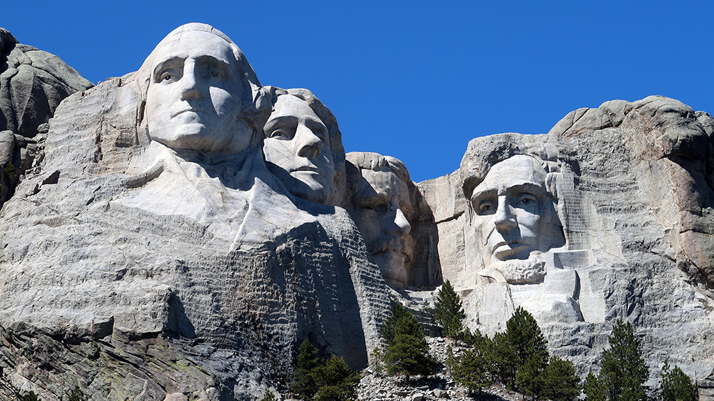
And that’s it. George Washington, Thomas Jefferson, Theodore Roosevelt, and Abraham Lincoln. You can’t really get much closer than how close I got for that photo, and that’s with my point-and-shoot camera zoomed in all the way. Washington is prominently visible and Lincoln is pret­ty clear, but Jef­fer­son is sometimes obscured, and Roosevelt is practically only visible from certain angles.

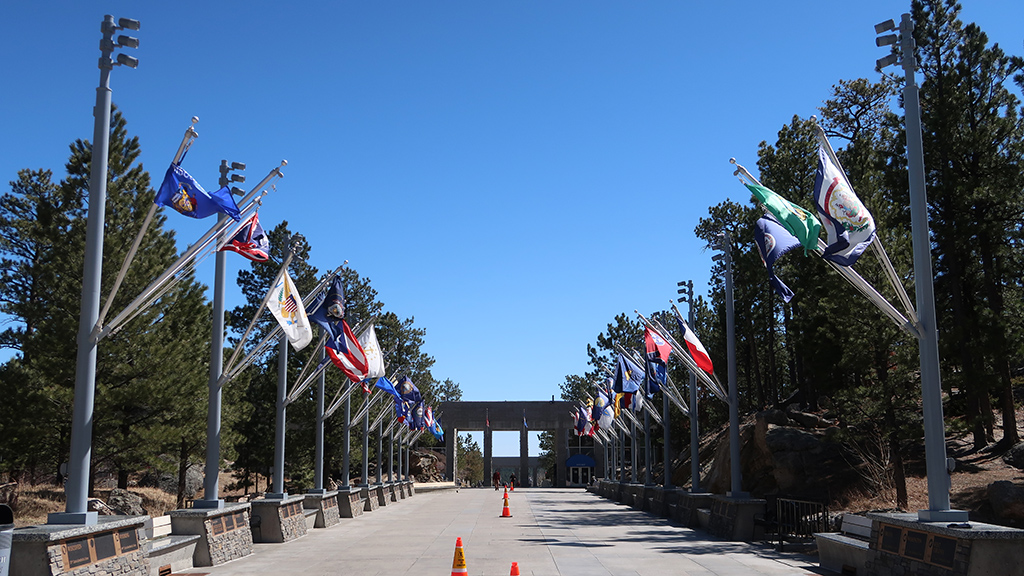
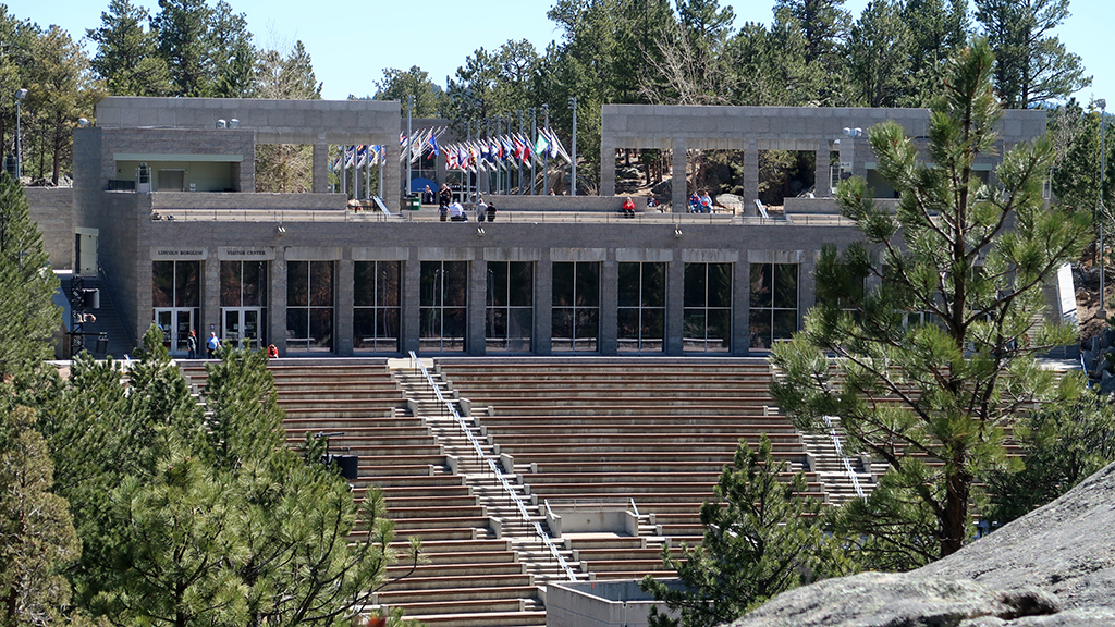
The path up to Mount Rushmore was nicely decorated with all the flags of the 50 states, as well as a few of the territories.

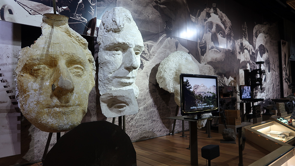
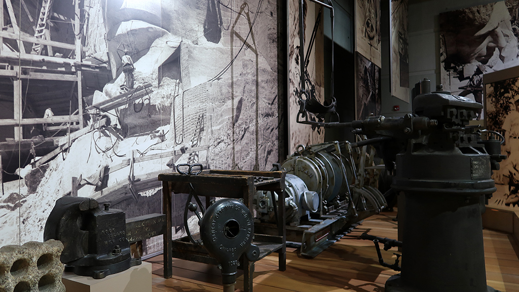
At the end of the path was the entrance to the museum and the auditorium. The museum wasn’t particularly large, and it was pretty text-heavy, but there were some exhibits showing smaller models of the stone and how the stone is most effectively carved at that height and at that kind of scale.

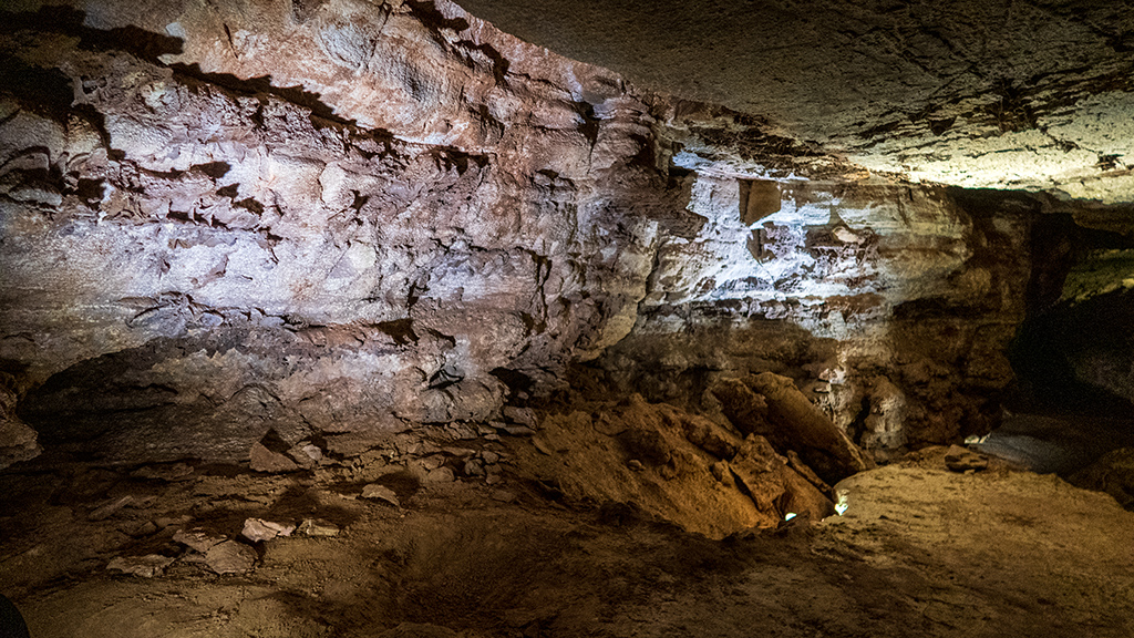
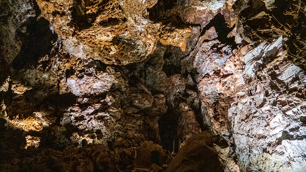
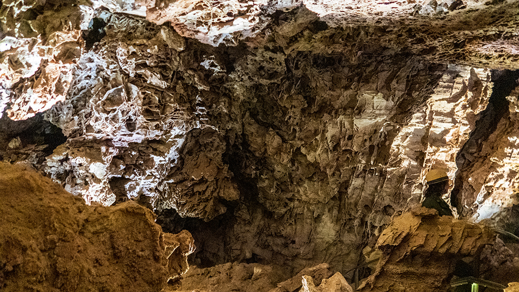
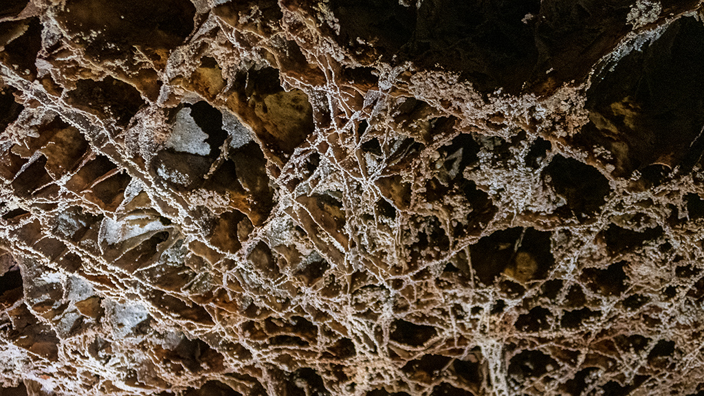
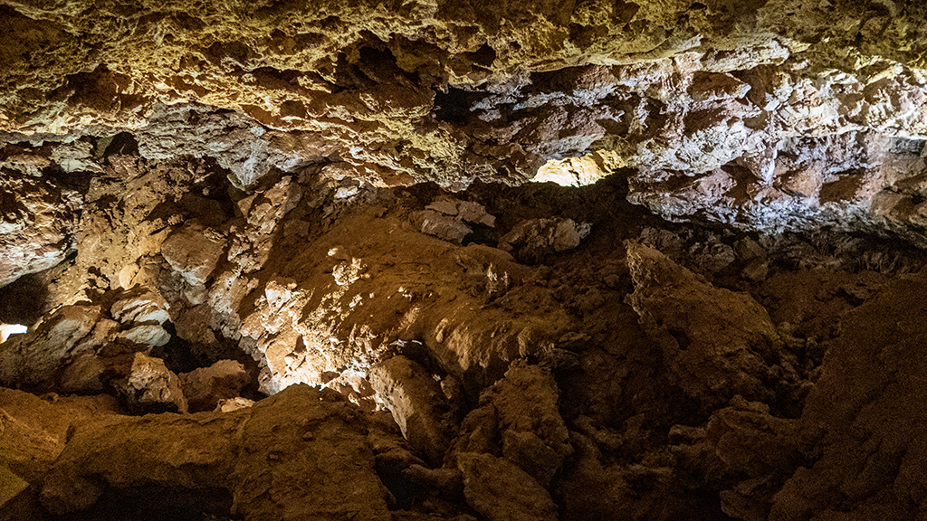
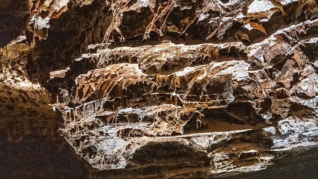
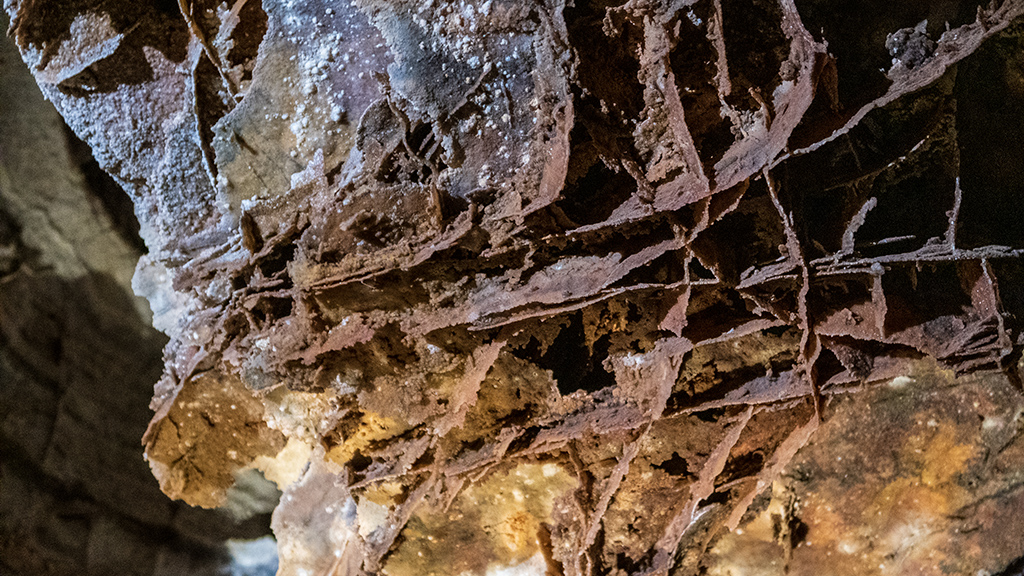
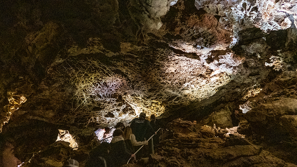
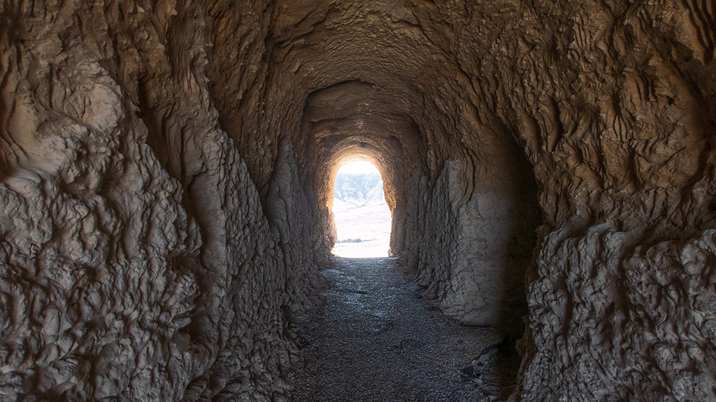
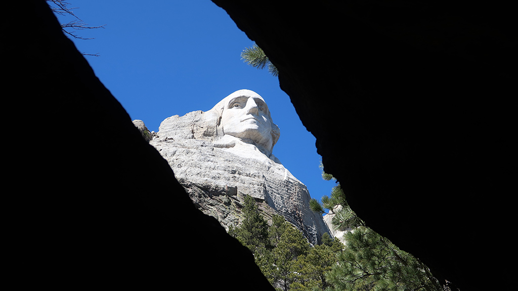
Apart from that, there was a short hiking trail around the area, and that was about it. The trail was called the Presidential Trail, and it had a lot of places where you could stop to read about the different presidents and look at Mount Rushmore from various different angles. One of them allowed you to walk into a cave-like structure and peep at Washington through some rocks.

Partway down the trail, there was a nice view back towards the entrance where you could see the flag display, entrance to the museum, and seating for the auditorium.

Further down the path was the Sculptor’s Studio, which was unfortunately closed due to being off-season. From there, I took the scenic route back to the park­ing lot.

I think for someone who is a huge Mount Rushmore enthusiast, you can get through everything there is to see (including all the museum exhibits and the videos that play in the miniature theater) in about 2-3 hours at most. I personally took about an hour and a half starting from when I entered the park­ing garage to when I got back to my truck.

This is definitely one of those places where you would go just so you can say that you’ve been there before, but isn’t something majestic or breath­tak­ingly stunning like some other national parks or national monuments. I think the most impressive thing about Mount Rushmore is just the fact that a man decided to carve gigantic faces into the side of a mountain, and then pulled it off.

One thing to note for America the Beautiful Annual Pass holders is that admission to Mount Rushmore is still going to cost you US$12.00. They man­age to get away with doing that because they charge that amount for using the parking garage, not for actual admission to the memorial. This means that, if you walk to Mount Rushmore, you could get in for free… but that isn’t exactly a viable thing to do, considering Mount Rushmore is fairly deep into the mountains, and there are no other free parking areas from which you can safely walk to the memorial.

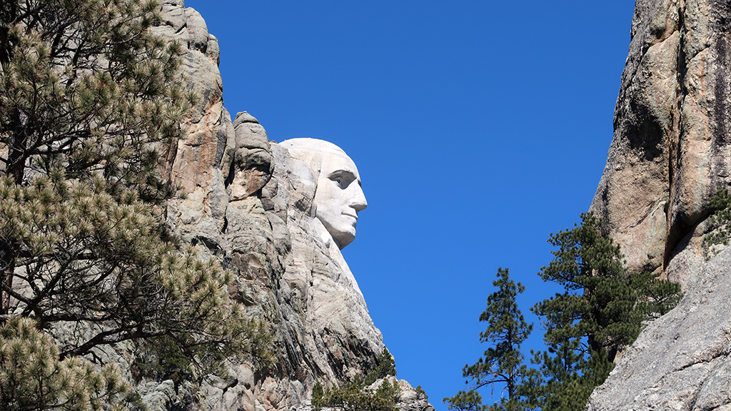
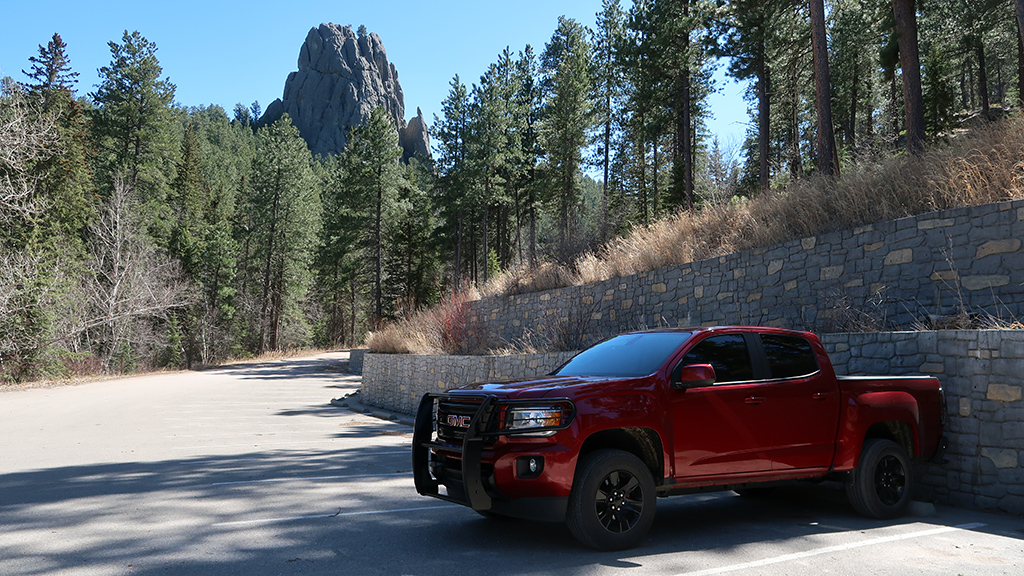
Being a little disappointed at how quickly that went, I decided to continue westbound on South Dakota Highway 244 and came across a little parking area where I could take a photograph of the profile view of Washington.

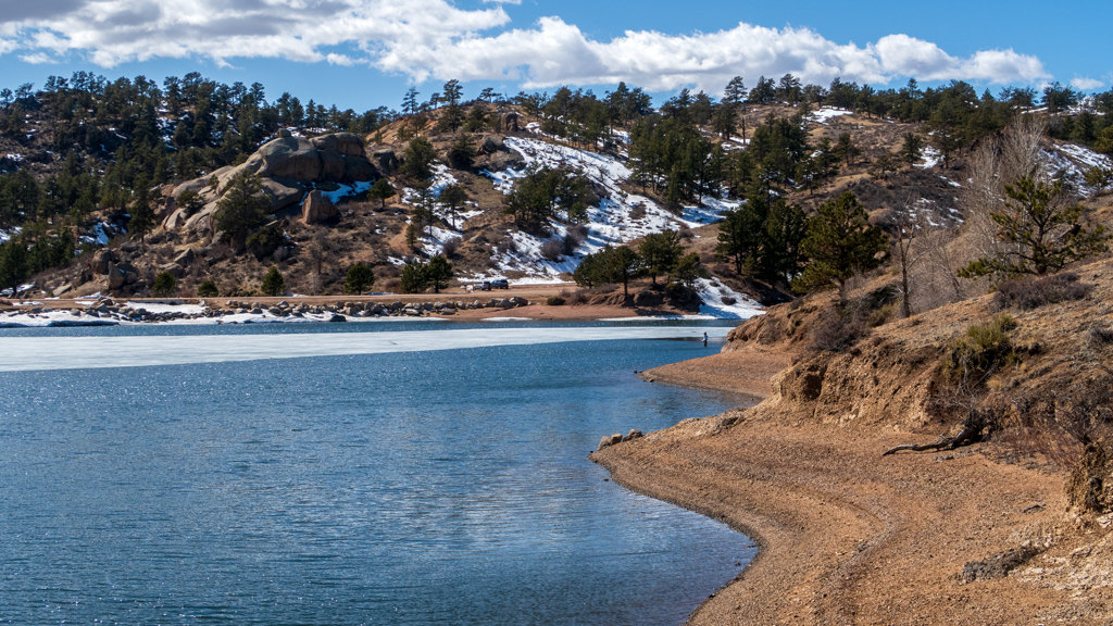
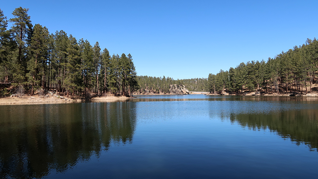
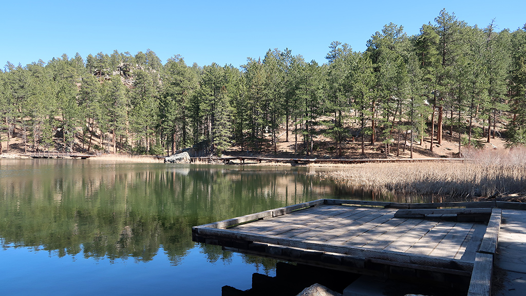
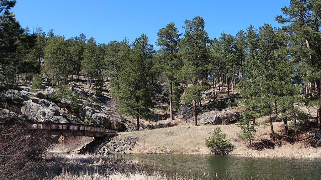
Continuing even further westbound led me to an intersection with a dirt road that takes you to Horse Thief Lake. There was nobody else around, so this was an amazing opportunity to take in the view, enjoy the tranquility of the water, and watch squirrels scurry around up and down the rocks.

Would I recommend a trip to Mount Rushmore National Memorial? Absolutely not. However, would I recommend a trip to the Black Hills that includes a stop at Mount Rushmore? Definitely yes.

My stay in Rapid City was unreasonably, unmanageably windy and cold, so I didn’t have much of an opportunity to go out and do everything I wanted to do. However, what I did manage to do in the Black Hills was great.

If you plan a vacation around Mount Rushmore in addition to stops at places like Crazy Horse, various hiking trails in the Black Hills, the scenic drives around Sylvan Lake, and maybe even some of the mines or the Presidential Wax Museum in Keystone, then that would make for a far more complete day than just going to only Mount Rushmore.


—§—


Hello, Reptile Gardens in Rapid City, South Dakota

I’ve been looking at a lot of rocks and mountains lately from all my hiking and visiting national parks and monuments, so I decided to switch it up a bit and go to the Reptile Gardens south of Rapid City, South Dakota to look at some animals.

Apparently the Reptile Gardens is in the Guinness World Records as having the largest reptile collection. I remember the Dallas Zoo in Texas also having a lot of reptiles, but I didn’t count the number of reptiles on display in either one of the locations, and the Reptile Gardens did indeed definitely have a lot of reptiles.

It’s still considered off-season (and it’s still pretty cold outside), so not all the exhibits were open. Apparently, Reptile Gardens has a lot of interactive areas where you can pet reptiles, but those weren’t available during my visit—the only animals I were able to safely touch were the giant tortoises that were just peacefully lying around (and even then, I only pet their shells).

Reptile Gardens is composed of both an outdoor area and a few indoor areas. The largest indoor area was the Sky Dome, and the mezzanine level had a ton of snakes. According to the labels next to the exhibits, the Sky Dome is home to some of the most dangerous snakes, both under the metric of the number of people who die to the particular species of snake per year, as well as the species with the strongest venom. And of course, there were plenty of non-poisonous snakes on display as well.

Of course, snakes weren’t the only reptiles on display; there were some lizards, dragons, toads, and frogs too, among other reptiles and amphibians. The bottom floor of the Sky Dome had a loop around the main vegetative area that housed crocodiles and alligators as well, including a sixteen-foot-long giant saltwater crocodile named Maniac, but that area had very poor lighting and none of my photos came out that well.

Taking a quick detour outside, there was a bald eagle named Cheyenne; she has apparently been a resident of the Reptile Gardens for over a decade now.

Back inside the central area of the Sky Dome where there was more vegetation, there were also some parrots. They were out in the open just perching on branches, and I was a bit confused as to why they weren’t just randomly flying around and away.

When I researched it online, I found out that a lot of zoos clip their wings as to inhibit their ability to fly. I’m not sure if the Reptile Gardens also do this, or if I just happened to get really lucky and saw the parrots when they were staying put for some rest—I wasn’t able to find a staff member nearby at the time to confirm.

And last but not least, my favorite section of the Reptile Gardens… had nothing to do with reptiles. Instead, it was the Prairie Dog Town, which housed a bunch of black-tailed prairie dogs running around in their enclosure and munching away at some hay.

The Reptile Gardens was a surprisingly pleasant trip. It had more of a small-town zoo kind of feel to it (which makes sense, because Rapid City is a pret­ty small city), but it definitely wasn’t at the cost of quality.

I actually liked this zoo a lot better than some of the other zoos I’ve been to, because I noticed that Reptile Gardens seems to put a lot more care and attention to detail into the animal habitats. I’ve seen a lot of other zoos build comfortable and compatible enclosures and environments for the animals, but I noticed here on many occasions that it looked like Reptile Gardens wanted to go beyond that and give the animals a luxurious home instead.

Another thing I noticed was how hilariously large the gift shop was. There was a lot of pretty decent and unique merchandise, and I felt like it acted more as a general Rapid City gift shop, rather than just a gift shop limited to the Reptile Gardens. The staff there was nice as well; I had a nice con­ver­sa­tion with one of the employees there who asked me about my travels and told me some stories about Rapid City that she’d experienced from over four decades of her living there.

I stopped by here because I saw that the general consensus from previous visitors was very positive, and I agree with that sentiment. The outdoor grounds were also still under active construction and renovation, so if you decide to visit, it’s possible that you might be able to see a lot more than I was able to this time around.


—§—


Hello, Museum of Geology at the South Dakota School of Mines and Technology

Ever since my arrival in Rapid City, South Dakota, it has been ridiculously and unmanageably windy. I mean that in the most literal way possible—the wind is so strong that I have trouble walking in a straight line, I have to have my steering wheel perpetually turned slightly against the direction of the wind when driving or else I will be pushed off the road, and I nearly had an entire pan of pizza take off and fly away from my arms.

While waiting out the wind and hoping it settles down in the coming few days, I decided to do an indoor activity and visited the Museum of Geology, part of the South Dakota School of Mines and Technology. I’m not exactly the biggest geology enthusiast, but the museum had good reviews online and it had free admission, so I decided to check it out.

I read a majority of the informational posters and signs about the different kinds of rocks and learned a lot about how different rocks are formed, but be­cause I wasn’t already that familiar and knowledgeable about geology, I wasn’t able to retain all the precise details of each of these rocks are and what is special about them. For the sake of avoiding accidentally giving wrong information, instead, here is just a large dump of photos of rocks and formations that I thought looked interesting.


—§—


Hello, Wind Cave National Park in South Dakota

On my way from Scottsbluff, Nebraska to Rapid City, South Dakota, I took a stop at Wind Cave National Park, a national park a little north of Hot Springs, South Dakota. Ever since booking this segment of my road trip, I’ve been particularly looking forward to Wind Cave, as this would be the first time I would be spelunking—I regularly hike upwards onto mountains, but never downwards into the earth.

At the time of my visit to Wind Cave, it had only been one week into spring, so it was still considered off-season for tourism, and not all the ranger-guided tours were available. One of the tours that were available was the Fairgrounds Tour, rated by the National Park Service as “strenuous,” which is the one I selected.

The Fairgrounds Tour is a one-and-a-half hour walk through a large portion of the cave, allowing visitors to see many different aspects of the cave sys­tem. As of today, it is also the longest tour during which you are allowed to take photographs; the more difficult and involved Candlelight Tour and Wild Cave Tour both prohibit phones and cameras for safety reasons.

Self-guided tours are not permitted, and for good reason—Wind Cave is the densest cave system in the world, meaning it has the greatest passage volume per cubic mile, offering many opportunities to get lost and die alone without GPS or cellular signal.

Prior to the beginning of our tour, the ranger showed us a map that had extremely complex lines drawn in multiple different colors on top of each other (with the shade of color representing the vertical axis) and packed in a small space. At first, I thought that the map covered a large area and potentially even extended as far as the nearby Black Hills National Forest, but I later learned that the scale of the entire map was only one mile from one edge to the other.

We entered Wind Cave via elevator out of a special room. When we first went a few hundred feet underground, it was clearly extremely windy—the at­mos­pher­ic pressure changes causes extreme wind in Wind Cave—but once we actually entered the cave, we couldn’t feel the wind anymore.

I took a lot of photos during the tour, but note that I took them in camera raw format and heavily edited and enhanced them prior to posting them here. Wind Cave is extremely dim, which meant my camera had a lot of difficulty capturing clean, crisp images. (I took some photos with my camera’s flash on, but that didn’t really help either, because then that would just overilluminate nearby cave structures and leave far-away rocks still dark; I ended up not posting any photos from flash photography.)

Wind Cave is apparently the place with the most boxwork in the world—approximately 95% of the world’s discovered boxwork is inside Wind Cave. Ac­cording to the ranger, boxwork forms when cracks in soft rock are filled with a harder substance, and then the remainder of the soft rock erodes away, leav­ing behind the harder substance that takes a web-like shape.

Wind Cave has multiple different levels, and during this tour, we were able to see all of them. Water has extremely high erosive properties, and once we got to places where water did not have enough time to work on breaking down the rock, the cave was much smoother and had no boxwork.

We eventually made it to a resting point where the ranger told us about the history of the cave, and how the cave was originally used for mining, but was later converted into a tourist hotspot. While we were all safely seated, the ranger turned off the already-dim lights to demonstrate just how dark it is un­der­ground in a cave. She told us to hold our hand directly in front of our faces, which we obviously couldn’t see—there was literally no light, which meant that our eyes would never “adjust” to the darkness.

This area also had some nice frostwork. I tried to take a photo of it, and I captured a lot of cave popcorn, but I didn’t realize that the bulk of the frostwork was out-of-frame (except for a few growths at the far bottom). Again, keep in mind that everything was extremely dim, it was very difficult for me to see (considering I already have horrible eyesight and horrible night vision), and these photos are heavily enhanced in post-production.

As our time together came to an end, we started heading back to the elevator to return to the surface. On the way back, I snapped a bunch more pho­to­graphs of everything interesting around me, including nice rock formations and a lot more boxwork.

Exploring Wind Cave was a great experience. As if I wasn’t already aware enough, seeing things like this reminds me just how vast and complex the world is, and gives me a reality check of how unimaginably tiny my life is compared to the scale of everything else happening. It also acted as a reminder not to get complacent about my safety and the fragility of life—nature doesn’t hold your hand and help you survive like modern-day civilization does, and it’s very easy to stumble into an unfortunate situation that kills you.

 
On my way from Wind Cave National Park to Rapid City, Google Maps decided to route me through 7-11 Road because it was the fastest way to my des­ti­nation, without informing me that it was a dirt road. I was fine with it, though; my truck handled it just as well as a regular road, and I made a new friend along the way.


—§—


Hello, Scotts Bluff National Monument in Scotts Bluff County, Nebraska

After my stop in Cheyenne, Wyoming, my next destination was planned to be Rapid City, South Dakota. The drive is around four and a half hours, which isn’t that bad—that’s about the time it would take me to drive from Las Vegas to Los Angeles if there was normal traffic conditions after entering the Los Angeles area—but I still wanted to see if there were any opportunities to split up that drive across two days.

Upon searching for available hotels along the route, I noticed that there was a Fairfield Inn and Suites by Marriott in Scottsbluff, Nebraska. Upon closer inspection, I realized that the Scotts Bluff National Monument was also nearby west of Gering, a city in Scotts Bluff County. I decided to spend one night in Scottsbluff, then scheduled a stop at the Scotts Bluff National Monument on the day I drive in, and another stop at another nearby national park on the day I drive out.

Just as a quick disclaimer, I want to point out that I am not making any typos when it comes to these location names. The national monument and the county are called Scotts Bluff with a space between the two syllables, while the city name is Scottsbluff as a single word. Funny enough, Google Maps also has a point where, driving from the national monument to the city, you would take Old Oregon Trail, turn onto Nebraska Highway 92, and follow signs for “Scottebluff” … but I think that might just be an error on Google Maps, as I wasn’t able to locate any signs that replace Scottsbluff’s “s” with an “e.”

Scotts Bluff National Monument was a fairly small and straightforward national monument. Admission was free, and upon entering, you had two op­tions for exploration: you could either park at the bottom and hike your way up to the top, or you could take the Scotts Bluff Summit Road via ve­hi­cle. I decided to do both.

Because of the shape of the National Monument, the hiking route started as a paved trail that stretched far outwards to the northeast, cutting through Scotts Spring.

Around that area, I was able to find some wildflowers, though they weren’t exactly the kind of flowers you’d see elsewhere, and I also wasn’t exactly sure whether or not they were still alive.

For a bulk of the first part of the hike, I thought the trail was relatively timid, but after making it more than halfway to the summit and looking back, I realized that the path was actually somewhat carved in the side of the mountain, and the drop off the edge was a lot steeper than it felt when I was walk­ing through that area.

Eventually, I made it to a tunnel that cut through the rock and opened a pathway to the other side of the mountain.

The other side of the tunnel had a lot more vegetation and opened up views to the northern side of the mountain, which were previously hidden by the mountain itself.

After some hairpin turns and a few steeper climbs, I made it to the North Overlook at the summit and was able to enjoy nice, sweeping views to the north, specifically of Scottsbluff, Terrytown, and the North Platte River.

On my way back down the trail, I decided to snap a photo of the tunnel through the mountain. At the time of the photograph, it was so bright outside and so dark in the tunnel that it just looked pitch black in the tunnel, but I was able to extract a lot from the raw sensor data from my camera. There were three tunnels in the vehicular route to the top as well, but this hiker tunnel had a lot more interesting detail to the texture of the rock.

On my way down, I also snapped a photo of a rocky ridge that had signs instructing people to stay on the trail and avoid going off course (i.e., on the ridge) due to high risk of falling. I’m not particularly the biggest fan of randomly falling off a mountain and dying, so I heeded that warning.

After making it back down to the vis­i­tor center, I got in my truck and took the scenic drive back up to the top of the monument so I could see the three other tunnels and the South Overlook as well. I could’ve just walked from the North Overlook to the South Overlook as part of my hike, but I saved the South Overlook for my drive so I could use it as a “reward.” The South Overlook had some nice mountain views, as well as a view of the vis­i­tor cen­ter and the first loop of Scotts Bluff Summit Road leading into the first vehicular tunnel.

The walk from the parking lot to the South Overlook wasn’t recorded on my GPS, and I also started tracking a little bit late, but overall, my total hiking distance was a little bit over three and a half miles.

I’m glad I stopped by Scotts Bluff National Monument. It obviously isn’t exactly the most impressive or stunning national monument or national park I’ve ever been to, but it has its own charm with its relatively small size. As a tourist, you’d be able to see everything there is to see in one single visit of a few hours, but with free admission, I feel like this national monument is more used as a regular exercise area for the residents of Scotts Bluff County, being only about a ten minute drive from central Gering.


—§—


Hello, Hidden Falls at the Curt Gowdy State Park in Cheyenne, Wyoming

I wanted to get in a hike in Cheyenne before heading out for my next destination, but I noticed that a lot of trails near the city were just greenways that connected different neighborhoods. After expanding my search radius, I came across Curt Gowdy State Park, a state park about half an hour west of the main city of Cheyenne.

I was anticipating doing a quick hike out to and back from Hidden Falls, but long story short, the quick hike ended up on the not-so-quick side.

I successfully found my way to the parking lot and the trailhead. Unfortunately, although the trails were actually pretty well-marked for off-road vehicles, they were almost not marked at all for foot hikers. Because of this, I just found a trail and started walking, and it ended up being in the wrong direction.

After occasionally taking a peek at my GPS (which was difficult, because there was extremely poor signal out there), there came a point where I realized that my trajectory was way too far off from Hidden Falls, so I retraced my steps and found a different path I could take. That path also ended up being in­correct; I made it much closer to Hidden Falls, but it took me to the foot of a mountain and Middle Crow Creek, and it wasn’t very realistic for me to attempt to cross the creek into forest and try to climb straight up a mountain without realizing where it would take me.

Eventually, I found my way onto the correct path, and after already having hiked about halfway or so down the trail, I saw a sign that said “To Hidden Falls,” even though this was now a straight shot to Hidden Falls and there was no possible way I could miss it.

Maybe if the person who nailed this sign to the tree was using both halves of their brain on that day, they may have come to the conclusion that the sign would have probably been far more useful and effective at the initial three-way fork in the road.

Once I got closer to Hidden Falls, the trail got much better. There were bridges in areas that were difficult to navigate, and even though there was a lot of snow and ice covering the path, there were enough footsteps in the snow from previous hikers trafficking the route that it was easy to see where to go next.

Eventually, I made it to Hidden Falls and realized that the waterfall was completely frozen over.

I’m actually fortunate that I wasted about an hour and a half roaming around in the wrong area, because that made it so the timing lined up where I met some ice fishermen at the waterfall. If I remember correctly, their names are Angel and Alex, and the guy pictured below goes by “Everyday Pikachu Hat Fisherman” on YouTube. Apparently the ice was extremely deep, and they actually had some success catching fish.

After enjoying the view, carefully sliding around so I wouldn’t get a concussion from slipping on the ice, and then making it back to the parking lot, I drove back onto Granite Springs Road and took a detour into the Happy Jack Camp­ground and shot a nice view of the Granite Springs Reservoir.

I’d say that, even though the hike ended up about twice as long as I was anticipating due to my poor navigation, it was ultimately a success. The scenery was great, the air was fresh, and the frozen waterfall was very intriguing. I also enjoyed meeting the ice fishermen and watching them fish—I’ve seen pho­tos and videos of people ice fishing online, but I never expected to be able to see it in-person, especially without having to go to somewhere like A­las­ka.

Continue reading


—§—