Hello, Pearce Estate Park and Prince’s Island in Calgary, Alberta, Canada

On the rare days that it wasn’t raining, I squeezed in a few walks around the downtown Calgary area. It actually reminded me a bit of my walk around down­town Spokane, in that there was a lot of nature directly surrounding downtown, and it was designed in a way that made it very pedestrian-friendly.

For my first walk, I went to Pearce Estate Park, which isn’t quite exactly in downtown, but was nearby in the Inglewood neighborhood by the zoo. A short walk from the parking lot on Bow River Pathway led to some nice views of the Bow River. I am assuming it was because it rained a lot recently and it washed a lot of dirt into the river, but the water was unusually brown, opaque, and muddy.

Continuing northbound on the shoreline made me end up at the Harvie Passage Lookout, a nice structure surrounded by flowers that had an elevated view of the Bow River, Hughes Island, and the surrounding area.

After going as far as I could on the sand, I cut back into the park and explored the winding paths and smaller trails in the center of the park. There were a few small ponds and waterfalls, as well as some open areas where people were having picnics. The landscaping crew was also out maintaining the park, so large sections of the park had the nice, refreshing scent of freshly-mowed grass.

For my next walk, I wanted to get a bit closer to downtown. As is expected for a downtown area, parking was paid, so instead, I parked on 1 Street North­east (yes, apparently Calgary names its streets with numerals, rather than cardinals like 1st, 2nd, 3rd, etc. like the United States does) over by Rotary Park in a free parking zone. From there, I cut through the park, crossed Centre Street North, walked down Memorial Drive Northwest, and went onto Prince’s Island.

With a t-shirt, gym shorts, sneakers, and white above-the-ankle socks sticking out, I don’t think I could’ve looked more like a tourist. I ended up getting stopped by every single solicitor asking me to buy something from their business or donate to their charity. I felt like I had been walking pretty briskly the entire time, but according to my GPS tracker, my mile split times were comparable to climbing up a mountain because of them.

On my way back to Rotary Park where I parked, I stopped by Mt. Pleasant View Point and got a nice shot of the Calgary skyline.

The GPS tracking map probably isn’t as interesting for these walks as they usually are for real hikes, seeing as I was just walking on paved roads and tak­ing a lot of stops to capture photographs and tell solicitors I’m not interested in what they were offering, but here they are anyway:


—§—


Hello, Boulder Mountain Lookout Trail and Moses Falls in Revelstoke, British Columbia, Canada

To put it simply, visiting Canada has been an amazing experience so far. I will have a dedicated blog post about traveling into Canada and my long-term stay in Calgary, but until then, here’s a hike I did near Boulder Mountain in Revelstoke, British Columbia, one of the stops I made along the way to Cal­ga­ry.

I started the first trail on Westside Road at the base of Boulder Mountain, just before the bridge across the Jordan River where it meets with the Co­lum­bi­a River.

Some areas were still muddy, but because of bridges, tree stumps, and tree trunks that I could walk on, it wasn’t too difficult. After about a fifth of a mile, I arrived at a clearing where I was able to get a nice view of the Jordan River.

From here, I got a bit confused and thought that it was already the end of the trail… which made no sense, because I had looked up this hike on AllTrails prior to arriving, and it was at least a mile and a half. I started wandering around in confusion, going off-trail to find where the path was, until I noticed a long rope coming down from a cliff.

Hikers on AllTrails had marked this as “easy,” so I questioned whether climbing the rope up the cliff was the correct path. Fortunately, as I was looking around for an answer, a family of hikers coincidentally arrived at the same time. They had previously done this hike before, so they confirmed that the correct path forward was to climb the rope, and they demonstrated that the rope was indeed sturdy enough by climbing up themselves.

The rest of the trail up wasn’t too bad—it was steep enough that I would get out of breath if I went too fast, and some areas were pretty muddy, but I made it to the summit without any further issues.

On my way back down, I found a slug (and, considering how bad my eyesight and depth perception is, I’m impressed at myself for noticing it and not step­ping on it).

Because this was a relatively short trail at about 1.5 miles (2.4 kilometers) round trip with about 620 feet (189 meters) of elevation gain, I continued driv­ing northbound on Westside Road to a second short hike.

I eventually made my way to a parking lot near Moses Falls. Part-way to the waterfall, I met a nice older lady who was trying to get to the waterfall be­cause she saw it on Google Maps, but was a bit concerned that she would get lost and not be able to make it back up the relatively steep terrain. My pres­ence there instilled enough confidence in her to follow me to the waterfall, where she asked me to take her picture, then offered to take mine.

She retraced her steps back to the parking lot, while I went deeper down towards the base of the waterfall.

Eventually, I made it to the bottom where the waterfall emptied into a small reservoir that connected into the Columbia River.

To the northeast of the Columbia River, I could see where it passed through the Revelstoke Hydroelectric Dam.

Unfortunately, because I went on this hike after I had already spent the day driving from Kamloops to Revelstoke, it was later on in the evening, and the Revelstoke Dam Visitor Centre was already closed.

When I plan out what cities I visit and for how long, I usually go by hotel prices to ensure that my travel is as cost-effective as possible. However, after trav­eling through this area, I’m realizing the major flaw in that strategy. Especially during the summer months, the nicest, mountainous areas in the north attract a lot of tourists, resulting in relatively high hotel prices. However, I think the high lodging prices are worth it for the great experience ex­plor­ing these areas.


—§—


Hello, Fragrance Lake Trail of the Larrabee State Park in Bellingham, Washington

On my way up north from the Seattle Metropolitan Area to Canada, I decided to take a stop in Bellingham, a city on the north-northeastern corner of Wash­ington. Like usual, I wanted to break up the monotony of driving too much in a single day, but I also spent a few nights in Bellingham to meet up with one of Tempo’s former employees, and to see if there was good-enough weather for me to squeeze in another hike.

Luckily, there was some good weather on the day I was driving up, so instead of going straight to Bellingham on Interstate 5, I exited early onto Wash­ington State Route 11, also known as Chuckanut Drive. This followed along the coast of Samish Bay and eventually led me to the Larrabee State Park. I parked right outside and across the street from the entrance to the main campground area and hiked Fragrance Lake Trail.

The trail itself at a macro level was fairly normal for what I would expect, but there were some very interesting smaller details to the area.

After crossing the intersection with the Whatcom County and Bellingham Interurban Trail and going deeper into the trail, I came across the Trees of Life, a group of trees whose roots were growing on top of and around a large boulder.

The next point of interest was at the Fragrance Lake Trail Overlook, where I had a nice view of the forest below and the Wildcat Cove and Bellingham Bay in the distance. I also saw some land in the distance; I’m not certain, but based on superimposing my perspective on a map, it seems like they were the Portage and Lummi Islands.

As I retraced my steps back from the overlook and went back on the trail to continue deeper towards Fragrance Lake, I saw a miniature version of the Trees of Life, this one having its roots growing over and around the trunk of a dead tree.

The deeper I hiked and the closer I got to Fragrance Lake, there was more green growing everywhere.

Eventually, I made it to Fragrance Lake.

There continued to be more unique vegetative life appearing as I got deeper. As I was walking around the lake, I saw some mushrooms growing dec­o­ra­tively around a tree trunk.

Once I got to the opposite side of Fragrance Lake as the previous photos, I saw the Fragrance Lake Lookout Tree, which is exactly what you’d expect it to be—a literal tree extending into Fragrance Lake from which you could look out into the lake. I didn’t walk onto the tree, not only because I didn’t want to lose my balance and plunge into the lake, but also because there was already a man on it fishing, and I wasn’t sure if me walking on it would cause us both to lose our balances and go plunging into the lake.

This was technically the end of the trail, so I had the option of circling around and going back to the parking lot. But, when I poked around on the map, I noticed that there was a waterfall a bit further away, so I decided to go a little deeper. I connected onto Two Dollar Trail and headed north.

Eventually, I made it to the Lower Fragrance Lake Waterfalls.

From the waterfall, I noticed that completing Two Dollar Trail would result in an additional three-mile round trip being added to my hike, so I decided against it and thought this would be a good time to turn around and head back to my truck.

I had poor GPS and 4G LTE connection throughout the whole hike, so it seems like my tracker had difficulty monitoring my movement. It says that my total distance was 4.75 miles, but because of a late start and a few sections that it didn’t catch, I think it was closer to about 5 miles. As for elevation gain, only hiking the Fragrance Lake Trail clocks in at just shy of 1,100 feet, so with my detours to the overlook and the waterfall, I’m guessing my total hike was closer to about 1,300 feet.


—§—


Hello, Des Moines Creek Trail, Park, and Marina Pier in Washington

Even though I spent a lot of time in the Seattle Metropolitan Area, I didn’t really have an opportunity to go out and do much.

When I first arrived, I visited some friends and did all my laundry that I had been saving up (because I didn’t want to pay $4 per load to wash and dry at hotels), got my belongings sorted and organized, and cleaned out my truck. It also rained nearly daily and nearly all day, and I’m not really a fan of getting drenched while hiking, so I stayed indoors.

After spending a few days resting up, I managed to get sick with a common cold, so I rested some more, stayed put in my hotel room so I wouldn’t infect anyone else, and took the opportunity to cram some work. After recovering, I flew back to Las Vegas for a week to take care of some routine errands.

Upon arriving back in Seattle, I spent a few days playing some of the new content on World of Warcraft’s latest two patches, then for the next week, I caught up on a lot of work and visited our COO at her house to get some work done in-person as well.

During the very eventful three and a half weeks, I did manage to get outside for one of the days, during which I took a very long walk in Des Moines, Washington. I say a walk and not a hike because a vast majority of it was nicely paved and there was very little elevation change.

My starting point was at the Des Moines Creek Trail Park, and I took the Des Moines Creek Trail south along the Des Moines Creek. As I got deeper into the trail, I ran into some jungle-like vegetation that I hadn’t seen anywhere else before.

There were also a lot of nice wildflowers along the path.

At the end of the path, I connected onto South Cliff Avenue, turned onto South Dock Avenue, and made my way onto the Des Moines Marina Pier.

From here, I was able to enjoy some nice views of Des Moines Beach and the City of Des Moines Park Conservation Area.

From the tip of the pier, I got as close as I could and snapped some photos of snow-capped mountains in the background, which I believe are part of Olympic National Park on the Olympic Peninsula.

After returning to the shoreline from the pier, I climbed down some rocks and went straight onto the stony beach to get some photos of the birds.

Shortly after I snapped this next photo, a couple came onto the beach with their dogs and set them free to chase after the birds, which, needless to say, hor­ri­fied the birds and made them all take flight away from the shore.

I generally try to avoid doing things on the weekends because I want to avoid crowds, but I visited this beach and pier on a Sunday because it had been raining so much that I was willing to take whatever clear day I could get. The beach was bustling and there were a lot of people out having picnics and enjoying the weekend, so it wasn’t like the quiet and solitary hikes I’m used to, but it was still nice to get out, get some fresh air, and get my body moving again.

In total, my walk was 5 miles (a little over 8 kilometers).


—§—


Hello Spokane, Washington

After heading out of Montana and towards the Seattle Metropolitan Area, I took a quick two-night stop in Spokane, the second most populous city in Washington, just barely ahead of Tacoma. I honestly didn’t really expect much out of Spokane, and I booked a stay simply because of its convenient lo­ca­tion between Missoula and Seattle, but I actually thought it was one of the more pleasant cities I’ve visited so far.

My hotel of choice was the Courtyard by Marriott Spokane Downtown at the Convention Center, a slightly older hotel in terms of décor, but still very well-maintained with great staff and an amazing location. I got an upgrade, presumably due to my Bonvoy elite status, which got me a nice view of the Spokane River and a nearby tree with blossoming pink flowers.

Long story short, I think downtown Spokane does downtown the right way. It definitely feels like a downtown area, but it’s not too congested, and I think it is the most welcoming “downtown” I have ever been to.

When I lived in Las Vegas, I lived on the Strip, which is sort of like the “second downtown,” but the City of Las Vegas was working on improving the “original downtown” to be a lot nicer. I feel like Spokane and Las Vegas have similar goals for what they want their downtowns to look like, but Spokane already finished development, and they did pretty much everything the right way. Las Vegas obviously can’t have a river slicing through the city, but if down­town Las Vegas ended up resembling Spokane, I would be very happy and very willing to live there (as opposed to the Strip).

Seeing as my hotel was in a perfect location and overlooked Centennial Trail, I decided to take a walk alongside the river and into Riverfront Park. My first “stop” was at the Spokane Pavilion, which seemed to have some sort of small business event going on, but was still open to the public so I could climb up some stairs and get some shots of the nice architecture of the outdoors area.

I retraced my steps and continued southbound, connecting onto North Howard Street. I crossed the wide bridge and pedestrian walkway, leading me to the Rotary Fountain near the Spokane Visitors Information Center.

I reconnected back onto Centennial Trail, then transferred over to Park Trail and Theme Stream Trail to head back closer to the river. A portion of this area was closed due to construction, but the Howard Street Middle Channel Bridge was open, which let me get onto Canada Island and get a nice view of the Upper Spokane Falls.

I’ve been to Niagara Falls at some point when I was an infant, so I obviously don’t remember it first-hand. I’ve also seen a few waterfalls during my road trip in the past year, though none of them were very big, and one of them was frozen.

I think Spokane Falls is the first waterfall of this volume that I remember seeing, and it is absolutely treacherous. The crashing water colliding with itself and the surrounding rocks, and the speed at which the foam atop the water forms, flows, and dissipates, is unlike anything else I’ve experienced. The waterfall created enough mist that I could feel the wetness from the pedestrian bridge, and it was a bit surreal being only a handful of feet atop a force of nature that could sweep me up and kill me within seconds.

After taking in the view for a little while, I continued northbound towards North Bank Park and started my loop back to my hotel, this time following the northern side of the Spokane River. I passed the Upper Falls Reservoir and continued east past Gonzaga University, where I ran into some marmots.

Just before reaching the intersection at East Spokane Falls Boulevard, I reconnected onto Centennial Trail and crossed the bridge towards Washington State University Spokane.

As I got closer to returning to my hotel, I saw some people huddled around a clearing of grass across from the Community Colleges of Spokane. I saw that they were looking at some geese, but upon closer inspection, I found what they were really interested in—the geese were standing guard over their babies. I’m pretty sure this is the first time I had ever seen baby geese, so of course, I snapped some photos.

Overall, my walk was 3.2 miles (5.15 kilometers) with negligible elevation gain.

After having such an amazing experience throughout Montana, I thought everything else would be underwhelming in comparison, but even with Mon­tan­a still fresh in my mind, Spokane was a very pleasant experience. I have plans to continue my road trip by going through Canada, but I haven’t fi­nal­ized my return path yet; needless to say, I’m thinking of a way to route my return path back through Spokane again, as I’m looking forward to ex­plor­ing the city some more.


—§—


The Montana round-up

After entering through the southeast in late April, I made my way all the way across the state of Montana, stopping for medium-to-long stays in four out of the five biggest Montanan cities: Billings, Bozeman, Helena, and Missoula.

Prior to visiting Montana for the first time ever as part of this road trip, my favorite state was Colorado, with Utah coming in at second. I really enjoyed South Dakota, but I wouldn’t consider South Dakota as a whole as one of my favorite states; just like how I wouldn’t call Nevada my favorite state just be­cause I love Las Vegas, I felt like I couldn’t generalize my experience in southwestern South Dakota and apply it to the entire state.

Now, I can pretty confidently say that Montana is my favorite state in the United States, bumping the other states down one place. I obviously don’t have comprehensive exposure to either Mon­tana or Colorado, but with my limited experience, as well as the knowledge I have about the areas of the states that I haven’t been to yet, I still think Colorado is amazing, but Montana beats it out by a little bit.

I’ve briefly touched on almost all of these points already sparingly throughout my previous Montana blog posts, but I figured I would do a summarized round-up and try to pinpoint some of the key reasons why Montana has taken my #1 spot:

  • The cities are not congested. Montanan cities have seem to found a sweet spot of equilibrium between density and sprawl. There are enough shops, restaurants, and activities for everyone to enjoy, and there are enough people around that businesspeople are incentivized to set up and make a good living, but it’s also spread out enough that everyone can have their own space.

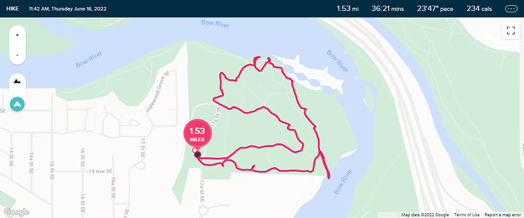
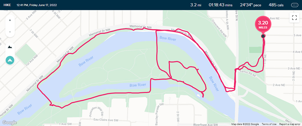
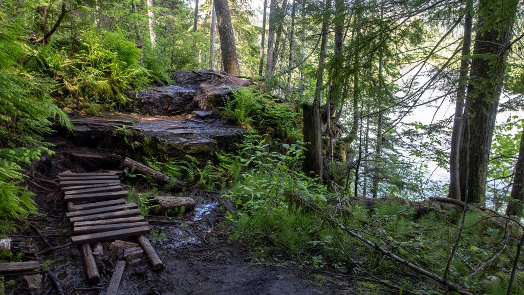
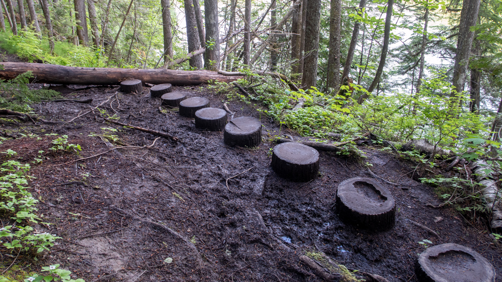
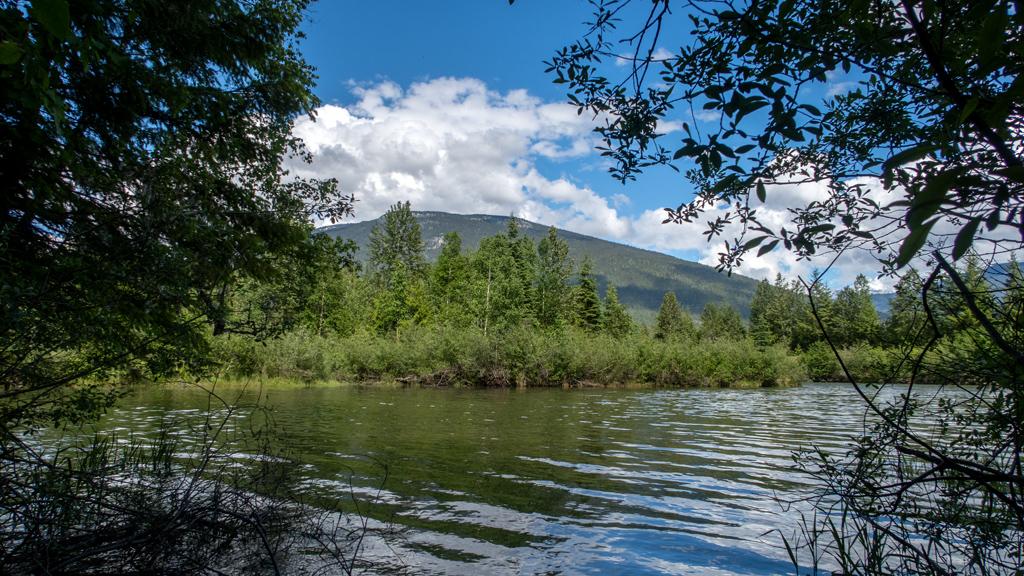
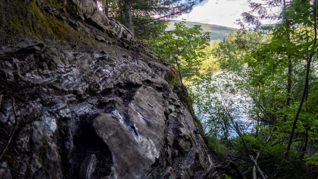
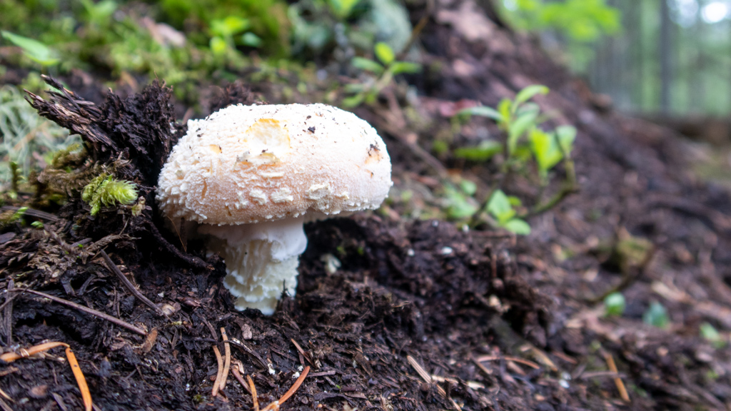
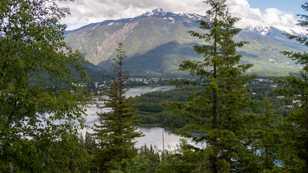
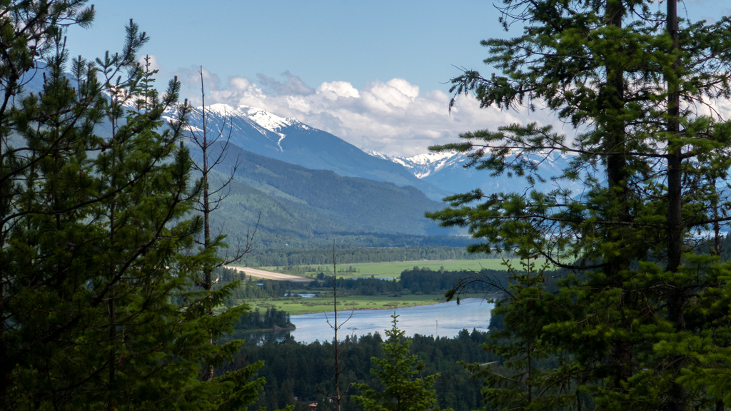
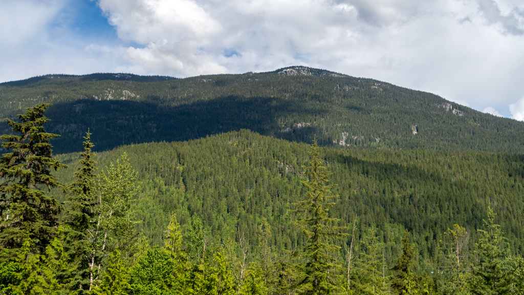
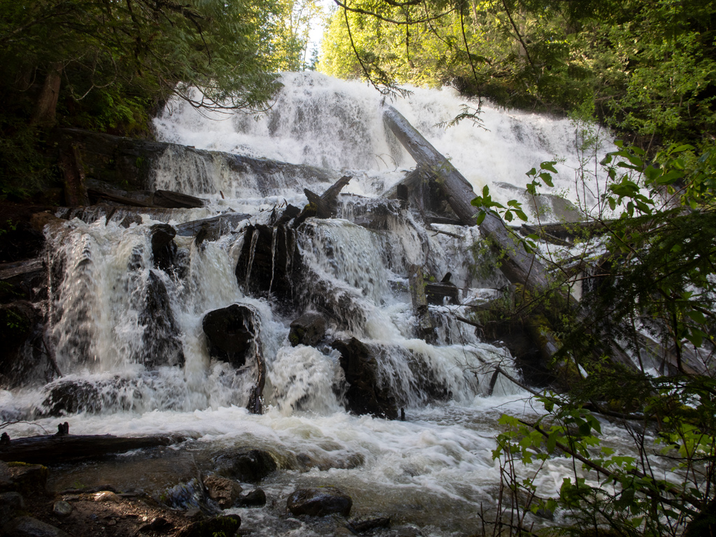
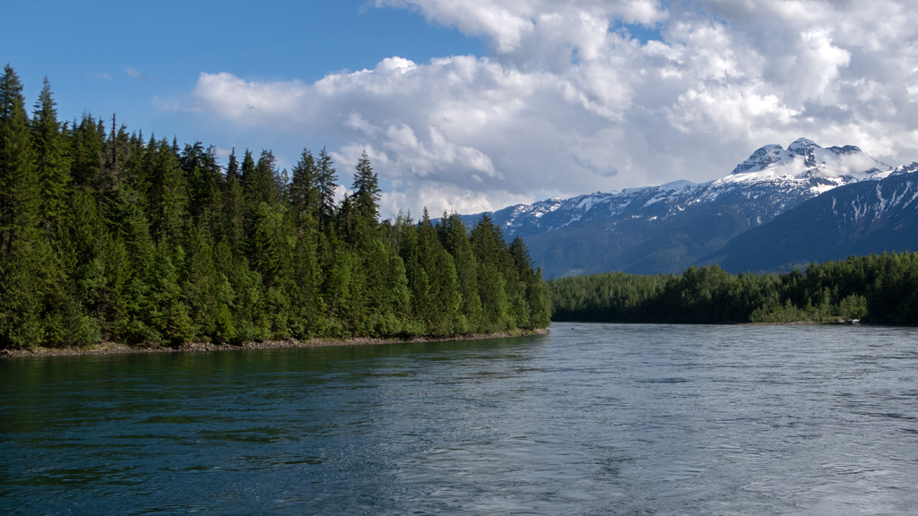
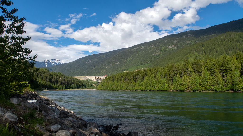
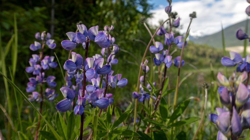
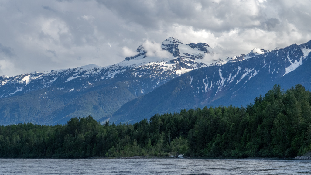
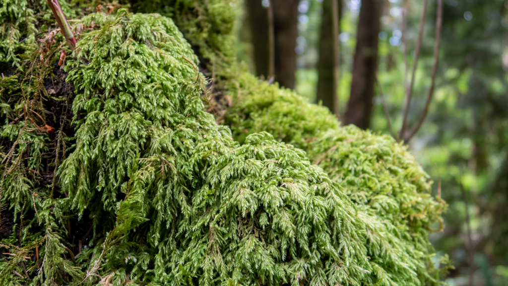
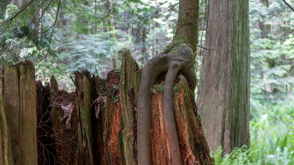
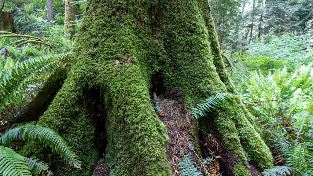
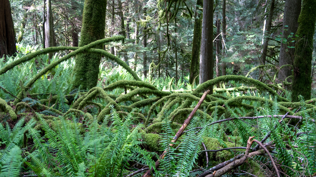
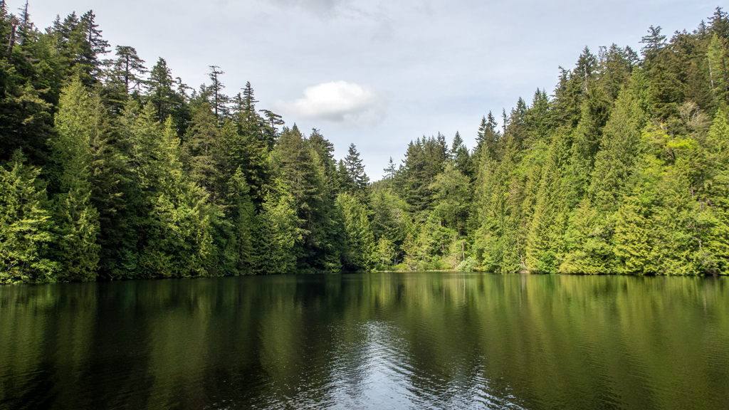
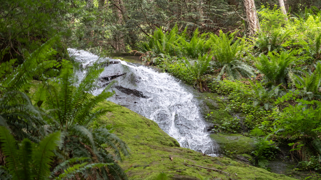
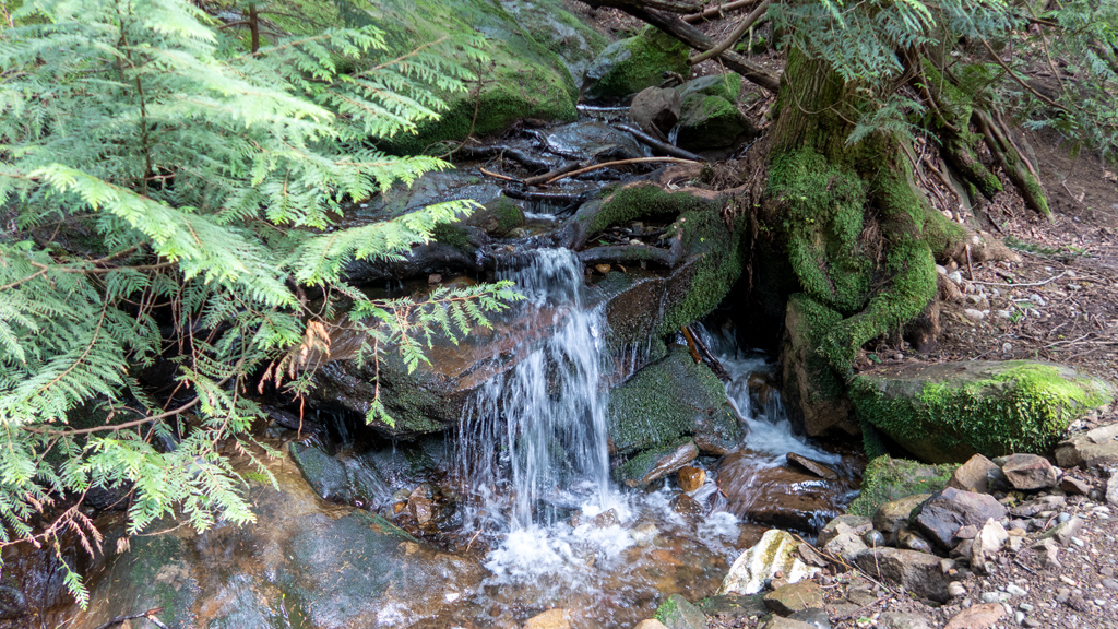
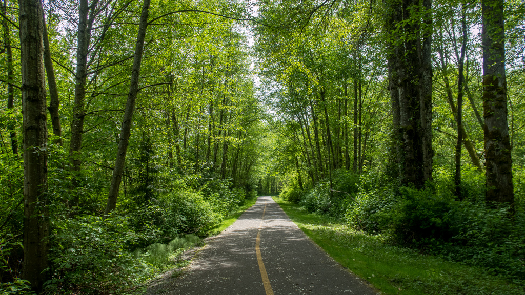
  • The outdoors in Montana are unparalleled by anything else I’ve seen in America—and I already think this, even though I haven’t been to the north­western corner of Montana yet, which allegedly is the most beautiful part. There are many outdoors activity opportunities (as you might have seen from all the hikes I’ve done). There is always interesting scenery to look at, and when you’re out in the wilderness, the air is probably the clean­est, purest, crispest air I’ve ever breathed.

  • The people are very kind and considerate. All the hikers I’ve encountered radiate warmth, peace, and happiness. Everyone has been proactively friendly to me, initiating conversation, but remaining respectful enough as to not pry too much unless I volunteer the information first.

  • The culture has a strong sense of community. I can’t quite pinpoint what exactly made me feel this way, but I immediately felt a sense of belonging through­out a majority of Montana (the only exceptions being the main university areas in Bozeman and Missoula, but even then, it was “normal” at worst). It’s as if everyone was genuinely interested in getting to know their neighbors so they can be there for one another when they need each other.

  • One silly (but meaningful) thing I really liked was the abundance of no-leash parks and hikes—it evokes great joy when a happy dog comes skip­ping towards you asking for pets, not only because I love animals, but also because it sends a clear message about the culture that people trust each other to be responsible and reasonable—something that is basically impossible in major cities.

  • Although there seems to be a lean towards conservatism, there is still good political balance across the state. Especially in the past few years, I’ve learned about the importance of politics and how it can shape a community. When it comes to important matters, failure to have differing o­pin­ions can be harmful, as we can see in states like California and in cities like Seattle and Portland. In Montana, people seem much more willing to actually share their conflicting view­points, discuss controversial topics, and listen to each other, rather than simply trying to shut down everyone who disagrees with them.

  • This isn’t quite as applicable to me because I don’t think I’m going to move to Montana, but for those who do, it seems like a good place to raise a family, with good in-state education options and low cost of living. There are also some more obscure perks, like no state sales tax.

I have plans to head into Canada for a bit over the summer, and because of how positive my experience has been in Montana, I’m looking to cross the border back into the United States through Montana, which would give me an opportunity to drive through Glacier National Park.

 
For now, with the current leg of my Montana visit wrapped up, I wanted to share some of the leftover photos I had that weren’t quite good enough to war­rant their own individual blog post, but collectively were enough for a round-up.

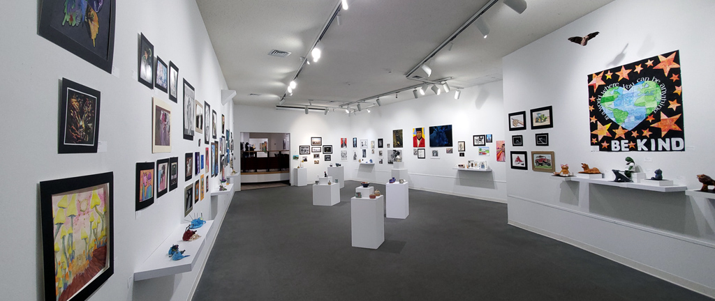
This first set of photos comes from the Holter Museum of Art in Helena, Montana. This was a relatively small museum with free admission (though I made a donation of US$5 to serve as an admission fee) that seemed to primarily feature art made by the children of Helena. I’m used to going to major museums with famous art pieces, but looking at art made by kids was a very unique experience and gave me some insight on how the current youth per­ceives the world.

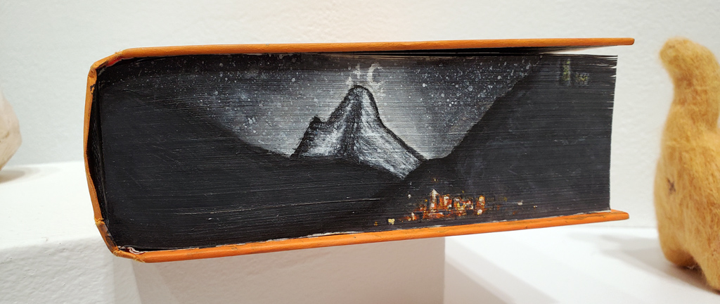
I went through a phase a little while back of being very interested in “luxury” books with full-grain leather covers, gold foil wrapping, and other unique features. One of the things I liked was art painted on the side of the book that morphed perspective when you opened and closed the book. I found something similar at this museum, which isn’t bad, considering it was painted by someone in middle school.

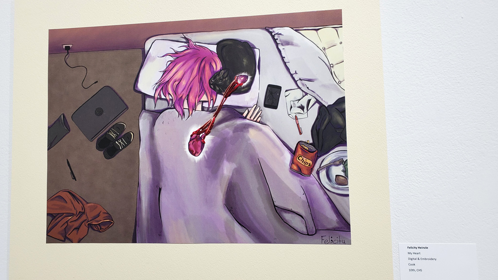
With my adoration of cats, and having lived with three cats with my most recent previous roommate, I liked this multi-layer art piece, which had thread link­ing the hearts of the girl and the cat. Pudding the Persian liked to sleep by my head on or beside my pillow, and this reminded me of him.

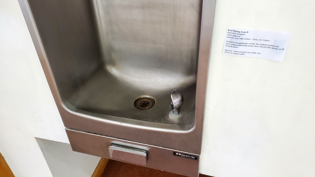
Funny enough, my favorite art piece wasn’t exactly an art piece, but rather, a satire label of the water fountain titled “Ever-Flowing Tears.”

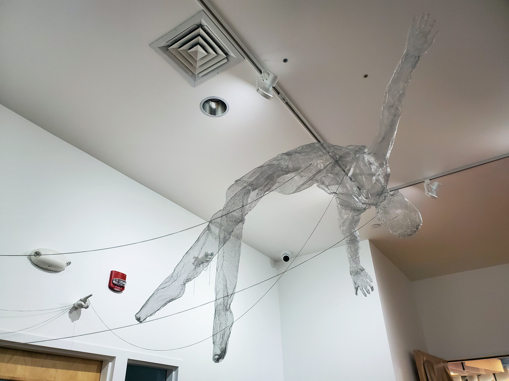
One section of the museum had wireframe models hung up on the ceiling, which I thought were very interesting. I also found it very impressive that a student managed to put all this together and have it come out so well.

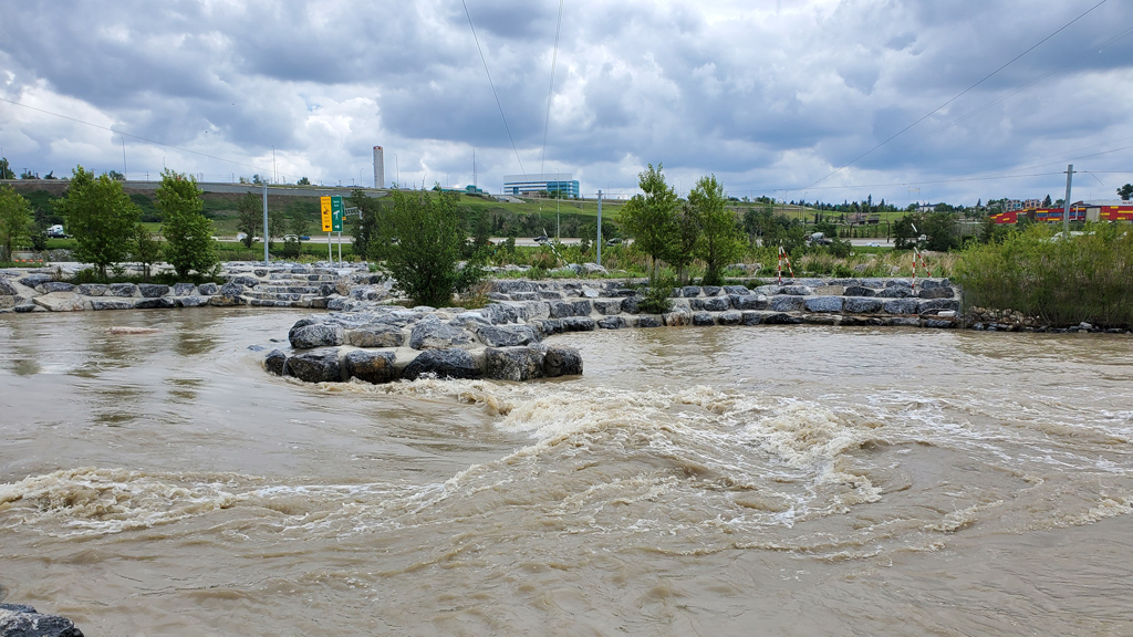
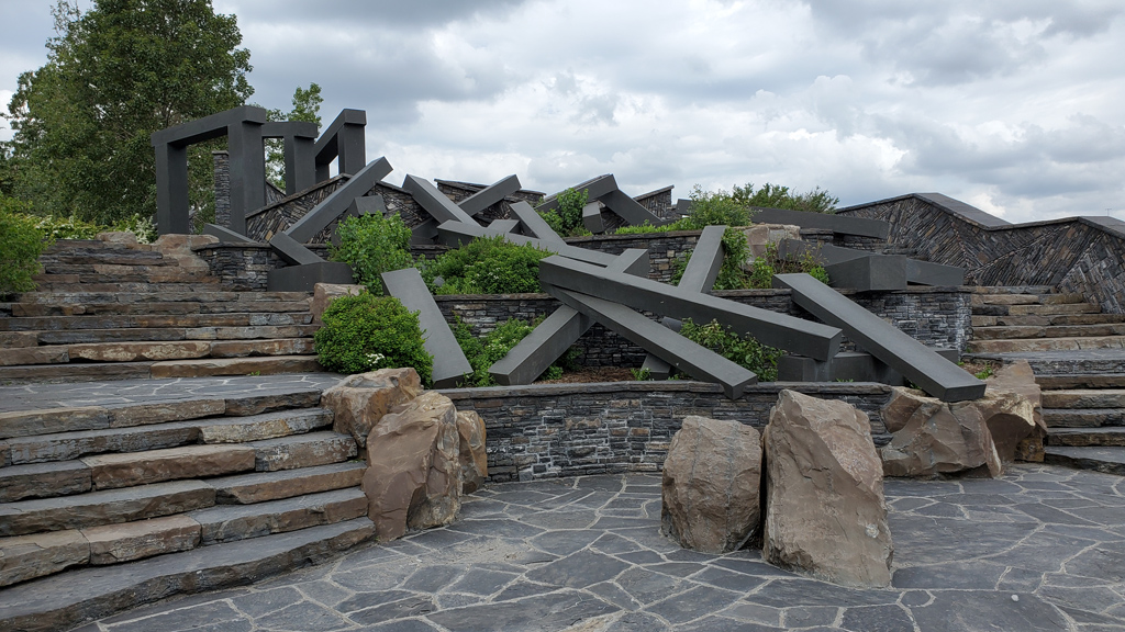
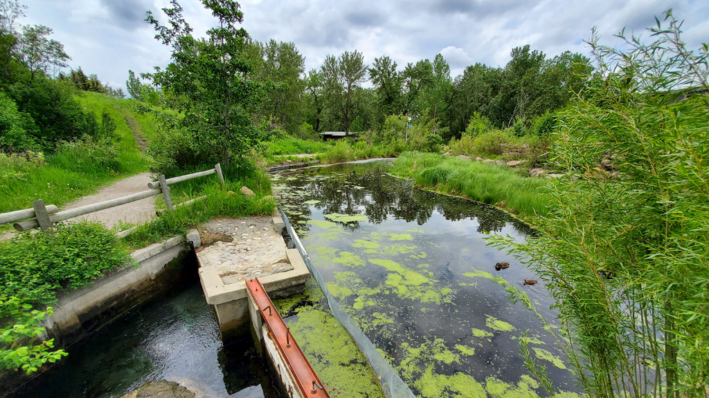
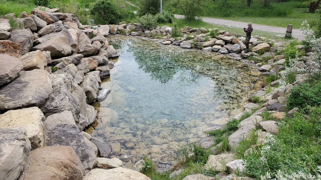
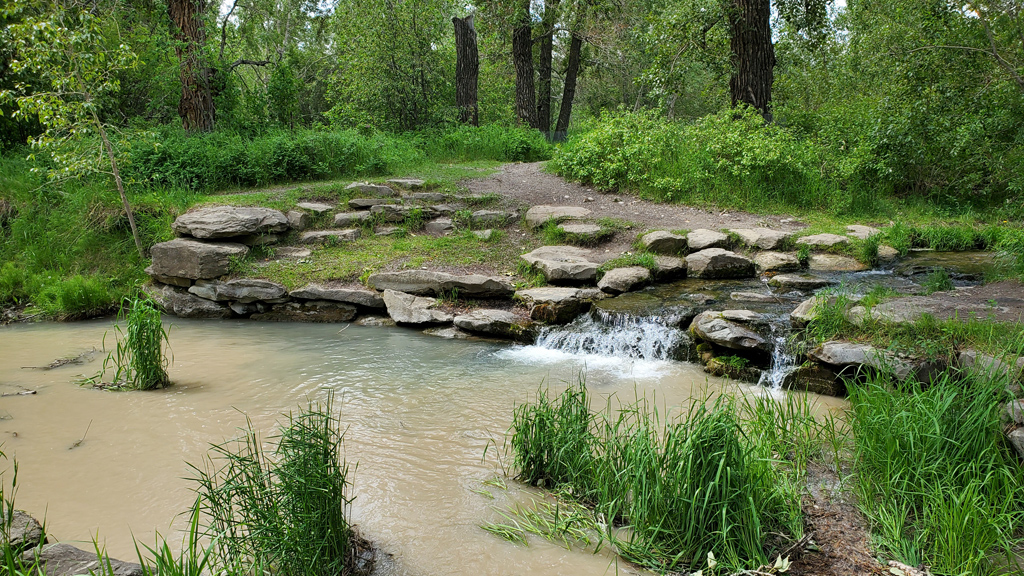
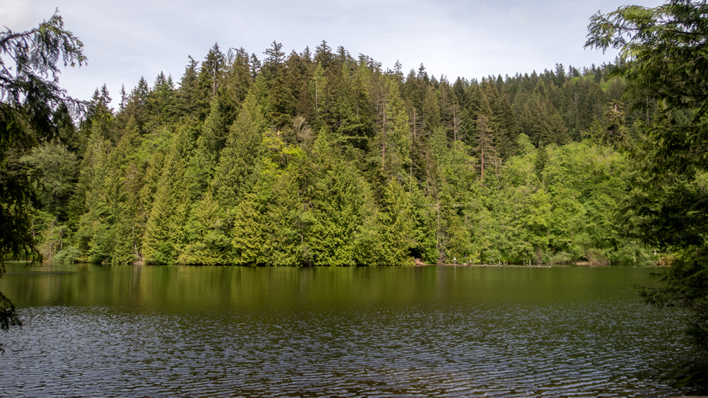
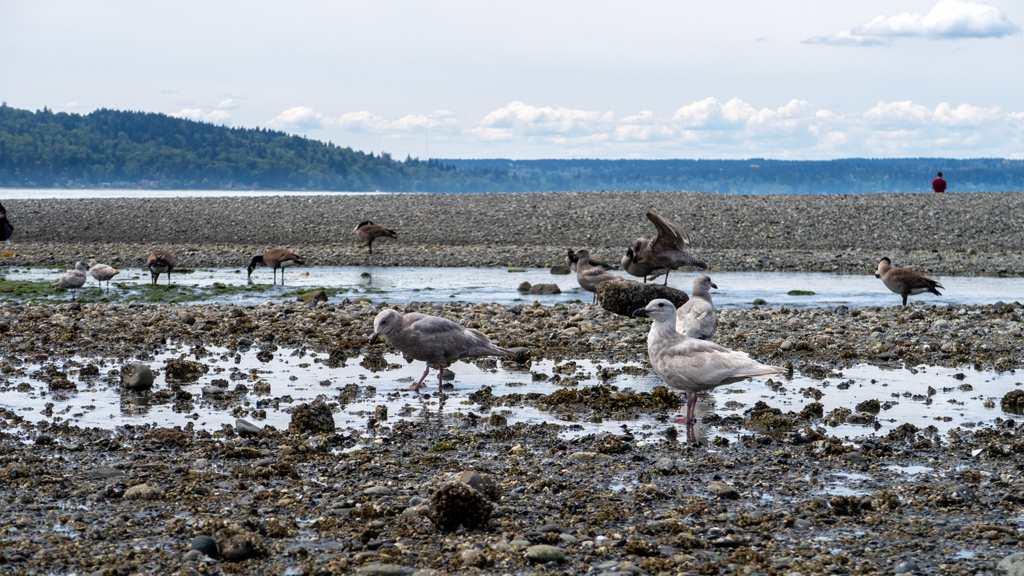
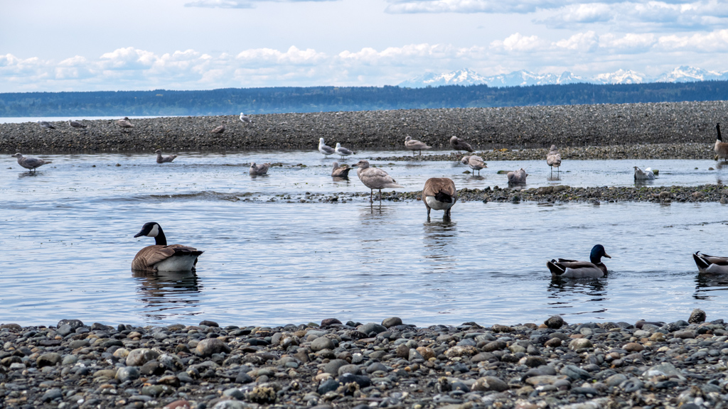
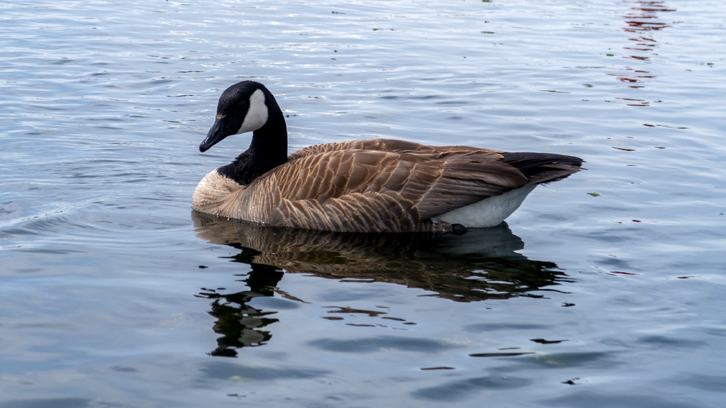
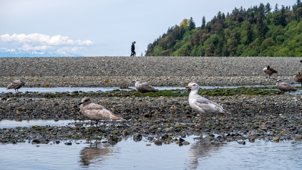
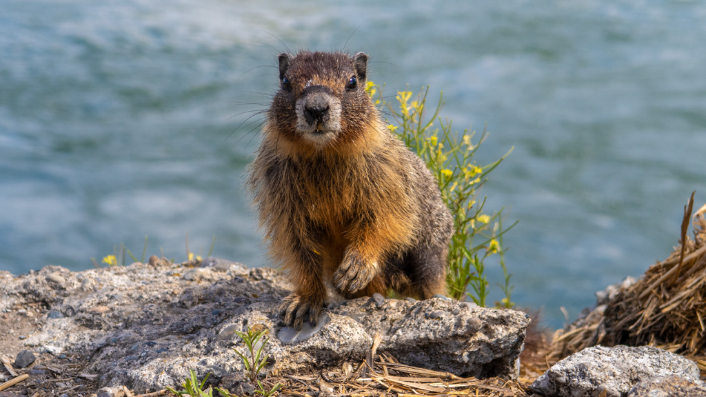
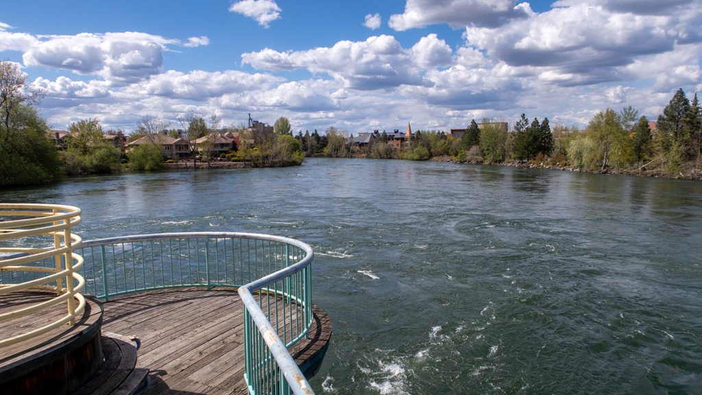
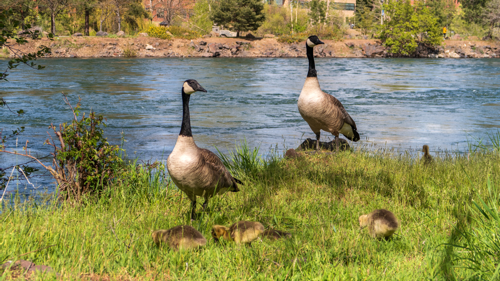
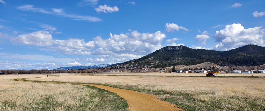
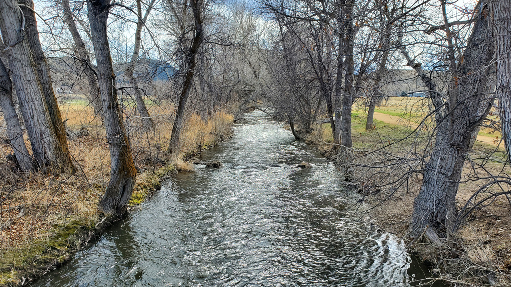
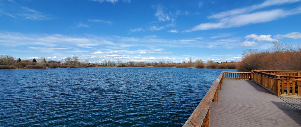
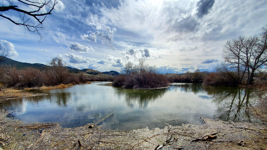
My next batch of photographs comes from Spring Meadow Lake State Park, also in Helena.

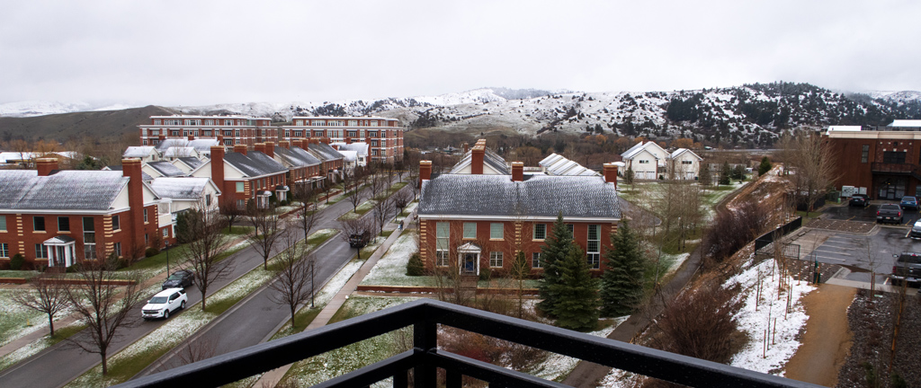
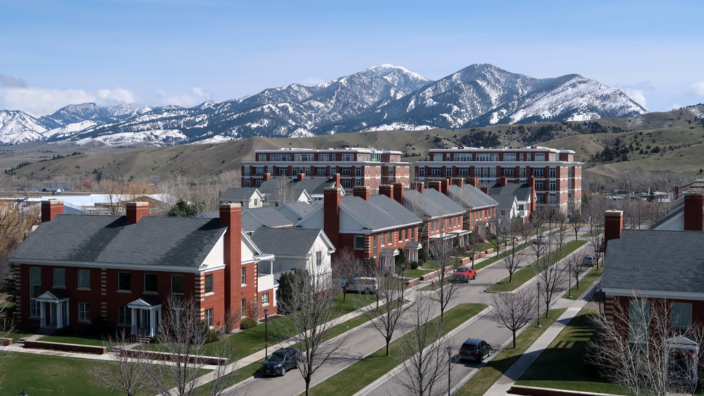
While in Bozeman, I stayed at the Residence Inn by Marriott Bozeman Downtown and was lucky enough to get a room with a balcony that had an a­maz­ing view to the northwest. It was snowy on the day I arrived, but once the snow melted, the cloud cover and fog cleared and revealed an amazing lay­er of snow-tipped mountains.

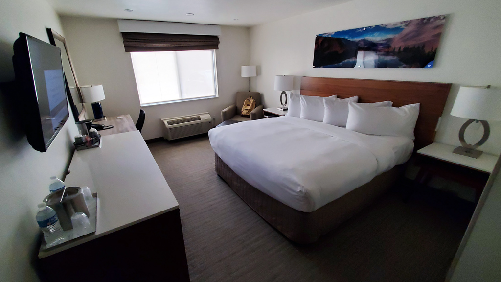
And finally, I like to share hotel room photos when I stay at a new hotel brand or one that is of a newer generation of interior design. In Helena, I stayed at the Delta Hotels by Marriott Helena Colonial, which was my first ever Delta. It seemed like it was an older hotel, though the interior was still nice and simple. The lobby area of the hotel had a vintage-feeling staircase going up to the second floor, and the building itself was actually quite large.

During my stay, I noticed that it wasn’t really that busy and the rooms weren’t getting filled, but the meeting rooms were bustling—it seemed like com­pa­nies rented out meeting rooms for corporate events during the day, and I saw that some of them were even being used for Advanced Placement ex­ams for high schoolers.

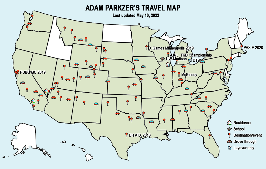
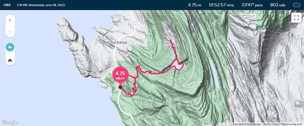
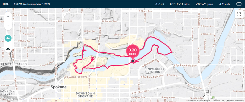
With Montana complete, here is the latest in my travel map:


—§—