Hello, Dinosaur Ridge in Jefferson County of the Denver Metropolitan Area, Colorado

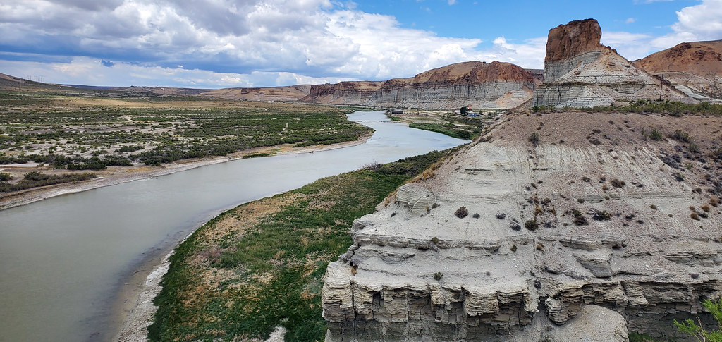
Yes, I know that the title of this blog post, as well as the one about Green Mountain, are a little ridiculous… but if you know me, you know that I like doing things right, and neither of these landmarks are officially within Denver (and Dinosaur Ridge isn’t even officially in any city), so they’re a little dif­fi­cult to describe.

Dinosaur Ridge in Colorado

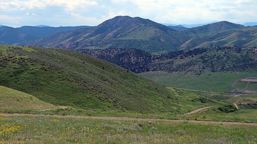
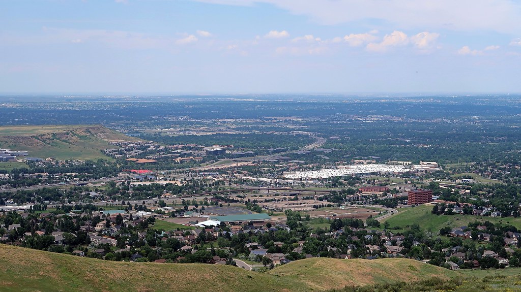
Anyway, for my final touristic activity of this leg of my trip, I headed over to the Dakota Ridge Trail to hike up Dinosaur Ridge. Dinosaur Ridge is right by Green Mountain, which I visited a few days ago, but I decided on this trail instead of something deeper west into the mountains because it already takes over half an hour for me to drive to this area from where I’m staying in Centennial. Because of this, you might recognize some of the scenery from these photos if you already read my Green Mountain blog post, but just from a closer or further point-of-view.

Dinosaur Ridge in Colorado

This hike was longer, but it was definitely easier than going up Green Mountain, and I only ended up climbing about half the elevation that I did for Green Mountain. The intensity of the climb wasn’t much different than Green Mountain, though; a lot of the elevation gain happens right at the be­gin­ning of the hike, then it plateaus out once you reach the top of the ridge.

Dinosaur Ridge in Colorado

Dinosaur Ridge in Colorado

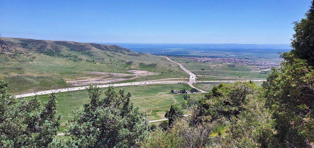
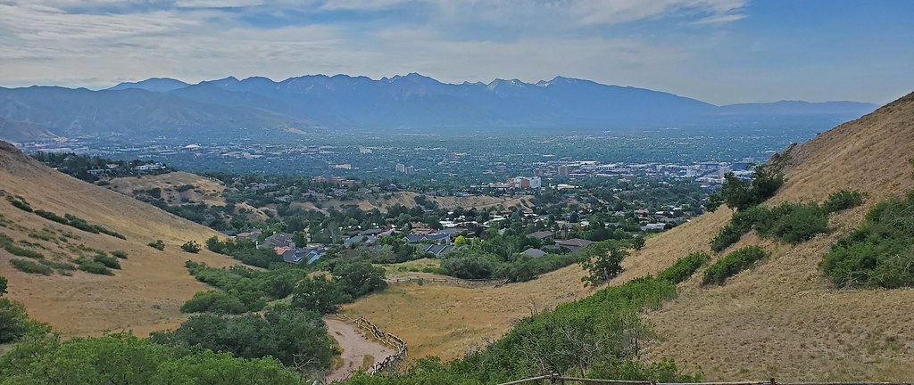
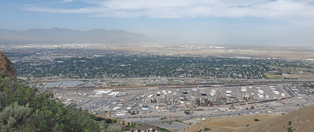
At the summit, there was a little flat platform of land where you could see Denver, and also transfer over to Zorro Trail if you wanted.

Dinosaur Ridge in Colorado

Dinosaur Ridge in Colorado

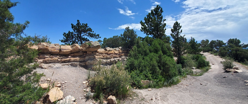
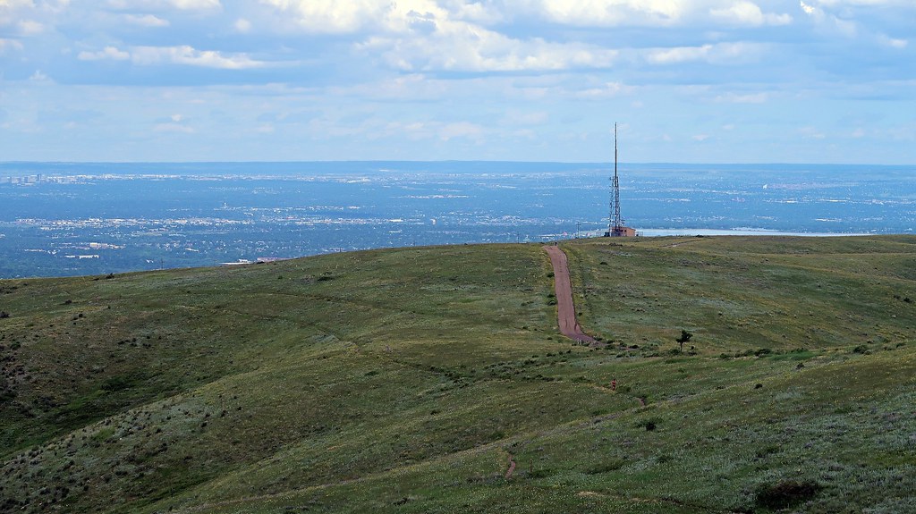
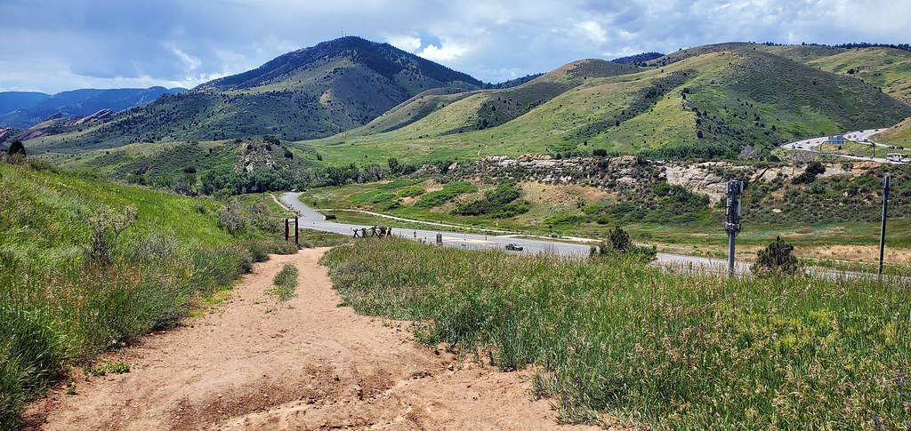
Instead of transferring, I instead chose to continue along the upper ridge of Dinosaur Ridge. I checked a handful of maps and wasn’t able to find a spe­cif­ic name for this trail, but it ran parallel to Dakota Ridge Trail. This path was much more woody and foresty.

Dinosaur Ridge in Colorado

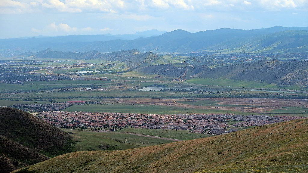
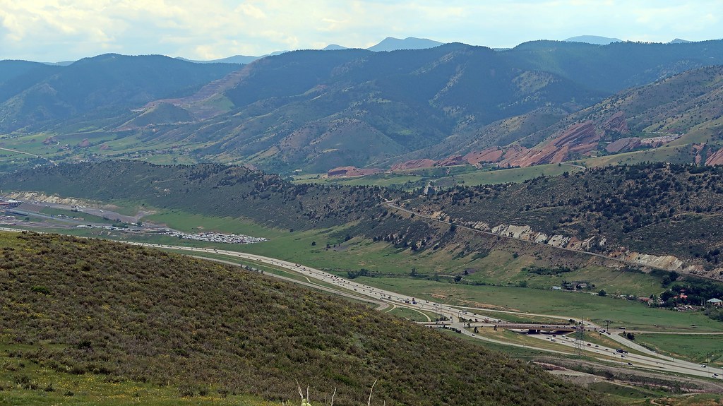
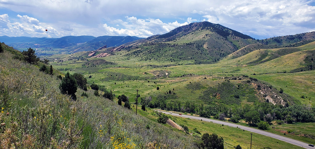
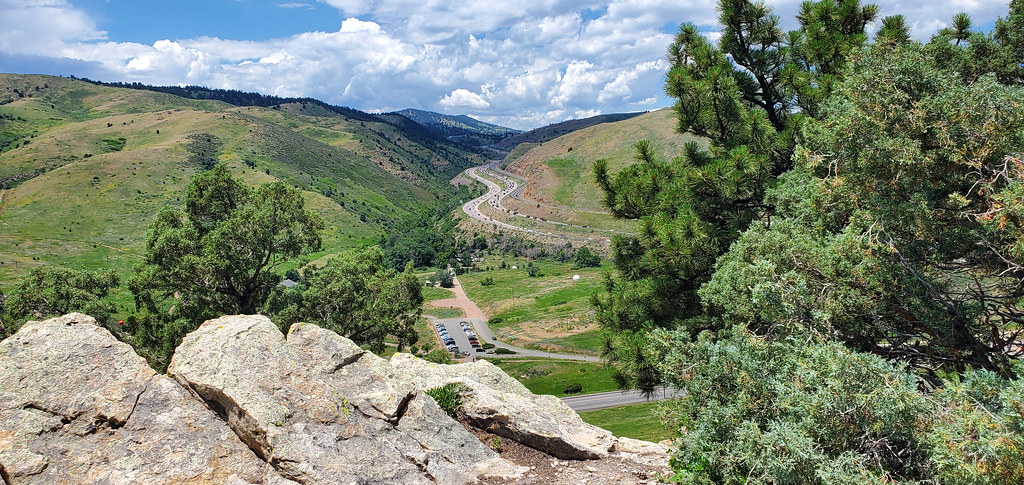
Once I got to the tip, I was able to get sweeping views to the north, with a sharp cliff down.

Dinosaur Ridge in Colorado

Dinosaur Ridge in Colorado

And with that, that wraps up my trip to Denver. I’m glad my final activity was a hiking trip, because I’m headed eastbound to Kansas tomorrow, and I’m definitely not going to be seeing any more mountains for a long time. My visits to Utah, Wyoming, and Denver were fantastic, and I’m hoping that I won’t be let down by the rest of my journey through the Midwest.


—§—


Hello, Denver Botanic Gardens

I wanted to go on another hiking trip today, but because of the flood warnings, I imagined that the terrain would be a bit too muddy for comfortable hiking, and I decided to find an alternative activity instead. I decided to go to the Denver Botanic Gardens on York Street in Cheesman Park (as opposed to the Chatfield Farms one in Littleton).

The Botanic Gardens were fairly dense with a lot of winding roads and a lot of things to take in. That was fine, though, because I arrived early enough before closing time that I had hours—plenty of time to see everything. … Or so I thought.

I started on the north side of the Gardens and walked through the bonsai tree exhibits.

Denver Botanic Gardens

There was also a desert garden, which made me feel right at home. I snapped a photo of some cacti.

Denver Botanic Gardens

Towards the western, central part of the Gardens, there were some water gardens.

Denver Botanic Gardens

At this point, it started lightly drizzling. It had been cloudy since I got to the Gardens, and I figured there was a chance of rain, but the light drizzle wasn’t too bad.

Denver Botanic Gardens

Denver Botanic Gardens

My favorite part of this area were the ducks. They were pretty quick and kept dipping in and out of the water, but I managed to snap this photo of three of them at once.

Denver Botanic Gardens

By this point, the rain was picking up a bit, but it was still manageable. I didn’t come prepared with an umbrella (and I don’t recall even using an um­brella ever since turning double-digit age), so I was getting a bit damp.

Denver Botanic Gardens

In the southwestern part of the Gardens, I found a rabbit running around (or maybe it was a hare? but it was fairly small, so I’m leaning towards rabbit). I’ve actually never touched a rabbit before because I’ve never interacted with domesticated rabbits. When I still lived in the Chicagoland suburbs, I would see hares around a lot, but it’s usually not a good idea to go touch wild animals—not that they would let me anyway.

Denver Botanic Gardens

Now the rain was really picking up. I had just finished navigating through a “birds and the bees” trail; it was nestled inside a lot of trees, so I didn’t realize how much it was raining, but when I popped out of the exit, I started getting very wet. I began looking for cover.

Denver Botanic Gardens

I made my way through some winding paths and found a little gazebo in the middle of the water gardens. By this point, it was absolutely pouring.

Denver Botanic Gardens

That was very unfortunate, because I had just made it through only about a third or so of the outdoor exhibits. Fortunately, there were some indoor ex­hib­its available, so I headed inside to check them out and hope that the rain would subside soon.

Denver Botanic Gardens

I found a peace lily; I snapped a photo because my parents had like five of these in their house when I still lived with them.

Denver Botanic Gardens

The conservatory connected to the Freyer-Newman Center, where there were a few art exhibits available for viewing.

Denver Botanic Gardens

Well, the bad news is, it never stopped raining. After sitting on a bench in the Boettcher Memorial Center to relax and reply to some emails and mes­sages, I realized that this rain probably wasn’t something that I could just wait out. It wasn’t a torrential downpour anymore, but it was still raining hard enough that I didn’t want to get absolutely drenched walking around outside.

I ended up leaving much earlier than I had hoped. I missed out on a lot of the gardens and exhibits, and also missed out on a few of the other indoor attractions (like the Tea House, Science Pyramid, and Solarium), as they were still closed, presumably because of the COVID-19 pandemic.

If I ever return to Denver, I’m definitely interested in coming back to the Denver Botanic Gardens. Not only is there still a lot more for me to see, but the environment is also just very pleasant and tranquil; it feels like a nice place to spend an afternoon relaxing, sitting on one of the chairs, and reading a book surrounded by plants.


—§—


Hello, Green Mountain in Lakewood of the Denver Metropolitan Area, Colorado

I made it into Denver Metropolitan Area from Rawlins, Wyoming this past Monday after a drive that lasted just shy of 4 hours.

The drive was pleasant with a decent amount of scenery, especially after entering into Colorado. With the state border receiving drizzles of scattered show­ers, the air smelled crisp and refreshing—a pleasant contrast from the polluted air of the cities in which I usually am. I also had a work call during my drive, which made that hour feel like it went by a lot faster. Overall, the trip felt fairly quick.

My hotel of choice for this leg of my trip is the Courtyard by Marriott Denver South/Park Meadows Mall, south of the main Denver city/county and near Centennial. (Interestingly, the hotel has an Englewood address, even though Englewood is several miles northwest of Centennial; I haven’t figured out why yet.)

Since arriving, I spent Monday night and most of Tuesday catching up on work and relaxing. I’m heading out of Colorado on Saturday, so I didn’t want to lose any more days; I went on my first hike this morning.

Green Mountain in Lakewood, Colorado

When selecting hikes, I like to pick trails that are moderate or intermediate in difficulty that will allow me to overlook the city with a wide, sweeping view. For today’s hike, I wanted to summit Green Mountain in Lakewood. I headed over to the Rooney Road Trailhead and made my way up the Rooney Valley Trail.

Green Mountain in Lakewood, Colorado

Green Mountain in Lakewood, Colorado

Once I got close to the summit, I transferred over to the Summit Loop Trail for a nice view of the entire Denver Metropolitan Area.

Green Mountain in Lakewood, Colorado

Green Mountain in Lakewood, Colorado

Green Mountain in Lakewood, Colorado

Green Mountain in Lakewood, Colorado

After reaching the peak of Summit Loop, I transferred back over to the Rooney Valley Trail and summited Green Mountain, which gave me some nice views of the southwest corner of the Denver Metropolitan Area.

Green Mountain in Lakewood, Colorado

Green Mountain in Lakewood, Colorado

It seems like the Denver area has a lot of great hiking opportunities. Unfortunately, I’ll only have time to hit two more spots at most, but I’ll definitely be putting my final two full days in town to good use.


—§—


Hello Wyoming

This post is over 5 years old and may contain information that is incorrect, outdated, or no longer relevant.
My views and opinions can change, and those that are expressed in this post may not necessarily reflect the ones I hold today.
 

Instead of going from Salt Lake City to Denver by heading back down south and driving through I-70, I instead chose to go through I-80 so I could hit Wy­o­ming on the way there. I’m told that the drive through I-70 is much prettier, but I also took this route sort of as a way to plan ahead for the future—I figured that, if I’m traveling to Denver again with other people, it is much more likely for us to drive through I-70 rather than I-80. For the sake of trying to seize the opportunity to do something I might not be able to again in the future, I mapped out a path through I-80.

Green River, Wyoming

My first stop in Wyoming was in Green River, a city in Sweetwater County. I exited off I-80 and took a break at Thomas Moran Park, where the Green River Chamber of Commerce and Visitor Center are located.

Off to the side of the Visitor Center was a little horse pen. I’m not sure why they were there, but they were my first two new friends of Wyoming.

Horses

Horse

An interesting thing I noticed about Wyoming is that I don’t actually get reliable cell service here. I use T-Mobile, but most of the time in Wyoming, I’m connected through a partner network. The speeds I get are so bad that Google Maps directions often take a very long time to load, or just don’t load at all. The only functional use for this data service seems to be receiving text-only emails.

After saying goodbye to my new horse friends, I tried to search for a restaurant so I could take a lunch break, but couldn’t load Google Maps properly. I ended up just driving around the city until I saw a McDonald’s in the distance. I got a burger and tried to use the McDonald’s wifi, but even that was so slow that I still couldn’t load anything on my phone.

After my meal, I followed street signs to I-80 East and continued on my way across Wyoming, while realizing how much I take for granted a reliable In­ter­net connection wherever I go.

Green River, Wyoming

My halfway point between Salt Lake City and Denver where I decided to stay for a few nights was Rawlins in Carbon County. My hotel of choice was the Fairfield Inn & Suites Rawlins. Luckily, the Internet connection at the hotel was surprisingly fast and reliable, so I grabbed an offline map so I could explore without fear of getting lost.

Rawlins is home to the Wyoming State Penitentiary. Having formerly been in law enforcement and earning a degree with a heavy focus on criminology, this was particularly interesting to me. Although I didn’t plan far ahead enough to get a tour of the active prison, I was able to walk in for a visit to the Wy­o­ming Frontier Prison Museum, a tourist attraction open to the public.

Wyoming Frontier Prison Museum

The museum exhibits were free to access, but I chose to go on a guided tour of the entire facility for $10.

The recurring theme throughout the tour seemed to be that Wyoming can get to be a very cold place, and the prison’s technology systems were fairly far be­hind, so the inmates were basically freezing to death the entire time and would go out of their way to do things to keep warm. For example, they would purposely cause mischief so they would be “punished” by being sent to a different, “harsher” area of the prison—which actually ended up being bet­ter for them, because it was warmer there. Or, because this was a working prison, some would do everything they can to get a job in the kitchen where they could stand by the vats of steaming food that would keep them warm.

Wyoming Frontier Prison Museum

Wyoming Frontier Prison Museum

This prison was the set of the 1987 film Prison. Back then, the prison was set for demolition, so the production company made some permanent mod­i­fi­ca­tions to the prison, including adding an extra door in a visitation cell and drilling a massive hole through a concrete yard barrier. However, after that point, it became very obvious how expensive demolition would be, so it was left as-is and is now a museum.

Wyoming Frontier Prison Museum

My stay in Wyoming was as interesting as I thought it would be—I expected pretty much nothing, and there was a whole lot of nothing.

Another thing there was a lot of was rain—apparently it’s commonplace for it to be sunny one minute, then pouring rain the next. The weather was in the 50-60s°F, which is usually a bit too cold for my liking, but was actually very refreshing this time around because I had spent a majority of the month in a 100+°F heat wave on the West Coast.

Tomorrow, I set off for Denver, Colorado.


—§—


Hello, Great Salt Lake in Utah

This post is over 5 years old and may contain information that is incorrect, outdated, or no longer relevant.
My views and opinions can change, and those that are expressed in this post may not necessarily reflect the ones I hold today.
 

Due to my broken eyeglass incident (which, by the way, has an update now that I edited in yesterday), I feel like four out of the six and a half days I had in Salt Lake City were robbed from me—the first day when my glasses snapped in half at the bridge, the second day when I drove around to a repair shop and eyeglass store trying to figure out how to resolve the situation, the following day when I tried to get accustomed to my new glasses and failed hard, and yesterday when my glasses snapped in half at the leg.

With that being said, I think I still hit the two most important places that I wanted to visit in Salt Lake City—Ensign Peak, where I was able to get sweep­ing views of the entire metropolitan area, and Great Salt Lake, the body of water after which Salt Lake City is named.

Great Salt Lake

I went to Great Salt Lake by means of the Great Salt Lake State Park, southwest of the Great Saltair; admission was $5. The park had an observation deck with a good lookout spot of the lake and beach.

Great Salt Lake

There was also a beach access spot, so I went down to the sand… which was a questionable decision. I imagine it’s because of the high salt content in the lake, but there was an absolute insane amount of bugs on Silver Sands Beach. In the photograph below, you’ll see some gray stuff floating along the shore­line, as well as on the green sand. … Those are all bugs.

Great Salt Lake

There were some areas of cleaner sand, but the entire area smelled terrible, presumably because of the bugs. I walked close to the water and got swarmed by bugs, and they followed me a good couple hundred feet back to the park.

Great Salt Lake

There was another nice lookout point at the edge of the park that overlooked the opening for boats to sail off from the marina into the lake. The area looked like it was closed down, so not many people went over there, but it seemed like the blockade was only to stop vehicles from passing through that area. I went around the barrier and walked all the way down onto the rocks.

Great Salt Lake

On my way back, I snapped a photo of the marina.

Great Salt Lake

And behind the Great Salt Lake State Park, the Oquirrh Mountains served as a nice backdrop.

Great Salt Lake

I don’t get too grossed out by anything, so I was fine walking around Silver Sands Beach, but it was quite frankly hilarious watching some of the other tour­ists go down there and freak out at the smell and bugs.

I’ve stared into the vast nothingness of the Pacific Ocean at astronomical twilight from a high point at the Palos Verdes Peninsula in Los Angeles, so star­ing into the Great Salt Lake wasn’t anything too life-changing, but I definitely enjoyed the experience.

Today is my final full day in Utah; tomorrow, I set off for Wyoming.


—§—


Hello Salt Lake City

This post is over 5 years old and may contain information that is incorrect, outdated, or no longer relevant.
My views and opinions can change, and those that are expressed in this post may not necessarily reflect the ones I hold today.
 

This post is a bit delayed because of my broken eyeglass situation, but I’m finally a functioning human being again, and that’s what matters.

The trip up north from St. George to Salt Lake City was fairly smooth; I drove for about two hours, took a lunch break at Fillmore, then fin­ished the re­maining two hours to the Fairfield Inn & Suites Salt Lake City Airport.

As of today, I’ve been to 26 states and have personally driven in 20 of them. Out of all those states, I would say that Utah by far has the best drivers by a no­tice­a­ble margin. I think this might be attributed to the fact that Utah is the only state that has abundant signage educating drivers about various po­ten­tial road situations.

A few of the ones I saw on my drive up were:

  • “No vehicles with trailers in left lane” and “No vehicles over 12,000 GVW in left lane,” to keep slow vehicles out of the passing lane
  • “Drowsy drivers take next exit in ___ miles,” because driving fatigued is basically just as bad as driving drunk
  • “Do not cross double white lines,” to stop people from swerving in and out of the HOV lane
  • “Legal to exit HOV when emergency vehicle present,” for the idiots who then proceed to never leave the HOV lane because they just saw a sign that told them not to cross double white lines, and thus impede emergency vehicles
  • “Fender bender take next exit and call 911,” to stop people from pulling over right on the side of the highway and causing rubbernecking traffic and putting their own selves in physical danger
  • “Fines up to $1000 for unsecured loads” and “Fines up to $500 for littering,” to remind people that there are actually punishments for this stuff

On the other hand, California by far has the worst drivers by an even greater noticeable margin, and could definitely use these kinds of road signs. Hi­lar­i­ous­ly, the only vehicles I’ve seen so far breaking traffic laws in the Salt Lake City metropolitan area are cars with California license plates.

 
Apart from my broken glasses incident, my stay in Salt Lake City has been fairly uneventful. I like to avoid going places over the weekends because I don’t like when it’s too busy, and it tends to be a lot busier everywhere on the weekends. So, I usually stay indoors on Saturdays and Sundays and catch up on work.

Now that it’s Wednesday and I can actually see where I’m going, I took my first leisurely trip outside earlier today and hiked up to Ensign Peak. It was a very short but fairly steep hike; apparently it’s only about one mile round-trip, but my fitness tracker says I climbed about 41 stories during the hike up. I picked this spot as my first nature destination because it was a great location to see the Salt Lake City metropolitan area with vast, sweeping views.

View from Ensign Peak in Salt Lake City

View from Ensign Peak in Salt Lake City

View from Ensign Peak in Salt Lake City

Ensign Peak in Salt Lake City


—§—