Hello, Aliso and Wood Canyons Wilderness Park

As my days in California are (finally) coming to an end before setting back out on my road trip, I wanted to do one last interesting hike. Although I’m probably one of the most anti-California people you’ll ever meet, that’s more about the California government; everyone has to acknowledge that South­ern California in general has some pretty stunning scenery if you find the right places to visit.

After doing a bit of scouting, I decided to head to Aliso and Wood Canyons Wilderness Park. My hike started in Laguna Beach and continued on into Alisa Viejo before looping back around to the trailhead in Laguna Beach. The drive here from the company headquarters in Long Beach was pretty in­teresting and scenic, and parking was easy to find at the Top of the World Park, even on a weekend.

As expected, the beginning of the trail had vast views of the surrounding area.

My main route was through Mathis Canyon Trail, but I connected onto a different trail to check out a unique point of interest.

The trail I connected onto was Car Wreck Trail. I saw online that this trail had been named as such due to a literal car wreck at the base of the trail. After an extremely steep descent, I found the car.

It obviously has a lot of graffiti now, but it makes me wonder what the situation was surrounding the crash, and what it originally looked like before na­ture decided to absorb the vehicle as a part of itself. There isn’t a way for me to easily verify this, but based on research I did online, the crash hap­pened in the 1940s, and the car is a 1946 Dodge coupe.

After getting a good look at the car, I continued on south to Oak Grove Trail, then reconnected with Mathis Canyon Trail to return to where I started. This part of the trail had some really nice wildflowers.

I saved the best for last—even though I started at Top of the World, I didn’t actually go up to Top of the World until I was fully done with my hike, to hold it as sort of a reward for finishing. It was an amazing reward, and these photos do not do it justice at all.

The views of the ocean were surreal and dreamy. The reflection of the limitless reach of the sun’s rays made the ocean look like the void, but the op­posite—instead of black nothingness, it was a blueish-white nothingness.

In total, my hike was just over three and a half miles with about 800 feet of elevation gain, and I’m happy I picked this trail for my final hike for my stay this time around. If you’re in the area, I recommend checking it out, though if you’re scared of heights or aren’t an expert at navigating uneven rocky ter­rain but still want to see the car wreck, you are much better off taking Mathis Canyon Trail all the way down, connecting onto Oak Grove Trail, vis­iting the car wreck, then taking Mathis Canyon Trail all the way back up for a much smoother incline during your ascent.


—§—


Hello, Palm Springs Air Museum

After a nice hike in the sizzling hot sun, I decided to stop by the Palm Springs Air Museum for my second major tourist activity of the weekend before heading back to Orange and Los Angeles Counties.

I’ve been to a few aviation museums at this point, but I’m still not very well-versed in aircraft, so I still don’t have too much commentary to add to my photos—I mostly just snapped a photo of everything that looked nice, then picked out my favorite photos to feature here.

However, I do have some more information about my first two photos. The Air Museum obviously had general admission tickets, but it also allowed peo­ple to purchase extras called “Warbird Rides.” These were rides in aircraft ranging anywhere from US$99 for a C-47 Skytrain to US$4,995 for a T-33 Thunderbird. While I was at the museum, I was lucky enough to see someone purchase a ride on a T-6 Texan for $495.

The first photo above shows the pilot and the passenger in Heave Ho GQ 286068, and the second photo above shows the plane taking off into the sky. The rest of the photos below are just interesting things I saw at the museum.

At the end of my museum tour, I went upstairs into the library, which had some flight simulators that I tried out. I discovered that I am an absolute ex­pert at shooting bullets where enemy aircraft used to be, no matter how much I try to lead my shots…

Although I’m still nowhere near competent at aircraft, I’m starting to learn and remember things from these museums I’m visiting, and it’s always sat­is­fy­ing to see a few recurring themes across these museums that I can recall from past visits to different museums.

I always like living in the present and looking towards the future, so I would love to see some displays of modern-day commercial aircraft that I per­son­al­ly take through major airlines, so that I can learn more about the big metal tubes in which I fly thousands upon thousands of miles per year. I think it would also be pretty neat to have prototypes of advancements in aircraft technology soon to come, sort of like how other museums in other fields of study will spotlight what scientists are currently working on.

However, until then, I still appreciate taking a look at the evolution of aircraft, and seeing just how quickly things have advanced so that I can hop on a plane whenever I want for a few hundred dollars and be wherever I want to be in a matter of hours.

Continue reading


—§—


Hello, Coachella Valley Preserve

After arriving back in Los Angeles from Newark, I gave myself a day of rest, then set out on another trip to the Coachella Valley. My previous visit to the Palm Springs area was great, and the hike I did at the Indian Canyons is still my favorite hike so far, so I figured it would be a nice weekend trip to head back there again.

The weather was pretty warm in California, which was a jarring difference from the New Jersey cold. The hike I selected, the Moon Country Loop via Mc­Callum Trail, had relatively low shade in the latter part of the hike, so that also made the sun feel particularly hot.

The parking situation was a bit strange here—there was an open area that looked like it was designed to be a parking lot, but the gate leading to that area was closed, so people ended up all parking on the side of Thousand Palms Canyon Road. Because it’s a Saturday, there were a lot of people out hiking, so I had to park a decent distance out from the trailhead.

 
The beginning of the trail was very tourist-friendly, with wooden bridges built over wet parts and clearly-marked dirt trails with plenty of shade.

I followed the McCallum Trail up to Simone Pond, which had remarkably clear water. A handful of people who ventured out here were having a picnic next to the water, and there also appeared to be a ranger answering tourist questions about the area.

After doing a loop around the pond, I transferred over to Moon Country and headed out into the barren desert. The first area of interest was a vista point where I was able to see an unobstructed view of the Coachella Valley Preserve. In the first photo below, you can see the palm trees surrounding Simone Pond, while the second photo shows the vegetation surrounding the McCallum Trailhead.

I continued past the vista point and hiked a fairly large circle around the desert, and was met with a zig-zagging path up a mountain, but I figured that I didn’t have enough food and water with me to continue up, and it was getting a bit too hot, so I turned around and followed the dried wash back to the trailhead.

This hike wasn’t quite as amazing as Murray Canyon, but it’s always fun seeing desert oases. There’s another hiking trail going southeast instead of north­west from the same general trailhead area that leads to Pushawalla Palms; I look forward to checking that off my hiking list as well, the next time I’m in the Coachella Valley visiting.

Continue reading


—§—


Hello, northern New Jersey

In early 2020, one month before the World Health Organization declared COVID-19 a pandemic, I went to visit my aunt and cousin in New Jersey. Even though I was still traveling somewhat normally throughout the pandemic, due to my aunt’s old age, I opted not to visit again in 2021. However, with the pandemic under better control and all of us having been fully vaccinated and having received an additional booster dosage, I decided to make a visit again this year.

As you’re probably already familiar, for the sake of protecting their identities and helping them maintain their peaceful and private lifestyles, I don’t like to share photographs or information about my friends or family members unless they are already public figures. Because of this, I won’t be sharing any photos from my time with family (except for one, which you’ll see later), but I do have some photos of other stuff I did while I was in town.

 
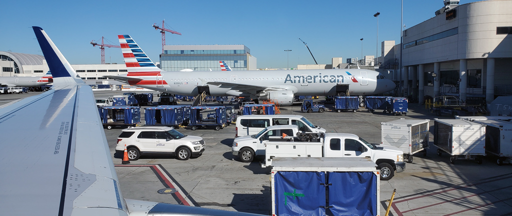
Getting to New Jersey this time around was a bit difficult—my flight outbound from Los Angeles International Airport to Newark Liberty International Air­port was canceled due to “Winter Storm Landon.” I am putting that in quotation marks because the United States generally does not name winter storms, so I’m not even sure how this winter storm got a name, but I guess it deserves one if it made JetBlue cancel my flight.

I did end up getting as lucky as possible for someone with a canceled flight, though, because I was rebooked onto a different flight out of Los Angeles International Airport, but instead heading to John F. Kennedy International Airport in New York City. It was obviously a bit more inconvenient, because I would have to drive a bit longer to get to northern New Jersey, and I would either have to pick between going through a toll bridge or driving through Manhattan (I ended up taking the toll bridge), but it only set me back by two hours, so I couldn’t complain that much.

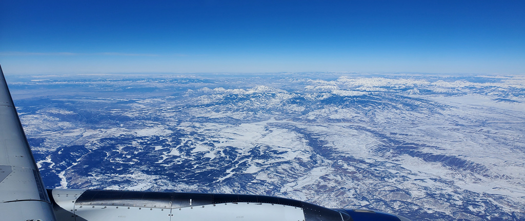
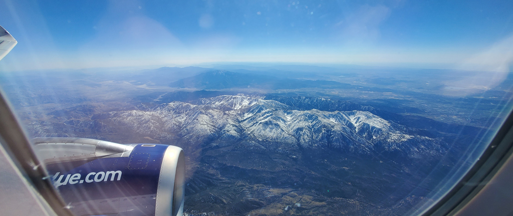
In fact, this might have been a worthy trade-off. I don’t know what the passenger density situation was like in my original flight to Newark, but this flight was so sparsely populated that I was able to have an entire extra-legroom row to myself.

That made for a much more comfortable and private travel ex­perience, and it also meant I was able to get snacks and beverages from the JetBlue Pantry without needing to climb over anyone, while still having a win­dow seat to be able to take nice photos, like this one while flying over Colorado.

I obviously had to change my rental vehicle pick-up location, seeing as it was originally reserved in Newark and now I’m arriving in New Jersey. Al­though I had a guaranteed pickup truck reserved in Newark, when I transferred it over to New York City, I guess there wasn’t enough pickup truck availability, because they ended up putting me in a Volkswagen Jetta, a compact sedan.

Needless to say, that was a horrible experience, because the mirrors were so small that the vehicle had a ton of blind spots everywhere, and the height of the car was so short that it felt like everyone around me was just going to run right over me, and the engine was so weak that I felt like I could’ve sprint­ed faster than the car accelerated… but I survived.

 
During one of the days that I was on my own and wasn’t spending time with family, I met up with one of my friends who lives in the area. I was looking forward to going to Elements to try out their chef’s tasting menu, which is similar to the one I tried at Nonesuch in Oklahoma City… except apparently, Elements is closed on Sundays, Mondays, and Tuesdays right now—which happens to coincide perfectly with the days that I was free.

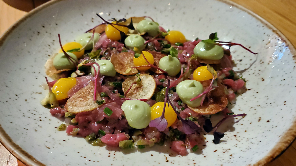
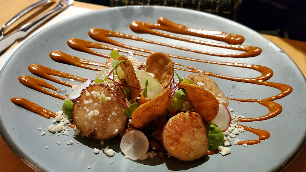
Instead, we went to Mistral, a restaurant right next door and owned by the same person. Although there was no tasting menu, there was still a nice se­lection of high-quality food options.

For our appetizer, we ordered beef tartare with cornichons, capers, and tarragon, topped with some potato chips. I usually like eating dishes with raw meat (like sushi, tartare, and blue rare steak), but this beef tartare was a bit too sour for my taste—the cornichons and capers completely overwhelmed any beef flavor that there was.

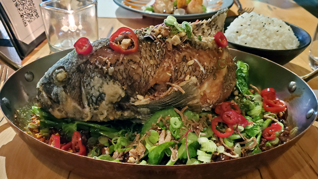
For my main entrée, I ordered a crispy whole black bass in mapo mushroom sauce topped with chilis, peanuts, and pea leaves. Although the name of the dish literally says “whole black bass” in it, for whatever reason, the true meaning of that didn’t register in my brain when I ordered it. Because of that, you can probably guess my utter appalment when the waiter brought out an entire crispy fish standing upright.

I had never eaten an entire fish like this before, and I had no idea what to do, so I asked the waiter for advice; he said that I can sort of just knock the fish over on its side and begin scraping away at it, being careful not to swallow any bones. This took a little over an hour for me to finish.

My friend decided to use both halves of her brain and ordered something much more reasonable–seared diver scallop with charred corn, peppadew pep­pers, queso fresco, and sorrel cream.

Although I would’ve preferred to have a dish that didn’t require more time to dig at it than it does to actually eat it, I’m honestly glad that I accidentally ordered this whole fish. If I had known ahead of time that I would have to strip all the meat off the fish myself, I wouldn’t have ordered it, but this was definitely an experience to add to my roster of interesting things I’ve done. … Definitely not an experience that I would ever want to have again, but still one that I’m happy I had.

 
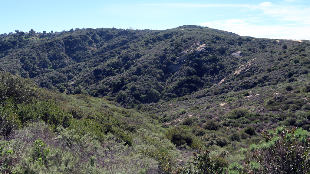
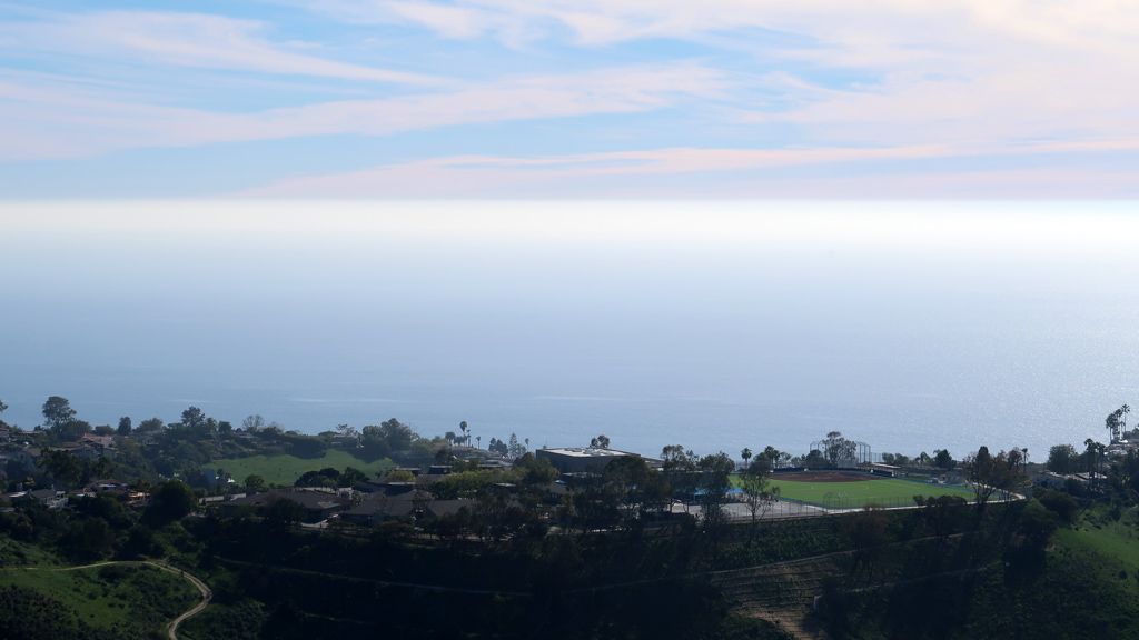
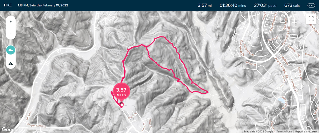
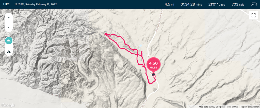
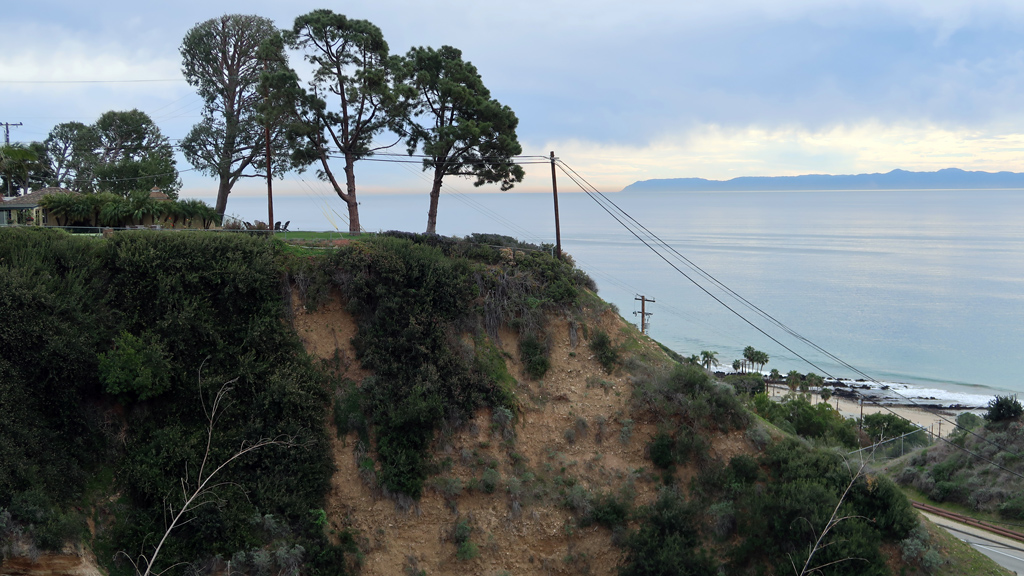
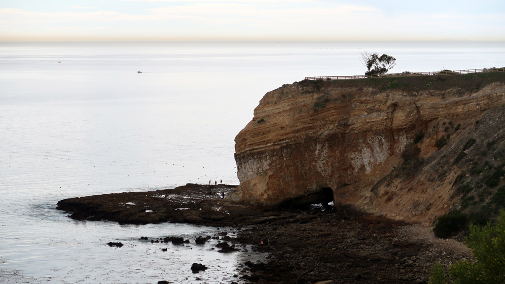
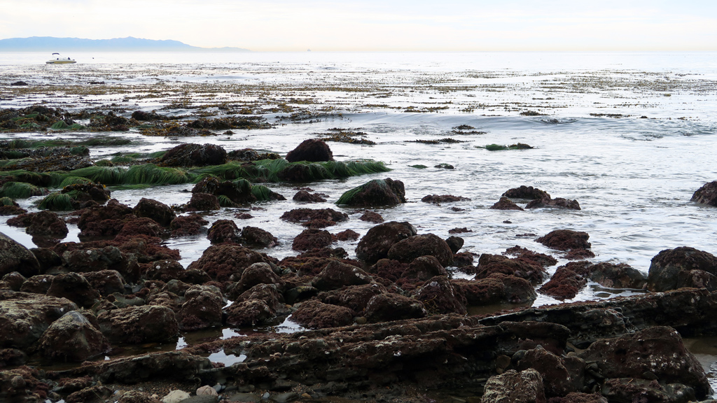
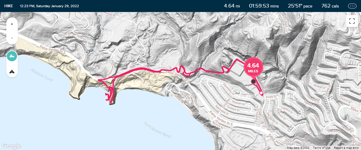
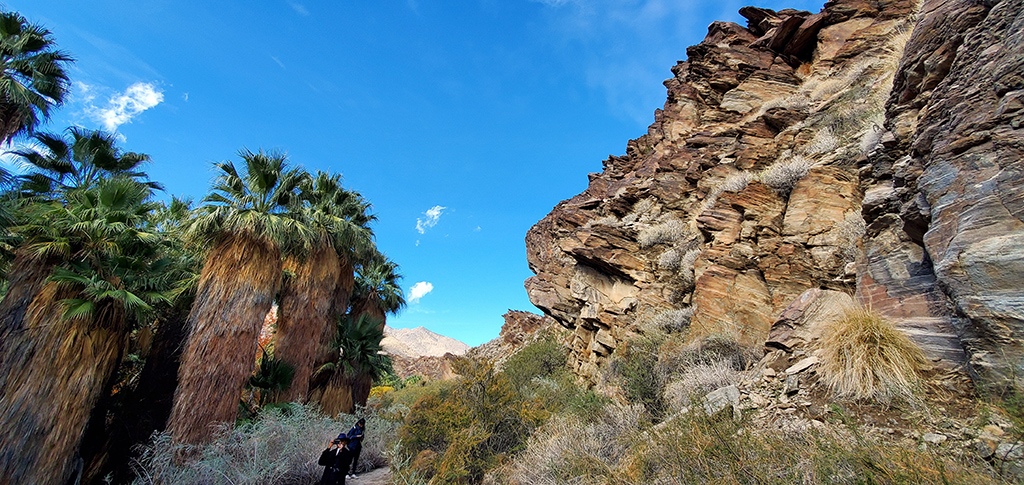
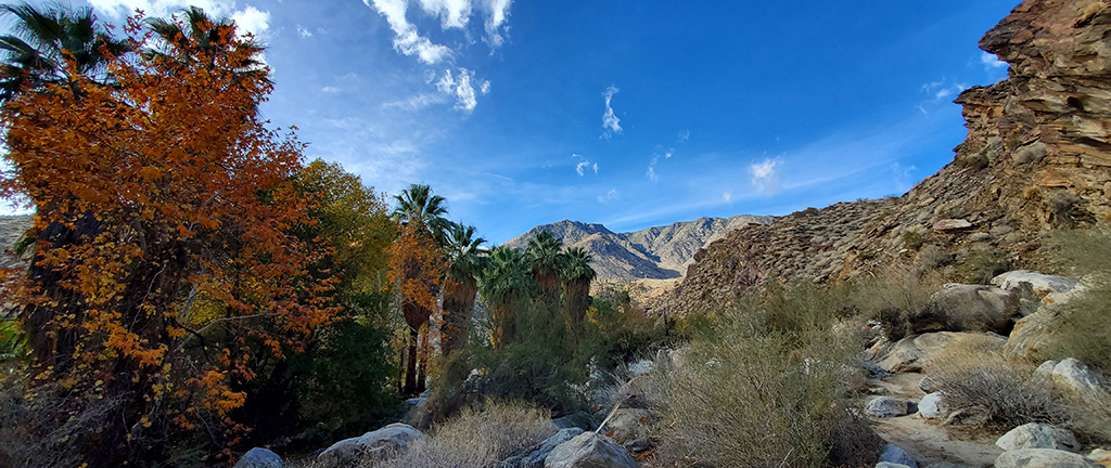
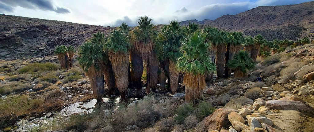
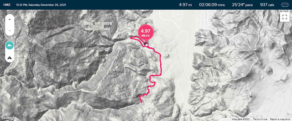
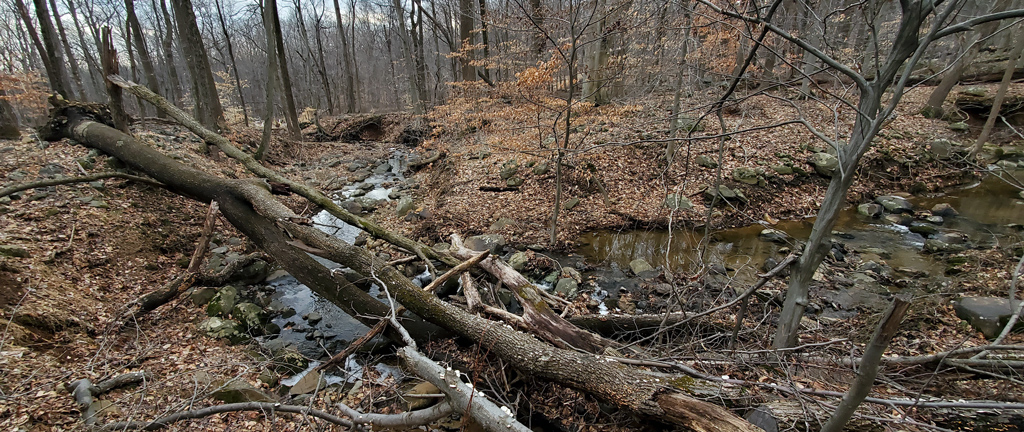
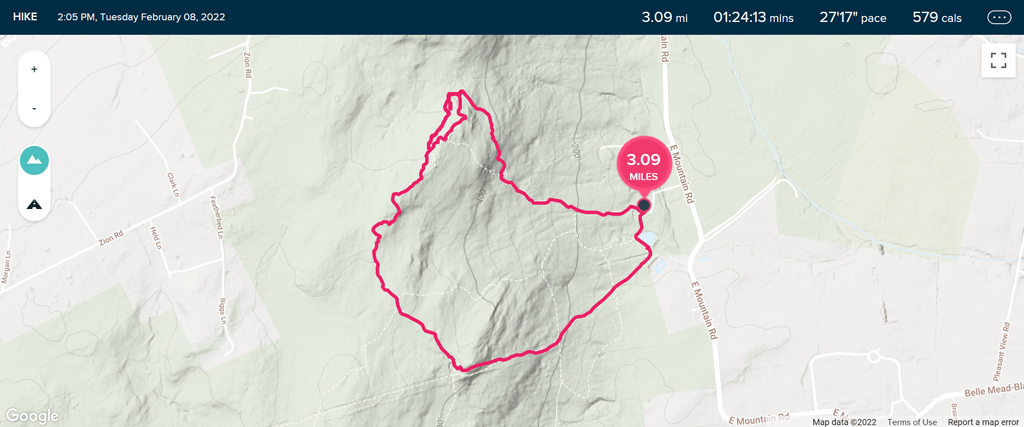
The following day, I decided to go on a quick hiking trip. Northern New Jersey isn’t exactly the most terraneous area, but I did still manage to find a trail that had decent elevation gain, at the Sourland Mountain Preserve in Hillsborough Township.

I think the hike would’ve otherwise been fairly mundane, but because there was so much ice on the trail, it actually made it a lot more technical and fun, as I had to constantly be on the lookout as to where I could step without having another comical fall like I did a few weeks ago and get another injury.

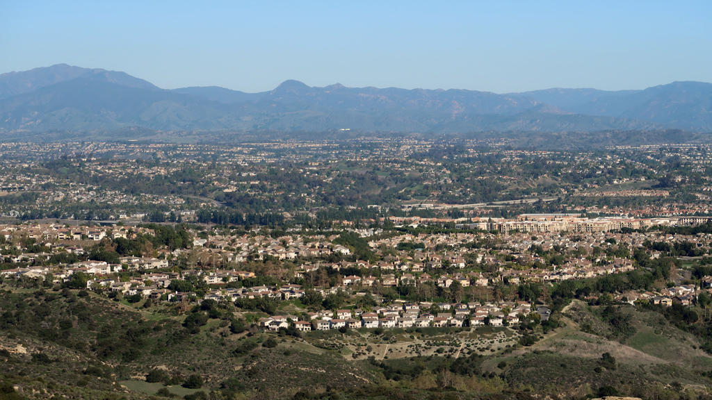
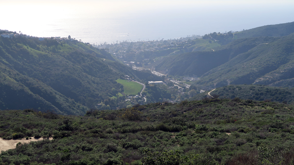
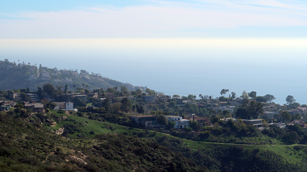
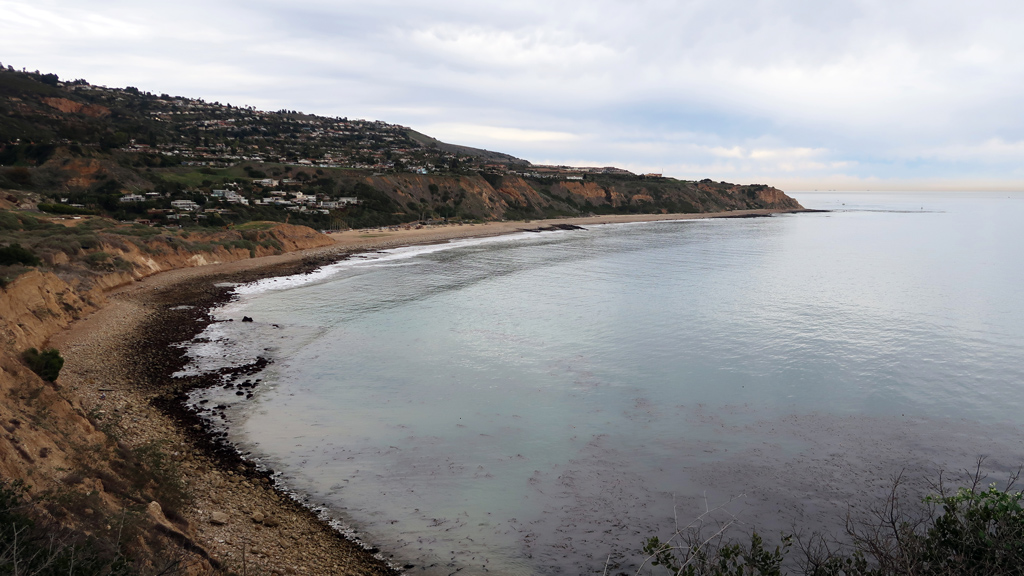
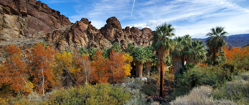
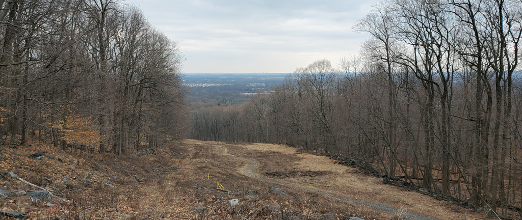
The summit had a clearing where you could look towards New York City and see the skyline. You might be able to see it in the photo below if you bring your screen right up to your face… the buildings appear as a few pixels above the horizon.

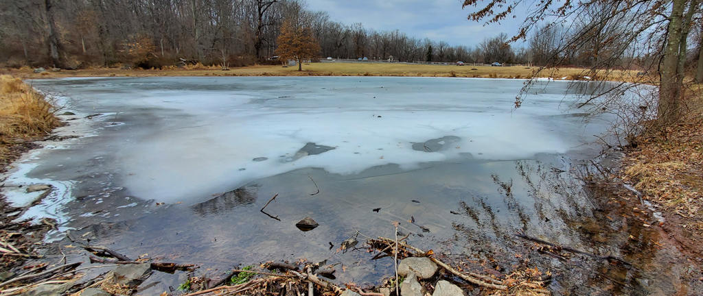
When I returned back to where I had parked, I went past a frozen pond. Even though I grew up in the Chicagoland suburbs where it regularly gets freez­ing cold in the winter, for some reason, I don’t think I’ve ever actually seen a frozen pond up-close in-person before.

After looking at it for a while, I thought I was getting vertigo, but what was actually happening was that the ice layer was slightly shifting, bending, and moving back and forth from the force of the water below. I sort of wanted to get a huge boulder and throw it into the pond to see if I can make a nice shattered ice pattern, but I decided against it.

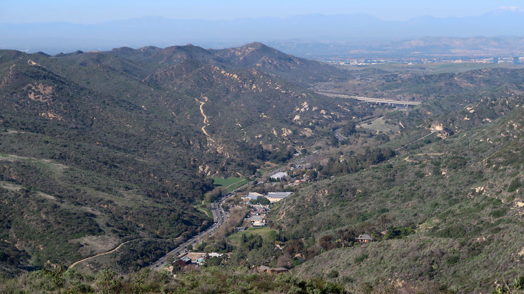
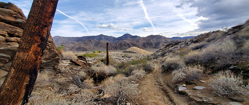
You can’t really tell from my GPS tracker because the line is a little too thick to effectively show path overlap, but the top corner of this trail was very con­fusing, not only because the trail wasn’t that well marked, but also because there was ice and fallen leaves everywhere, so it felt like I was just ran­domly walking through thin forest.

Whenever I did think I caught a trail, I would follow it… but I ended up just walking in circles about three times before finally noticing that everything looked awfully familiar, and realizing that I should probably keep an eye on my map while trying to escape this maze.

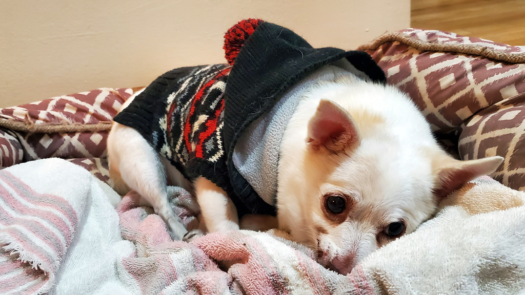
Remember how I said earlier that I usually don’t share photos of family, but I had one exception here? This is the exception photo. This is Tinkerbell, my cousin’s dog. I believe she is a Chihuahua mix, but I’m not 100% sure what breed she is (though the likely answer is that she is just a normal, healthy, mixed breed).

After the conclusion of my five days in New Jersey, I went to refuel my rental vehicle and drop it off before flying out. I found a gas station and pulled up to a vacant pump. I swiped my credit card, but the machine rejected it. Wondering if Chase was blocking my personal credit card, I pulled out my busi­ness credit card and tried that… and the machine rejected that too. Wondering if this particular gas station only accepts debit cards, I tried swiping my debit card, but still, to no avail.

I got back my rental car and reversed to a different vacant pump. I went through the same procedure again, but all my cards got rejected again. Confused, I left the gas station and went to another one nearby.

The exact same thing happened at the other gas station too. I tried two pumps, three payment methods at each of the two pumps, and everything got de­clined. Now mildly annoyed, I decided to just use the rental car provider’s refueling service, even though it is astronomically more expensive than re­fueling myself, because I didn’t want to risk missing my flight while going from gas station to gas station trying to find one that wants my business.

I later texted my cousin and was informed that, in New Jersey, it is illegal to pump your own fuel. Apparently, I wasn’t supposed to drive up to a vacant pump and try to do it myself… I was supposed to drive up to a pump with an attendant (which I didn’t even see) and have them pump my fuel for me.

I researched this while waiting for my plane, and it’s true—New Jersey is one of only two states out of 50 in the United States that prohibits you from refueling your own vehicle, with Oregon being the other state (though that law in Oregon only applies in cities, and not in areas with a population under a certain thresh­old).

They claim that refueling gasoline yourself can be dangerous, especially for pregnant women. Well, I guess the entire rest of the country’s infants are all born with birth defects, then. They may as well just say it how it is—this inconvenience is clearly a result of political lobbying.

Apart from the refueling fiasco, this was overall a nice trip. I generally like to avoid excessively cold places, but for some reason, this wasn’t too bad—I just bundled up in a coat thicker than I usually wear, and I was able to manage fine.

I was originally planning on going to Seattle for one week immediately following my trip to New Jersey, but I decided to switch up my plans a bit due to some unexpected scheduling conflicts. Instead, I’ll be sticking around Southern California for another week and a half before setting off to continue my road trip.

Continue reading


—§—


Hello, Abalone Cove Shoreline Park and Reserve in Rancho Palos Verdes, CA

Ever since arriving in Southern California in December 2021 to take a two-month break from road tripping, I haven’t really been doing too much except for working and resting. This is probably evident by the fact that I haven’t published any travel-related blog posts apart from my Christmas trip to Palm Springs; it’s not that I’m getting lazy, it’s that I just haven’t been doing anything interesting.

I’m still exercising regularly and going for walks around Naples Island where the company headquarters is located, but apart from that, there isn’t really much to do around here. The traffic is horrible so it takes an exhausting amount of time to go anywhere, most tourist hotspots have admission ticket prices that are massively inflated and several times more expensive than what you’d expect elsewhere in the country, and I also haven’t really even felt that motivated to go out and be active.

With that being said, I wanted to make sure I didn’t end up in unhealthy dormancy in the team house until I continue my road trip, so I searched on AllTrails for some good hiking spots around Long Beach and found some nature preserves in Rancho Palos Verdes in the southwestern peninsula. Un­sur­prisingly, I had to drive about 40 minutes, but I figured it would be worth it because of the vast views of the Pacific Ocean from Rancho Palos Ver­des.

This wasn’t my first time in RPV; I was last there a few years ago when I was looking at properties for Tempo‘s PUBG team for the National PUBG League that took place in Manhattan Beach. We ended up getting a house in Redondo Beach, but Rancho Palos Verdes was one of several cities that we were considering. The most memorable part about this city was the fact that I encountered a random peacock just walking down the street at one point, and later Googled it and found out that RPV actually did have a wild peacock problem.

 
For my hike, I went to the Forrestal Nature Reserve where there was a free parking lot in front of the Ladera Linda Community Center. There were a few different trailheads to which I could have gone, but I picked this one because apparently the other trailheads have a much more complicated parking sit­u­a­tion where you have to reserve a spot on an app and pay $10.

From there, I hiked into the neighboring Portuguese Bend Reserve and immediately saw some nice views of the ocean juxtaposed alongside the homes within the Portuguese Bend Beach Club.

Rancho Palos Verdes

As I got deeper into the hiking trail, I transitioned to the next area, the Abalone Cove Shoreline Park and Reserve. This was my final destination, and the area that had the nicest and closest views of the ocean from this side of the peninsula. There are a lot of private neighborhoods on the Palos Verdes Pen­in­su­la, so part of this hike involved walking alongside motor vehicles on the public road Palos Verdes Drive atop dirt and rocks.

I eventually made it onto Sacred Cove View Trail, which connected onto Inspiration Point Trail. This led to Inspiration Point at the tip of the peninsula-of-a-peninsula, which provided nice views of Portuguese Point and the Terranea Resort to the west, and the Trump National Golf Club Los Angeles to the east.

Rancho Palos Verdes

Rancho Palos Verdes

Rancho Palos Verdes

Zooming in to the east gave a nice view of the neighborhood nestled inside Palos Verdes Drive to the south, Conqueror Drive to the east, Dauntless Drive to the north, and Klondike Canyon to the west. I wasn’t able to find a name to this neighborhood or subdivision, but it looked like it was mas­ter­planned because it had a nice tiered layout to the homes, sort of like what they’re doing in the luxury neighborhood MacDonald Highlands of Hen­der­son back at home in the Las Vegas Valley.

Rancho Palos Verdes

After taking in the sweeping, unobstructed views, I wanted to make my way down to the beach. The hike down was unexpectedly steep, and there were a few signs warning people of unstable cliffs. Staying close to the inside of the path away from the bluff, I slowly descended to the sand.

Far away, I saw someone staring out into the ocean for a long time. I thought it might be someone who’s going through a tough time, finding solace in the calming monotony of the crashing waves, staring out into the vastness of the ocean and realizing that maybe their problems aren’t that bad after all. If I was more extraverted, I might have even gone up to chat with them to show that there are people out there who care. Instead, I just snapped a photo.

I have incredibly poor eyesight. I nearly failed my vision exam when I renewed my driver’s license, and since then, my eyesight has gotten noticeably worse. Often, I will take pictures of things, then zoom in later to realize that the subject of my photograph is not what I thought. I zoomed into the a­fore­mentioned person… and realized that it wasn’t someone in distress. It was just a fisherman.

Rancho Palos Verdes

I continued walking out through the soft, gray sand and toward the rocks, which I noticed were different depending on how close they were to the ocean. The ones closer to shore were softer and smoother, while the ones further out were rougher and more jagged.

Rancho Palos Verdes

Rancho Palos Verdes

I wanted to see if I could find any signs of aquatic life, so I made my way out onto the rocks. I’m usually fairly coordinated with balance and bodily nav­i­gation, but today, I suffered from a cartoonish fall where I proceeded to slip on a smooth rock, lose my balance, try to use my other foot to catch my balance, slip even harder, hover in the air for a bit, and come crashing down onto my tailbone, right elbow, and left knuckles. If I listened carefully enough, I’m sure I would have heard a comical sound effect play in the background as well.

Miraculously, I landed mostly in the areas that had padding from my jacket, so that absorbed a lot of shock from the impact on the rocks. The epidermis on my right elbow got scraped clean off and my dermis started oozing blood, and my knuckles also got scratched up pretty badly, but I managed to keep my head upright during the fall and was able to get up fine. It was worth it, because I got to see crabs, urchin, what I think were oysters, and a few other sea creatures swimming around.

Rancho Palos Verdes

Rancho Palos Verdes

Usually, getting to your “reward” with the nice view is the hard part, then the trip back to the trailhead is easier, but it was the opposite for this hike—heading down to the ocean was a relatively easy descent, then hiking back up to the parking lot was moderately strenuous. According to my fitness track­er, I went up right around 90 floors’ worth of elevation during the hike.

Rancho Palos Verdes

Continue reading


—§—


Hello, Andreas Canyon and Murray Canyon of the Indian Canyons in Palm Springs, California

I know that I just recently said that my hike at the Grand Canyon was my new favorite hike of all time, but it’s lost its title already. Yesterday, for the second half of the day I spent in Coachella Valley, I went to the Indian Canyons.

Admission usually costs US$12 per adult, but they ran a Christmas Day special of only US$10 per vehicle, so, needless to say, the line was extremely long to get in. Once I did finally make it in, the parking area was completely packed and it took me a little while to find a place to park. Even better, a vast ma­jor­ity of the people visiting were just regular people who were touring Palm Springs (as opposed to hikers).

I’m often cold at the beginning of hikes so I like to bundle up, but I warm up quickly and end up having a sweater to hold onto throughout my hike. For this hike, I decided to do a small loop off to the side to warm up before the “main event.” The small loop off to the side was the Andreas Canyon Trail, a one-mile trail that has regular dirt paths mixed in with some rocky areas. And thus, the hilarity ensued.

Remember how I said that most people were there as tourists instead of hikers? There were people literally in skirts, fancy shoes, and other non-hiking attire trying to walk this trail. The beginning was deceptively easy, but it soon became much more involved, and this is the trail where I’ve seen the most people turn back around and retreat after making it less than a quarter mile into the hike.

After the warm-up, I stopped by my truck at the parking lot again to drop off my sweater, then walked over to the main reason I came to Indian Can­yons, which was to hike the Murray Canyon Trail. This area was a lot less busy, which I assume is because there were warning signs about main­tain­ing health and safety throughout the hike, and because the first small segment of the hike wasn’t really that scenically appealing.

However, it quickly got a lot more interesting once I arrived in the actual canyon portion of the hike. I was originally greeted by a long parade of horses being ridden by a group of people, but once they passed by, I went down into the wetter part of the hike.

At first, it seemed like I could stay dry by hopping on protruding rocks, but I quickly realized that I’m eventually going to get pretty wet, so I stopped caring and just waded through the water. It seemed like the other hikers didn’t take that approach, though; this became a lot more apparent when there was a backup at one of the stream crossings when people had trouble making it across the stepping stones.

I eventually made it to what I thought was the top of the waterfall, and the spot where most people assumed was the end of the trail. There was a nice waterfall with a nice view down to where we just climbed.

However, I looked up the trail before hiking, and something felt off—I remembered that it was supposed to be a bit longer. Having been regularly fooled by false summits in the past, I looked around and saw an extremely steep and rocky area along the side of the waterfall that looked scalable. I wondered if there was anything beyond that, so I took a chance and started climbing up the rocks.

I’m glad I did, because this is where the best part of the hike started. The constant nice views that I had experienced throughout the hike so far got even better, and the stream of water got bigger, faster, and deeper. At this point, my shoes and socks were completely soaked, and at one point, I had stepped into water that reached up to my knees, so the bottom half of my pants were wet as well.

Eventually, I made it to the final stretch, which involved walking alongside the stream on top of slanted rocks.

Just around the corner from this final stretch was the end of the trail, and the final waterfall. This photograph absolutely does not do it justice—the sat­is­fac­tion of making it to the end of the trail where you witnessed so many people give up and turn around, and having done so by scaling rocks and bas­ically half-swimming through a creek, is pretty nice. That, along with the sound of crashing water accented by the chirping birds, and if it wasn’t so tricky to get here, this would be a great place to bring a lawn chair and read a book.

A lot of hikes have stunning, breathtaking summits with sweeping views, but are fairly boring until you get there. Murray Canyon isn’t like that—the journey is just as impressive as the end. When you do get to the end, the dynamic and technical difficulty of the hike makes you appreciate it more be­cause it feels like it’s something that you’ve truly earned. For these reasons, as well as due to my biased adoration of desert oases, this has become my new favorite hike of all time.

Immediately after completing this hike yesterday, I drove back to Los Angeles County to attend a Christmas gathering (which is also why I didn’t have time to post this until today). It’s unfortunate that I only got to spend one day in Coachella Valley, but I also didn’t expect to enjoy it this much.

Seeing as I’m going to be spending a few months or so in Southern California recharging from my six-month road trip, I plan on making a few more trips to Palm Springs, considering it’s a relatively nearby place to get away and go exploring for a bit.


—§—