Hello, Andreas Canyon and Murray Canyon of the Indian Canyons in Palm Springs, California

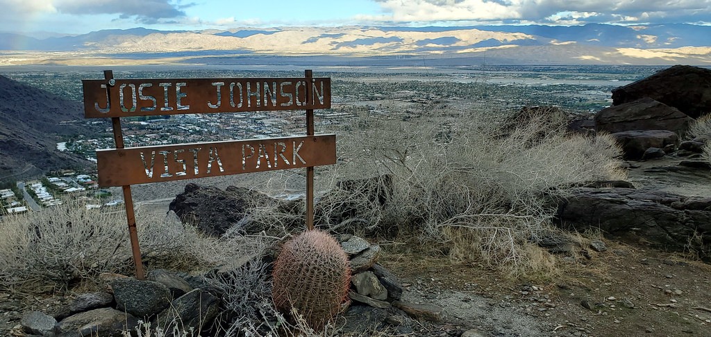
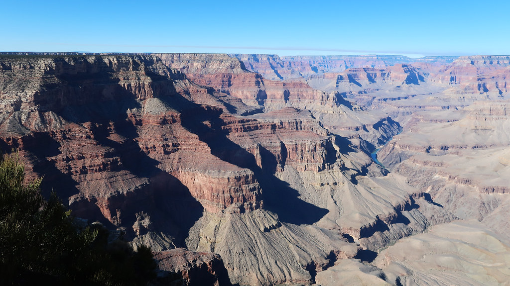
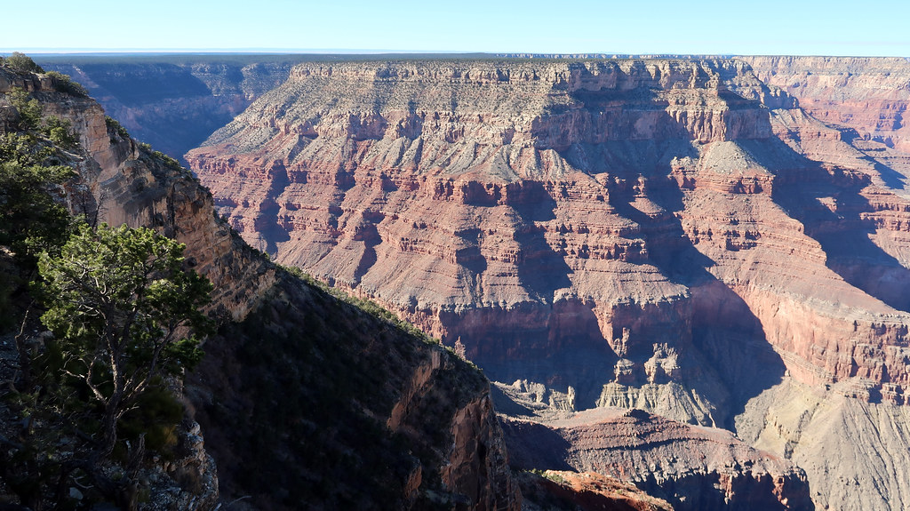
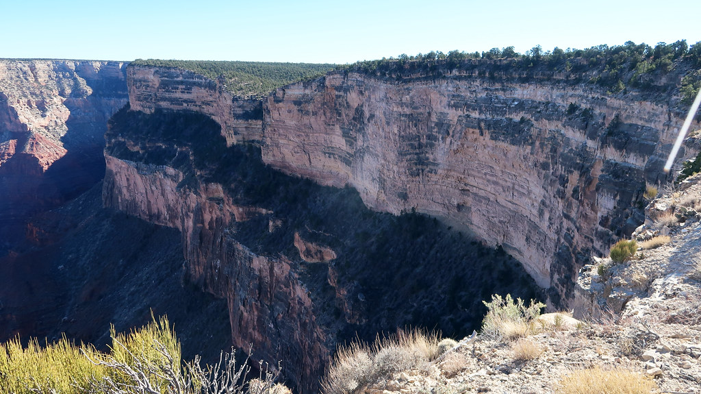
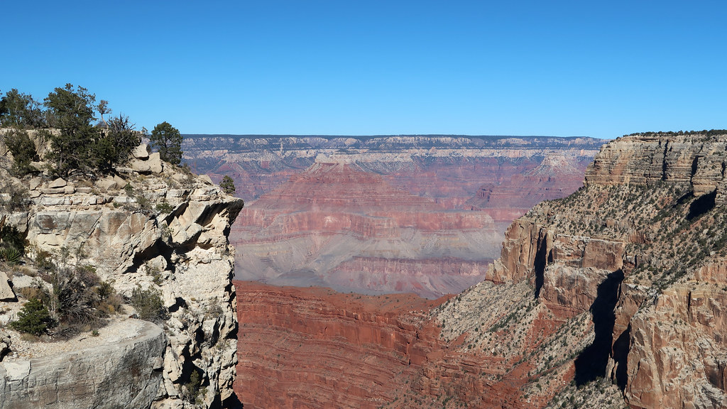
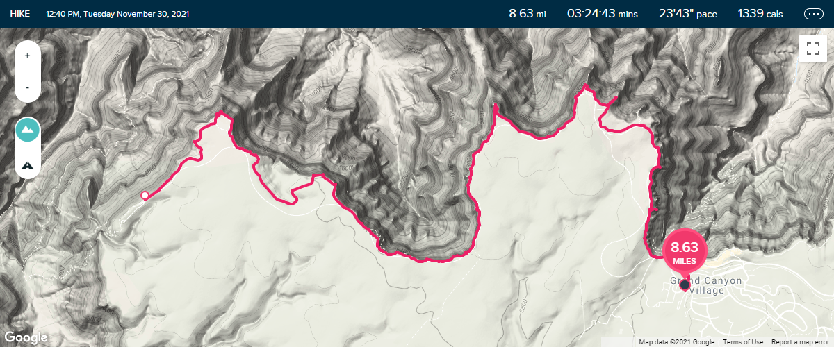
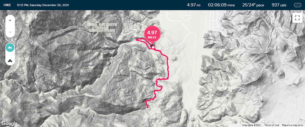
I know that I just recently said that my hike at the Grand Canyon was my new favorite hike of all time, but it’s lost its title already. Yesterday, for the second half of the day I spent in Coachella Valley, I went to the Indian Canyons.

Admission usually costs US$12 per adult, but they ran a Christmas Day special of only US$10 per vehicle, so, needless to say, the line was extremely long to get in. Once I did finally make it in, the parking area was completely packed and it took me a little while to find a place to park. Even better, a vast ma­jor­ity of the people visiting were just regular people who were touring Palm Springs (as opposed to hikers).

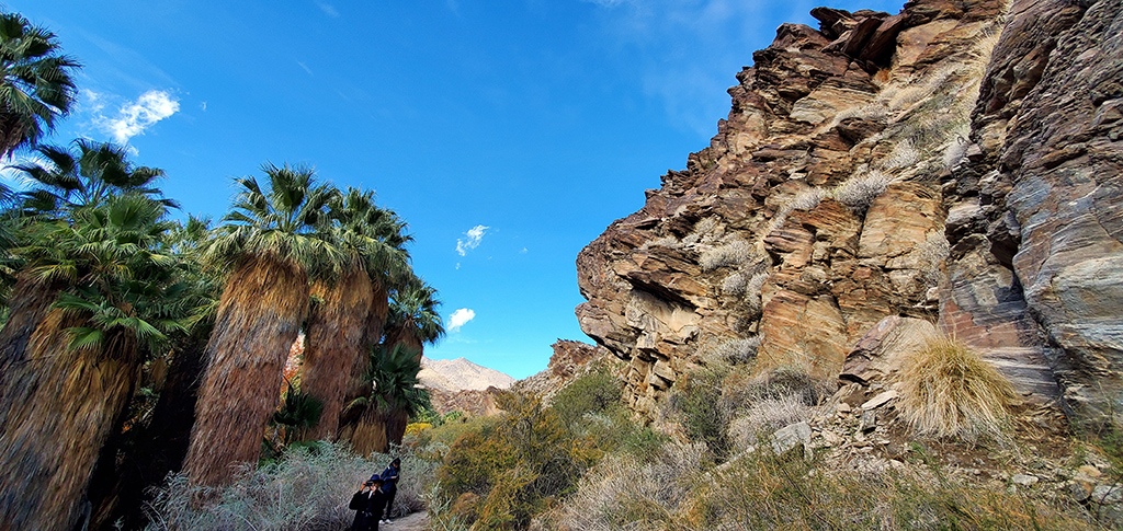
I’m often cold at the beginning of hikes so I like to bundle up, but I warm up quickly and end up having a sweater to hold onto throughout my hike. For this hike, I decided to do a small loop off to the side to warm up before the “main event.” The small loop off to the side was the Andreas Canyon Trail, a one-mile trail that has regular dirt paths mixed in with some rocky areas. And thus, the hilarity ensued.

Remember how I said that most people were there as tourists instead of hikers? There were people literally in skirts, fancy shoes, and other non-hiking attire trying to walk this trail. The beginning was deceptively easy, but it soon became much more involved, and this is the trail where I’ve seen the most people turn back around and retreat after making it less than a quarter mile into the hike.

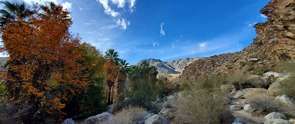
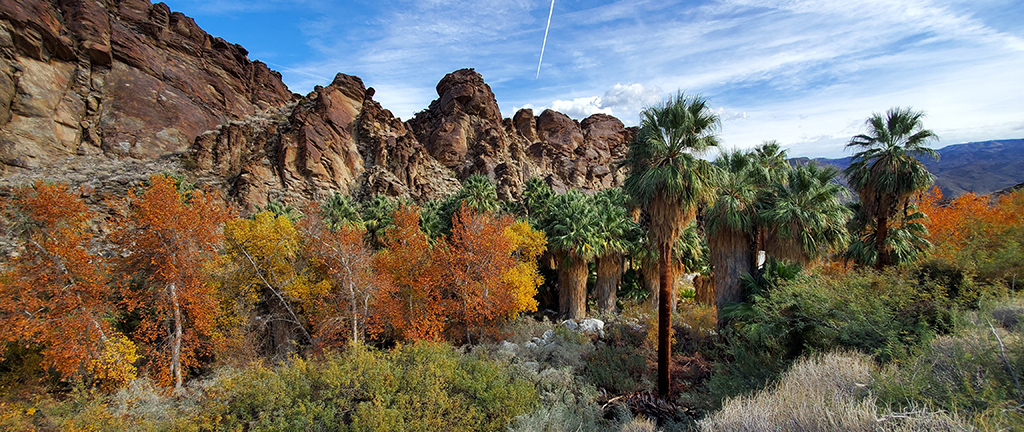
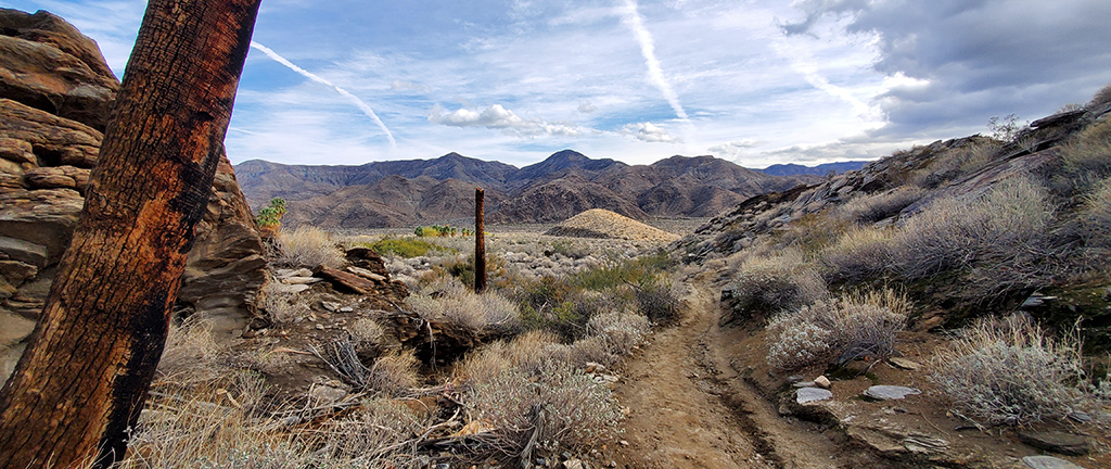
After the warm-up, I stopped by my truck at the parking lot again to drop off my sweater, then walked over to the main reason I came to Indian Can­yons, which was to hike the Murray Canyon Trail. This area was a lot less busy, which I assume is because there were warning signs about main­tain­ing health and safety throughout the hike, and because the first small segment of the hike wasn’t really that scenically appealing.

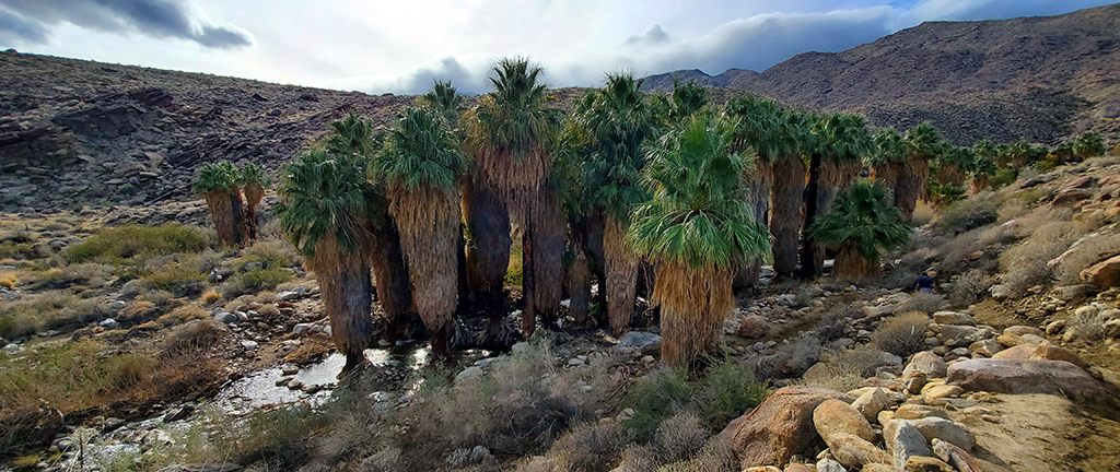
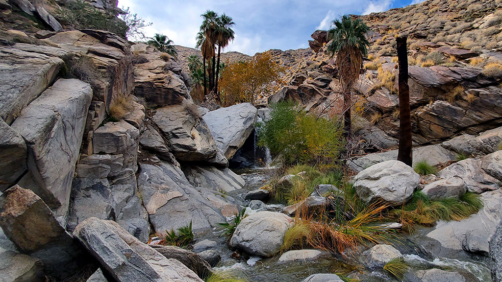
However, it quickly got a lot more interesting once I arrived in the actual canyon portion of the hike. I was originally greeted by a long parade of horses being ridden by a group of people, but once they passed by, I went down into the wetter part of the hike.

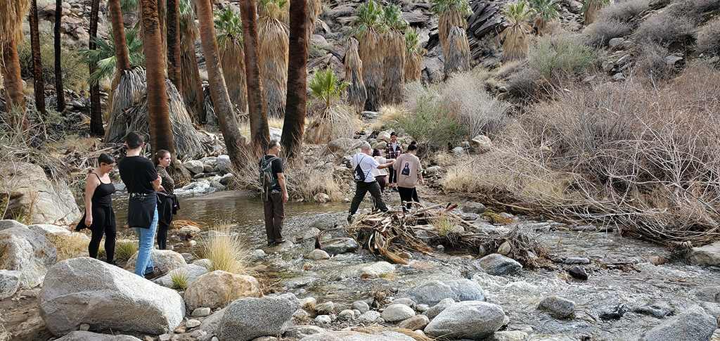
At first, it seemed like I could stay dry by hopping on protruding rocks, but I quickly realized that I’m eventually going to get pretty wet, so I stopped caring and just waded through the water. It seemed like the other hikers didn’t take that approach, though; this became a lot more apparent when there was a backup at one of the stream crossings when people had trouble making it across the stepping stones.

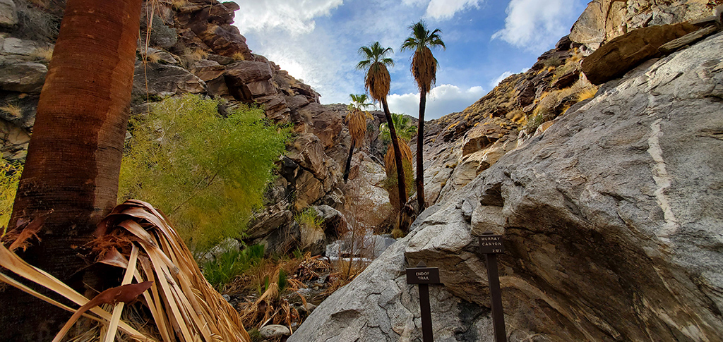
I eventually made it to what I thought was the top of the waterfall, and the spot where most people assumed was the end of the trail. There was a nice waterfall with a nice view down to where we just climbed.

However, I looked up the trail before hiking, and something felt off—I remembered that it was supposed to be a bit longer. Having been regularly fooled by false summits in the past, I looked around and saw an extremely steep and rocky area along the side of the waterfall that looked scalable. I wondered if there was anything beyond that, so I took a chance and started climbing up the rocks.

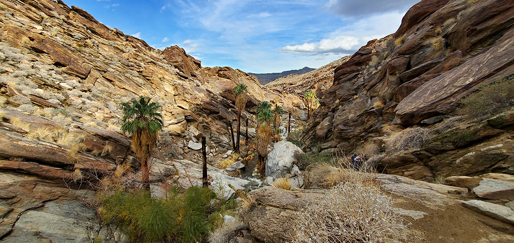
I’m glad I did, because this is where the best part of the hike started. The constant nice views that I had experienced throughout the hike so far got even better, and the stream of water got bigger, faster, and deeper. At this point, my shoes and socks were completely soaked, and at one point, I had stepped into water that reached up to my knees, so the bottom half of my pants were wet as well.

Eventually, I made it to the final stretch, which involved walking alongside the stream on top of slanted rocks.

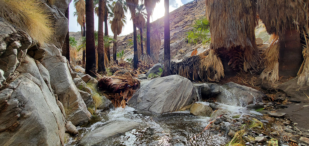
Just around the corner from this final stretch was the end of the trail, and the final waterfall. This photograph absolutely does not do it justice—the sat­is­fac­tion of making it to the end of the trail where you witnessed so many people give up and turn around, and having done so by scaling rocks and bas­ically half-swimming through a creek, is pretty nice. That, along with the sound of crashing water accented by the chirping birds, and if it wasn’t so tricky to get here, this would be a great place to bring a lawn chair and read a book.

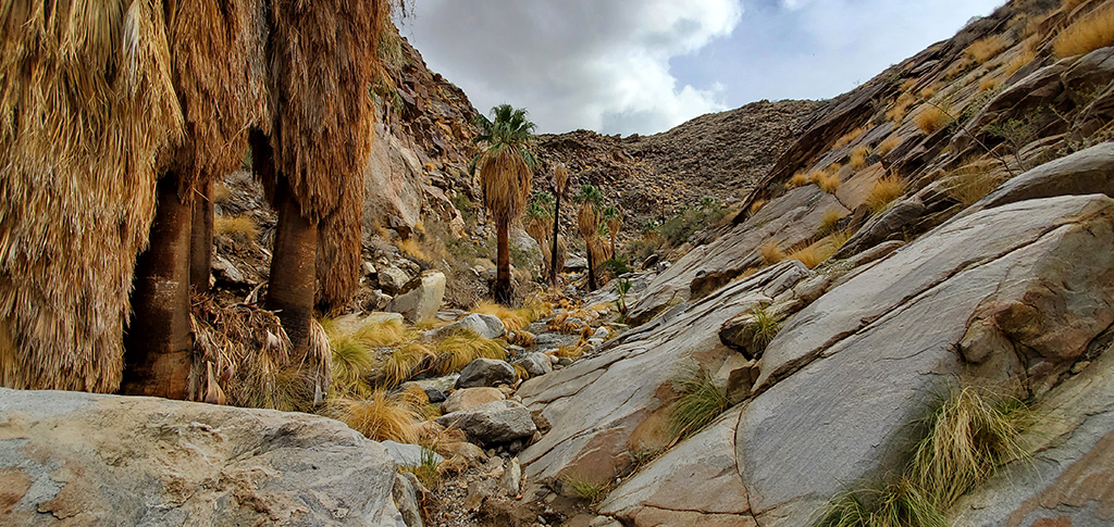
A lot of hikes have stunning, breathtaking summits with sweeping views, but are fairly boring until you get there. Murray Canyon isn’t like that—the journey is just as impressive as the end. When you do get to the end, the dynamic and technical difficulty of the hike makes you appreciate it more be­cause it feels like it’s something that you’ve truly earned. For these reasons, as well as due to my biased adoration of desert oases, this has become my new favorite hike of all time.

Immediately after completing this hike yesterday, I drove back to Los Angeles County to attend a Christmas gathering (which is also why I didn’t have time to post this until today). It’s unfortunate that I only got to spend one day in Coachella Valley, but I also didn’t expect to enjoy it this much.

Seeing as I’m going to be spending a few months or so in Southern California recharging from my six-month road trip, I plan on making a few more trips to Palm Springs, considering it’s a relatively nearby place to get away and go exploring for a bit.


—§—


Hello Coachella Valley

After my hike at the Grand Canyon, I made my way back to Las Vegas for a week and a half to catch up on a bunch of errands and appointments, then arrived at the Tempo team house in Long Beach to settle down for a little bit and rest up from my road trip.

However, after sticking around there for a week and a half, I started remembering why I hate Los Angeles, and ended up just staying indoors and working all day. Realizing that this isn’t a healthy lifestyle, and trying to continue the trend of exploring the outdoors and being more active, I decided to take an impulse and unplanned trip to Coachella Valley, best known for containing popular vacation des­tinations like Palm Springs, Palm Desert, and Indio.

I wouldn’t really consider this to be a part of my road trip, and I’m only staying here for a day (as opposed to the week that I usually spend in major cities during my road trip) because I need to be back in Los Angeles County tomorrow to attend a small Christmas gathering.

My plan was to drive from Long Beach to Palm Springs, go hiking, then head to Palm Desert and check into my hotel. I ran into an obstacle with that plan because it rained a lot and there was flash flooding on a lot of hiking trails, so a few that I wanted to go to were closed to the public. However, I eventually managed to find one near the Agua Caliente Tahquitz Visitor Center and hiked the South Lykken Trail. I’d say that it was moderate in dif­fi­culty with some fairly steep areas, but the sweeping views from the top were very rewarding.

South Lykken Trail in Palm Springs, California

South Lykken Trail in Palm Springs, California

South Lykken Trail in Palm Springs, California

South Lykken Trail in Palm Springs, California

South Lykken Trail in Palm Springs, California

South Lykken Trail in Palm Springs, California

After coming back down from the summit, I took the half-hour drive from Palm Springs to Palm Desert, seeing Cathedral City and Rancho Mirage along the way. I’m not sure if the roads were emptier than usual because it’s Christmas Eve (though I would feel like a desert vacation destination like this would actually be busier during a holiday), but the drive was very smooth and refreshing.

My impression of this western rim of the valley is that it actually reminds me of the Las Vegas suburbs, but more polished, better taken care of, and with a higher attention to detail. The rows of palm trees lining the streets, the succinct but visually pleasing desert landscaping, and the clean neighborhoods made me happy to be there. People regularly ask me where I would live if I didn’t live in Las Vegas, and even though I’ve only been in Coachella Valley for half a day, I’m thinking that Palm Springs or the neighboring cities might be a strong contender to take that spot.

 
My hotel of choice for this one-day trip was the JW Marriott Desert Springs Resort and Spa. I’m usually not the biggest fan of resort-style hotels because I prefer barebones lodging that is clean, simple, and straightforward, but due to my eligibility for a great deal on a room at this property, I decided to give it a try.

JW Marriott Desert Springs Resort

JW Marriott Desert Springs Resort

JW Marriott Desert Springs Resort

I wanted to try some food from an in-house restaurant, but didn’t want to go through the hassle of going directly to the restaurant and waiting to be seated on a nearly-sold-out holiday night, so I instead requested it to be delivered to my room. I ordered some Skuna Bay salmon with sautéed mush­rooms and roasted garlic mashed potatoes, with a side of chimichurri sauce, and iced tea for my beverage.

JW Marriott Desert Springs Resort

My experience here was as expected—I wasn’t really a fan. With the long walk from the self-parking lot to the entrance (it was literally a quarter mile in each direction, which I later found out through my fitness tracker when it told me I had walked half a mile when I made a round-trip back to my truck because I forgot my charger), long wait times to check in, and constant noise coming from the hallway due to a plethora of guests with children, it made me miss the simple-but-reliable Fairfield Inns and SpringHill Suites from my recent road trip.

If I wasn’t able to qualify for the special heavily-discounted rate on this hotel, it absolutely would not have been worth it for me, as I noticed that rates were going for ~US$700 for the night. I spent (and will spend) a majority of my time out and about exploring Coachella Valley and never truly got to experience and enjoy the resort aspect of the hotel.

If I was a very regular visitor to the area and ended up hitting all the tourist spots, then a resort like this would be a nice way to keep things fresh, but for someone like me who has a massive list of things I want to see here for the first time, a resort like this is a horrible lodging selection if all you need is a clean and safe place to sleep overnight.

With that being said, I’ll be heading out tomorrow morning for another hiking trip in Palm Springs before making the two-hour drive back to Los Angeles County in time for dinner. If it wasn’t for that plan, I definitely would’ve extended my stay here, and I look forward to coming back sometime soon to see if I’m fallaciously tunnel-visioning on only the nice parts of Coachella Valley, or if it’s actually as nice as I think it is right now.


—§—


Hello, Grand Canyon National Park in Arizona

After my one-day “layover” in Gallup, the next and final destination of this segment of my road trip was in Flagstaff, Arizona. As you might have guessed, my main reason for stopping by Flagstaff was to visit the Grand Canyon National Park.

I’ve always heard great things about the Grand Canyon, ranging anywhere from people saying it was one of their favorite vacation destinations, to one person alleging that he had heard from all his friends that it was life-changing. Although I personally disagree about the “life changing” part, I do think that it’s an amazing place to visit, and it has been my favorite hiking destination so far.

I have to make it back to Las Vegas soon for some time-sensitive stuff, so I only scheduled one day at the Grand Canyon. As a secondary point, it is also a bit inconvenient to get to the Grand Canyon, because the closest Marriott-branded hotels are in Flagstaff, and the lodging options closer to the Grand Canyon all seem a bit underwhelming and expensive. Because of that, I opted to stay at the SpringHill Suites by Marriott Flagstaff and made the three-hour round trip to the Grand Canyon on my visitation day, an hour and a half there and an hour and a half back.

My hike of choice was the West Rim Trail. I took a shuttle out to Hermit’s Rest and walked the path back to Grand Canyon Village. Along the way, I stopped at Pima Point, Monument Creek Vista, The Abyss, Mohave Point, Hopi Point, Powell Point, Maricopa Point, and Trail View Point.

I took 143 photos throughout my hike, and I’ve picked out my favorite ones to feature here. Although I don’t precisely remember exactly where each of these photos were taken, the progression of the photos follows the order of the scenic overlooks that I just listed.

Grand Canyon

Grand Canyon

Grand Canyon

Grand Canyon

Grand Canyon

Grand Canyon

Grand Canyon

Grand Canyon

Grand Canyon

Grand Canyon

Grand Canyon

Grand Canyon

Grand Canyon

Grand Canyon

Grand Canyon

Funny enough, my main takeaway from my hike at the Grand Canyon is that I should probably get laser eye surgery soon. The Grand Canyon in person was incredible, but after browsing through the photographs I took and zooming in all the way, there is an immense amount of detail that I missed out on due to my poor vision. It left me speechless as to just how massive the scale of the Grand Canyon is, and how intricate the rock formations are.

In a similar vein, there are no photographs that do the Grand Canyon justice. Looking back at the pictures I took is reminding me how big the Grand Canyon is, but that’s only because they are simply acting as a memory trigger for me to immerse myself back into my experience of being there in-person. Prior to this, I’ve obviously looked at plenty of other people’s photos of the Grand Canyon, but that wasn’t enough to prepare myself for how much I was impressed when I first saw the canyon in-person.

The route I took for my hike was fairly easy and straightforward, but there are a plethora of more difficult hikes that I can tackle when I am better pre­pared. One of the hikes I definitely want to do is to go down into the canyon. The depth of the Grand Canyon is right around 6,000 feet (or 1,829 me­ters), so I probably will not be fit enough to head all the way down to the bottom anytime soon, but I’m eager to be able to go down part-way during my next visit.

Grand Canyon


—§—


Hello, Pyramid Rock in Red Rocks Park in Gallup, New Mexico

Using the day I gained in my schedule by departing Albuquerque, New Mexico early, I decided to stop by Gallup, New Mexico, a small city on Historic Route 66 on the western side of the state near the Arizona border. Gallup is adjacent to Church Rock, a census-designated area in McKinley County that has boundaries that include Red Rock Park, a park with a convention center, a museum, campgrounds, and rodeo grounds.

My hike of choice in Gallup was the Pyramid Rock Trail, with the trailhead starting deep beyond the horse stalls and extending to the summit of Pyr­a­mid Rock, the highest point of the park.

Pyramid Rock Trail in Red Rocks

This was a fairly well-trafficked trail, so it was a very pleasant hike. The path was clearly marked a majority of the time, and in areas where there might be some confusion, there were rock towers built by other hikers to show people the way. (I contributed a rock to one of the towers.)

Pyramid Rock Trail in Red Rocks

I’m great at falling for false summits, and it happened again on this trail. It seems like I took a wrong turn at one of the intersections, because I ended up in a dead end with a moderately nice view.

Pyramid Rock Trail in Red Rocks

This clearly wasn’t Pyramid Rock, though, because I could see the actual summit off in the distance. It seems like I wasn’t the only one fooled, because there was another woman there with me. I took in the view for a bit, snapped some photos, then retraced my steps back to the intersection to take the other path.

Pyramid Rock Trail in Red Rocks

As I got closer and closer to the summit, I realized that I was clearly getting closer distance-wise, but not necessarily height-wise. This hinted me towards the fact that there is probably a tough, steep, strenuous climb right before the summit (and I ended up being correct).

I didn’t bring any snacks and only had a single bottle of Powerade Zero, so I was mildly concerned about running out of energy, especially at this el­e­va­tion of about 7,000 feet above sea level, and also considering that I was already getting tired.

Pyramid Rock Trail in Red Rocks

As you might have guessed, I did indeed make it. Reaching the summit was very rewarding. There were a few people coming down from the summit who cheered me on and told me I was almost there. Once I got to the top, the sweeping 360° views were amazing. The woman I saw earlier at the other sum­mit also joined me about 10 minutes later at the true sum­mit of Pyramid Rock.

Pyramid Rock Trail in Red Rocks

Pyramid Rock Trail in Red Rocks

So far, I think this is one of my favorite hikes that I’ve ever done. If you’re a beginner who’s looking for a challenge to step up your hiking, I think this is a fantastic intermediate trail to try out.

This hike feels like a real hike and not just a walking trail. There are sufficient obstacles, but the more difficult ones are assisted (i.e., the steepest rocks you have to scale have cut-outs for your feet). The path isn’t just a mindless straight line; you’re not going to constantly get lost, but you do have to use your eyes to look around and think about where you’re going to go next, which I think adds an important element of mental stimulation to the hike.

I also think the summit is very important—it’s pretty disappointing when you reach the end of the trail and there isn’t really much there. The view from the summit here couldn’t get any better—not only is there a view from all different directions, but I’d go far as to say that each quadrant of the view had u­nique elements that made it look like you were at multiple summits at once.

Pyramid Rock Trail in Red Rocks

Pyramid Rock Trail in Red Rocks

The hike down was obviously much easier, and I managed to survive only having a single bottle of Powerade… though I did eat two protein bars that I had in one of my storage boxes once I got back to my truck. If you’re going on this hike and aren’t used to high elevations with lower oxygen saturation, it definitely wouldn’t hurt to bring some snacks along with you.

Pyramid Rock Trail in Red Rocks


—§—


Goodbye Albuquerque

As of today, my five days in Albuquerque, New Mexico have come to an end. My original plan was to stay for six days, but I shortened my stay by one day and decided to spend one night in Gallup, New Mexico, which is on the way to my next major destination, Flagstaff, Arizona. I did this for two main rea­sons, the first being that I wanted to break up the monotony of my drive by cutting it in half and doing it over two days instead of one, and the sec­ond reason being that I wasn’t really that big of a fan of my hotel room.

You might already know this, but I have a very acute and sensitive sense of smell. If there’s mold, mildew, or mustiness in an area, I’ll notice it im­me­di­ate­ly, no matter how subtle it is, and if I’m in the area for too long, I’ll start getting headaches. This was a massive problem back in St. George, Utah when the air conditioner spewed out a horrible smell of mold and mildew akin to dirty gym shoes, and the curtains had some strange musty, me­tal­lic odor to them. Since then, I’ve been much more careful about picking out newer hotels, and generally haven’t had this problem anymore.

That is, until Albuquerque. This was clearly an older hotel, and it wasn’t really maintained the best, so my room smelled very musty when I arrived. I in­ten­tion­al­ly picked the full-service corporate-run Marriott Albuquerque so I could have a nice view, enjoy free beverages and snacks in the lounge, and have a nicer stay. Although I had an amazing view out of floor-to-ceiling windows, the lounge was still closed due to being short-staffed from the pan­dem­ic, and the room was clearly dated and a little bit rough around the edges.

With all that considered, I figured that it wasn’t worth the extra cost to stay at this hotel, so I decided to leave a day early, which not only gave me an op­por­tu­ni­ty explore another city for a day, but also saved me a little bit, because I booked a SpringHill Suites instead. (Just to be clear, the Marriotts brand­ed as just “Marriott” are usually very nice and have a lot of amenities, and I would highly recommend them; it’s just that this particular one in Al­bu­quer­que was disappointing.)

View from Marriott Albuquerque

Marriott Albuquerque

Marriott Albuquerque

I already have two dedicated blog posts from two of my major tourist activities in Albuquerque, one where I went to the National Museum of Nuclear Science and History, and another when I explored the Sandia Mountains. I went on two additional hikes, but I felt they didn’t warrant their own blog posts, so I decided I would put them in this Albuquerque round-up instead.

The first hike was at the Albuquerque Volcanoes, which are in the general area of the Petroglyph National Monument. There are five volcanoes in that cluster, and I hiked around and onto three of them—the JA, Black, and Vulcan Volcanoes. The first two, I was able to summit, but the third one was blocked off so hikers couldn’t get to the top. I snapped some photos from the two volcanoes I was able to climb up, then took a photo of the volcano that I wasn’t allowed to.

Albuquerque Volcanoes

Albuquerque Volcanoes

Albuquerque Volcanoes

Fitbit Activity Tracker

My second hike was the Canopy Loop at the Rio Grande Nature Center State Park. I figured it would be a mistake to visit New Mexico and not see the Rio Grande up close, so I found a hiking trail that went right alongside it.

My favorite part about this hike was how visually different it was from all the other hikes that I’ve done recently. A majority of my hikes throughout the sum­mer and fall have been exceptionally green, so it was a nice change of pace seeing a lot of trees that had finished going through their autumn phase and were now ready to weather the winter.

Canopy Loop Trail at Rio Grande

Canopy Loop Trail at Rio Grande

Canopy Loop Trail at Rio Grande

Canopy Loop Trail at Rio Grande

Fitbit Activity Tracker


—§—


Hello, Sandia Mountains in New Mexico

For my next tourist activity of Albuquerque, I wanted to check out Sandia Crest, the highest point of the Sandia Mountains in Bernalillo and Sandoval Counties, east of Albuquerque. Many tourism websites suggested doing so via the Sandia Peak Aerial Tramway, a 15-minute tram ride up the western side of the Sandia Mountains.

When I went to buy tickets, I saw that a round-trip tram ticket cost $29, there was an extra $3 grounds fee, and tax came out to an additional $2.06, for an overall total price of US$34.06. I thought that was fairly steep for a tram ride, so I looked into an alternative, which would be to drive up to Sandia Crest myself. From my hotel, it was 31.6 miles there and 31.1 miles back, and at the IRS average mileage rate of 56¢ per mile, that is the functional equiv­a­lent of spending $35 to drive there instead. The price difference was negligible, but I would have much more control over my sightseeing schedule and get to stop at many other locations along the way with my own truck, so I decided to drive.

I’m glad I did, because on the way out to the mountains, I took Historic Route 66 and went over the musical highway to listen to America the Beautiful. There’s a location on Google Maps for the Musical Highway, but it’s marked as permanently closed, and the reviews state that you can’t hear anything anymore. Through first-hand experience, I can guarantee that, as of today, the musical highway is still there and still singing. The notes aren’t that crisp, probably because the New Mexico Department of Transportation decided not to service the grooves in the road anymore, but as long as you align your right-side tires prop­er­ly, you can definitely still hear it.

Sandia Crest’s elevation is 10,678 feet (3,254 meters) above sea level, so I knew it was going to get cold up there, but I didn’t realize just how cold. Not even halfway up the winding Sandia Crest Scenic Highway portion of New Mexico State Road 536, there was already snow piled up along the side of the road.

Sandia Mountains in New Mexico

I eventually made it up near Sandia Crest, but quickly reached a point where I couldn’t advance further due to severely limited visibility.

Sandia Mountains in New Mexico

I went back to the fork in the road and tried to take the other path, but I had no luck there either—it was a decently steep hill, and my truck ended up getting stuck in the snow. I did what felt like a nine-point turn to get out of the snow, and just parked in a random spot on the side of the road.

Of course, to add insult to injury, a small blue Subaru showed up from behind me and just zoomed right up the road that I failed to summit.

Sandia Mountains in New Mexico

Luckily, my feet and legs have all-wheel-drive, so I used them to walk up the hill instead. When I got to Sandia Crest, shivering in the cold and being plum­meted by powdered snow being blown airborne by the wind, I went to the railing and looked out past the trees—the precise location where you’re supposed to have sweeping views of Albuquerque. Well, that clearly didn’t work out.

Sandia Mountains in New Mexico

Having no choice but to admit defeat, I returned to my truck and figured that today just wasn’t the day for a successful Sandia Crest visit. However, I did have other plans.

Sandia Mountains in New Mexico

As I mentioned before, one of the benefits of me driving to Sandia Crest instead of taking the tram was that I could make more stops along the way for some more sightseeing. When I was headed for Sandia Crest, I drove straight up there without stopping, but on my way down, I stopped at literally every single possible stopping location to take in the views.

Sandia Mountains in New Mexico

As I got further and further down the mountains, the weather got increasingly better, and I was able to walk around a bit without being turned into an ice statue.

Sandia Mountains in New Mexico

My hope was to get a nice photo of Albuquerque, which clearly didn’t happen, but I got an alternative that was good enough—a nice, sweeping view of the opposite side of the mountains facing towards the east.

Sandia Mountains in New Mexico

Even further down the mountains, I found a little building nestled in the trees. It looked like it was a commercial building and not a residential one, but if you were in fact allowed to have a residential property out here, this seems like an incredible place to have a second home. I’d definitely want a place where I could come out during times when I want to take a break from the city so I can breathe some fresh air and go on hikes through nature.

Sandia Mountains in New Mexico

Seeing as I never actually took the Sandia Peak Tramway, I can’t necessarily conclude that driving is better, because I never actually experienced what the tram was like… but I think I did myself a huge favor by driving. The Sandia Mountains are much more than just the top, and if you’re into nature, I’d rate the Sandia Mountains as a must-see if you’re in the Albuquerque area.

(Though, as a side note, try to download an offline map of the area before you head over… I didn’t, and it was mildly disconcerting not having cell sig­nal in the middle of a snowstorm on the top of a mountain.)


—§—