I had a small internal conflict about whether I should publish this blog post and these photos or not, because when I went hiking at this trail, I forgot my regular camera so I just snapped some quick shots from my phone.
What is extra problematic for me is that the views from this trail were actually pretty amazing, so not only does my phone not produce high-quality photographs, but it doubly does not give the trail justice because of how vast and sweeping the real views were.
Ultimately, I decided to just post these anyway because I didn’t want to fall into the trap of content creators striving too much for perfection and being too hard on themselves. The entire point of my blog is supposed to be for me to leave a trail of memories to look back at, and this will still definitely serve that purpose.
The trailhead for the Heughs Canyon Trail is inside Canyon Cove, a wealthy neighborhood in Holladay, Utah. The “parking lot” for the trail is at the outside of the subdivision and was just a short row of angled street parking spaces, but as I approached it, I didn’t notice it at first. I was driving too quickly and didn’t have enough space to slow down to get into a spot, so I just continued on into the neighborhood.
There were a lot of areas in the neighborhood that had “No Parking” signs, but I managed to find a clear area close to the trailhead, on Oak Canyon Drive. I’m not sure why, but there were three Greater Salt Lake Unified Police Department SUVs parked there in a row, so I just parked right alongside them in an effort to blend in and pretend like I belonged. That ended up working, because by the time I finished my hike and got back to my truck, I didn’t have a parking ticket.
Being able to park here was actually a pretty big deal, because the neighborhood is built on a hill and it would’ve added an extra 100 feet or so of elevation gain and about half a mile round-trip onto my hike. This way, I was able to save my energy for the actual hike, as opposed to just walking to the trailhead.
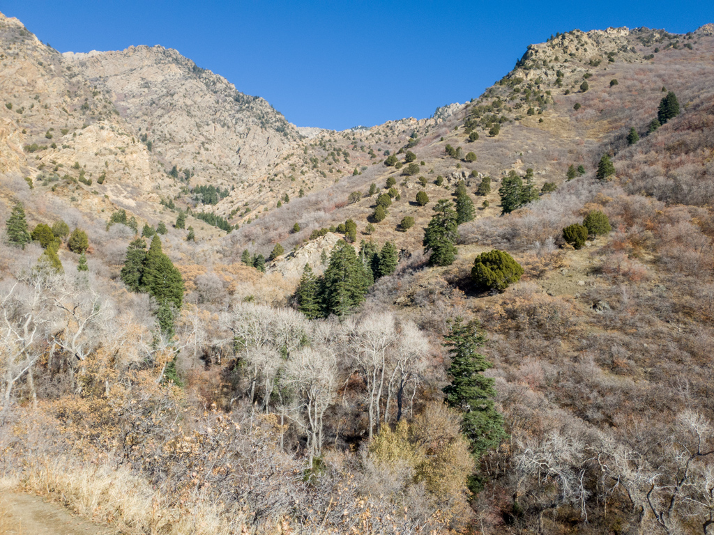
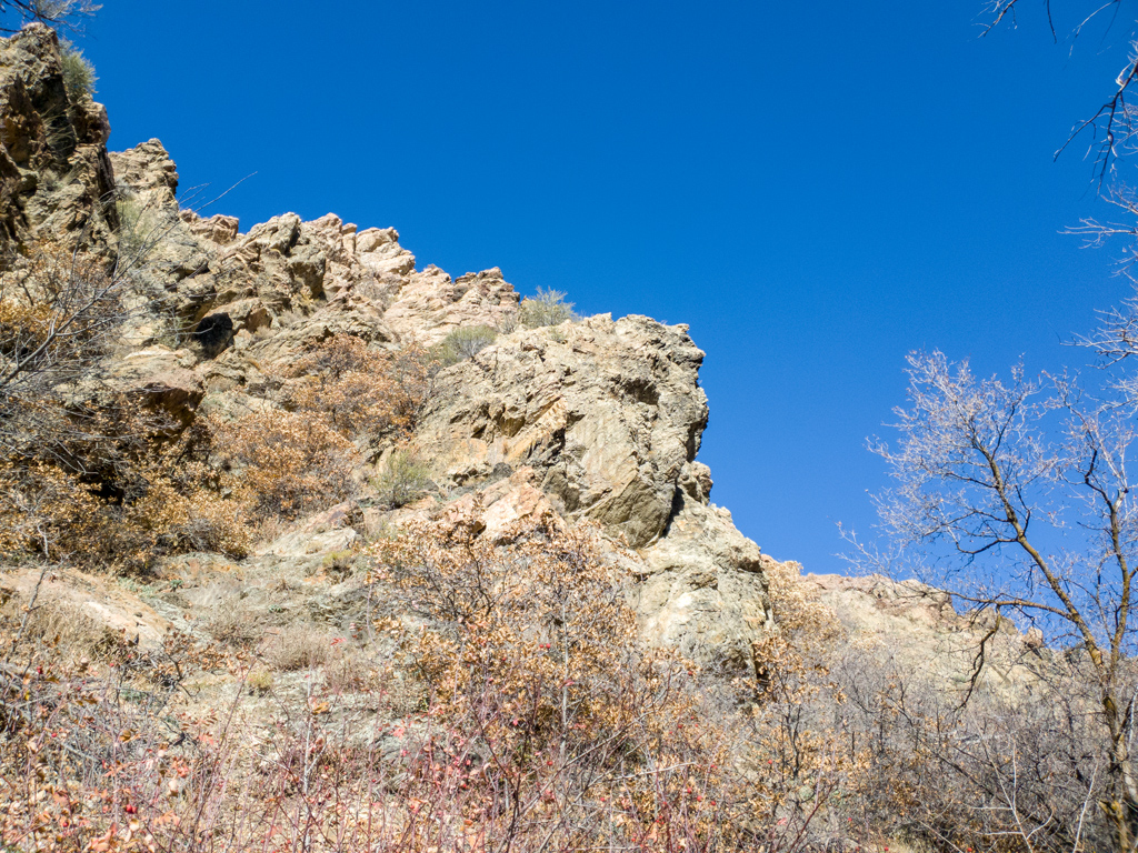
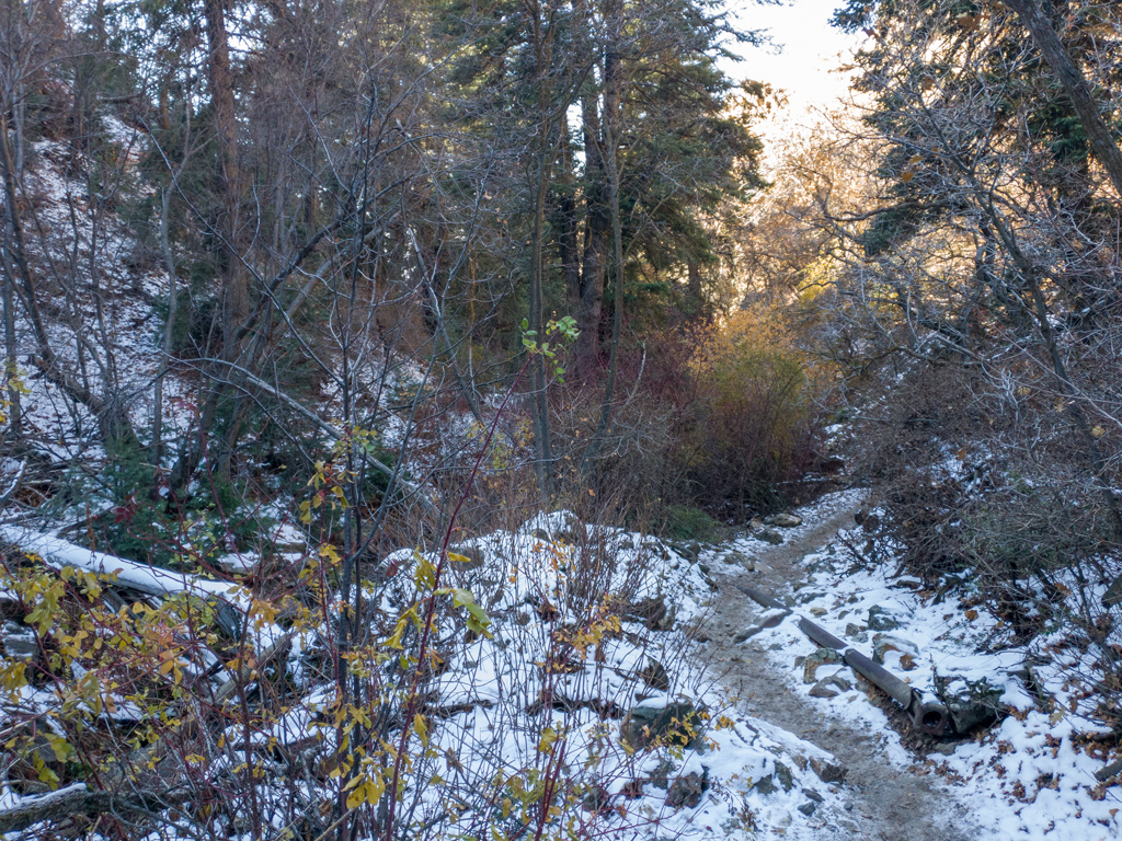
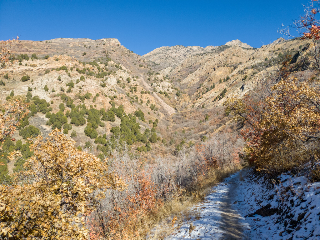
The beginning of the trail was basically just a straight shot deeper into the mountains via a narrow valley. This area was heavily shaded from the sun, so a lot of areas still had snow coverage, and some areas were even icy.
A little under a mile into the hike, I had an option of continuing deeper on Heughs Canyon Trail, but I instead took a switchback and connected onto Bonneville Shoreline Trail. I’m not really quite sure why it is called a “shoreline” trail; the elevation here was over a mile above sea level and about a thousand feet above the rest of Holladay, so if the water level rose that much, then I guess it could’ve technically been a path along the shoreline.
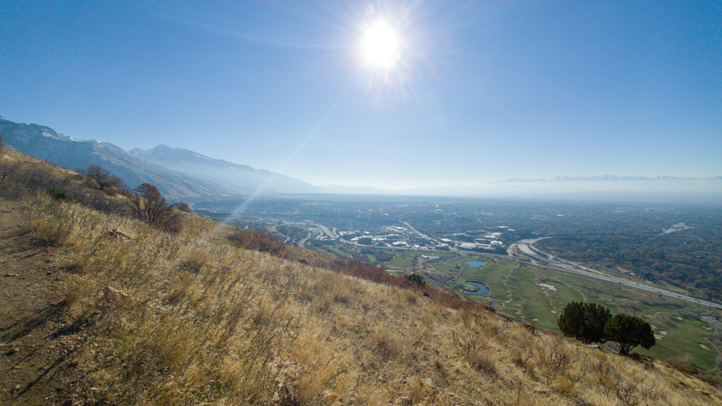
After making that switchback, I started seeing the amazing views into the Salt Lake City metropolitan area.
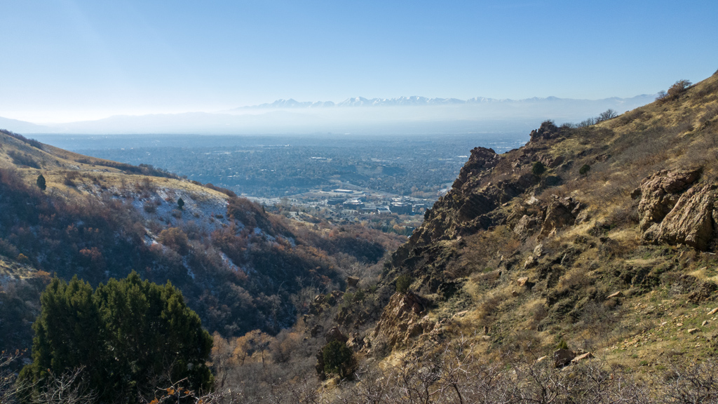
I continued on along the trail, which progressively opened up better and better views of the city. Again, I’m disappointed that I only had my phone to take photos because its optical zoom is highly limited (as you can tell) and anything above its optical zoom limit is just digital zoom, so you can’t really pick up much detail of the cities and mountains.
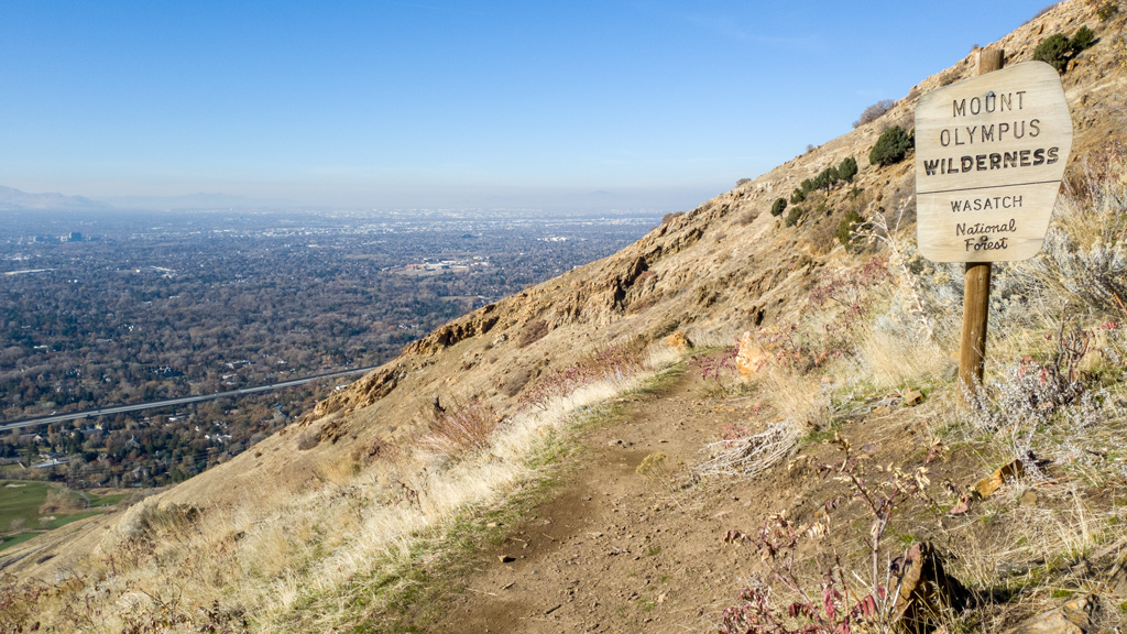
Part-way through my hike, I entered the Mount Olympus Wilderness, part of the Wasatch National Forest.
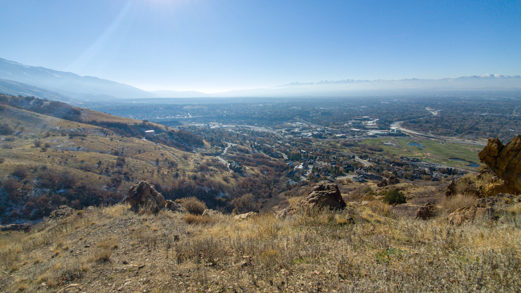
The trail slightly curved along the mountainside, so as I continued to walk, it progressively opened up slightly new angles of perspective of the view of the city.
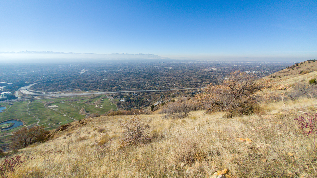
I loved that there was some very low haze coverage on this day, presumably of some thicker mist or moisture. It created a narrow layer of white above the horizon, but the skies were still clear, so the tips of the mountains to the west still stuck out above the haze, which made for a very interesting sight.
Once I reached the intersection with Mount Olympus Trail, I retraced my steps back and returned to my truck.
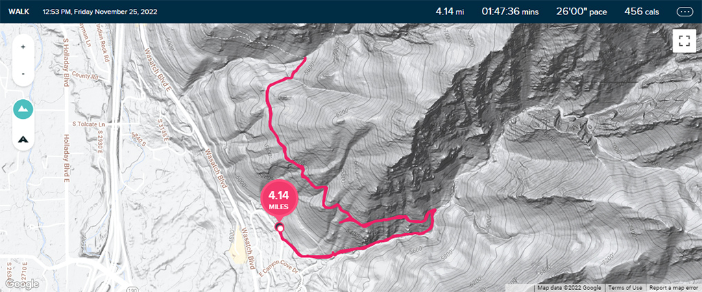
My round-trip hike ended up being a little bit over 4 miles (which is just over 6.5 kilometers). I didn’t have a working altimeter so I don’t know for sure, but based on the topographical map, it appears like my total elevation gain for the hike was about 900 feet (or about 275 meters).